
Ask most Americans to picture the ultimate hike and you’ll hear the same answers: Half Dome, the Grand Canyon, maybe the Tetons. Yet the trails that keep landing on U.S. bucket lists are often thousands of miles from the nearest national park entrance. They come with permit scrambles, thin air, relentless rain, and wind that can knock you sideways.
That’s the strange part, and it’s why these ten earned their reputations. One is quietly losing its remote feel to bulldozers. Another gets called the finest walk in the world while soaking everyone on it. And the trail waiting at #1 has no famous summit and no glossy brochure status, yet it may be the one you least expect to see on top.
#10 – Inca Trail to Machu Picchu, Peru
🔥 Would you like to save this?
We'll email this post to you, so you can come back to it later!
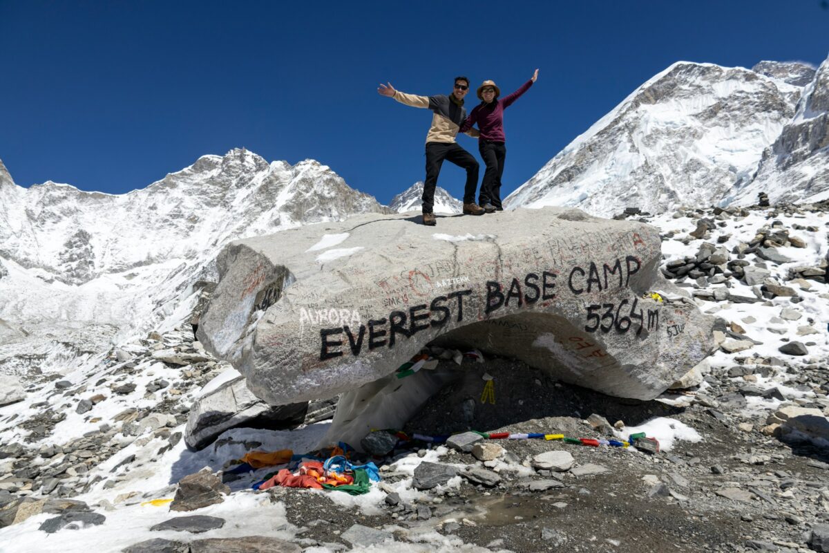
Most people picture the Inca Trail as a pleasant stroll toward a famous photo. The reality is four days of stone staircases, thin air, and a permit system that has wrecked plenty of last-minute plans. Only about 500 people a day are allowed on the trail, and that number includes the guides and porters, so actual trekkers are a minority of it.
The classic 26-mile route climbs through cloud forest and over Dead Woman’s Pass, at roughly 13,800 feet, before dropping toward the Sun Gate. If the clouds cooperate, Machu Picchu appears below you in early light after days of walking toward it. Many hikers say that moment hits harder than the ruins themselves, because you earned the view instead of stepping off a bus.
- Distance: about 26 miles over four days.
- Highest point: Dead Woman’s Pass, roughly 13,800 feet.
- Best window: May through September, the drier months. The trail closes every February for maintenance.
The Inca built much of this path in the 15th century, and some of the stonework, including steps, tunnels, and terraces, still channels water the way its builders intended. Hikers must go with a licensed operator, and porters carry the bulk of the group gear. That makes the trek easier on your back, but it also makes planning ahead non-negotiable.
The next climb has no ruins at the end, just a sign at the top of a mountain that rises above the clouds.
#9 – Mount Kilimanjaro Summit, Tanzania
🔥 Would you like to save this?
We'll email this post to you, so you can come back to it later!
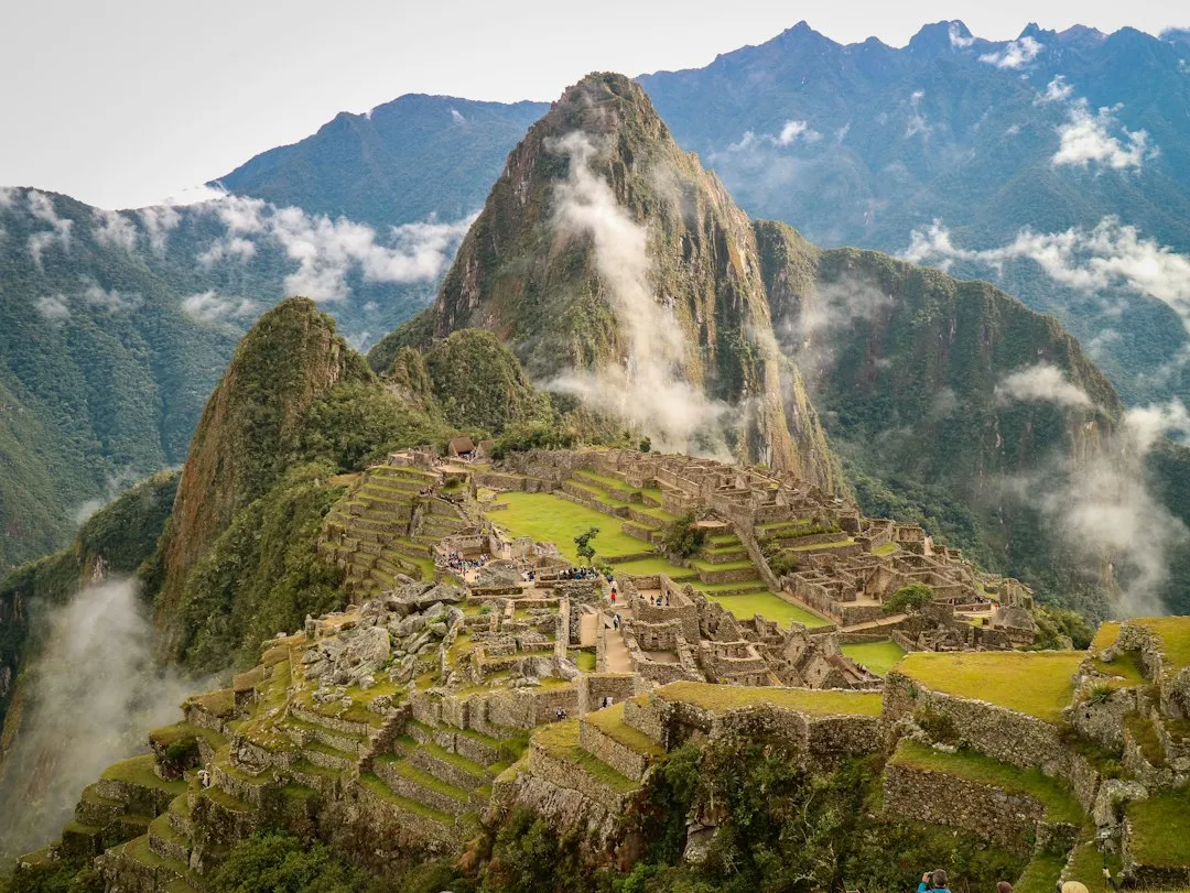
Kilimanjaro needs no ropes and no crampons, which is exactly why so many people underestimate it. At 19,341 feet, Uhuru Peak is the highest point in Africa, and the air up there holds roughly half the oxygen you get at sea level. Thousands of Americans line up for that bragging right every year.
The surprise is how much changes along the way. In under a week you walk from farmland through rainforest, heath, and alpine desert to an icy summit zone, all on a mountain sitting near the equator. You can start the climb sweating in tropical humidity and finish it in a freezing, pre-dawn push to the top.
- Popular routes: Machame (about 6-7 days) and Lemosho (about 7-8 days).
- Success rate: commonly cited at around 65 percent, with longer itineraries doing better.
- Rules: guides and porters are required.
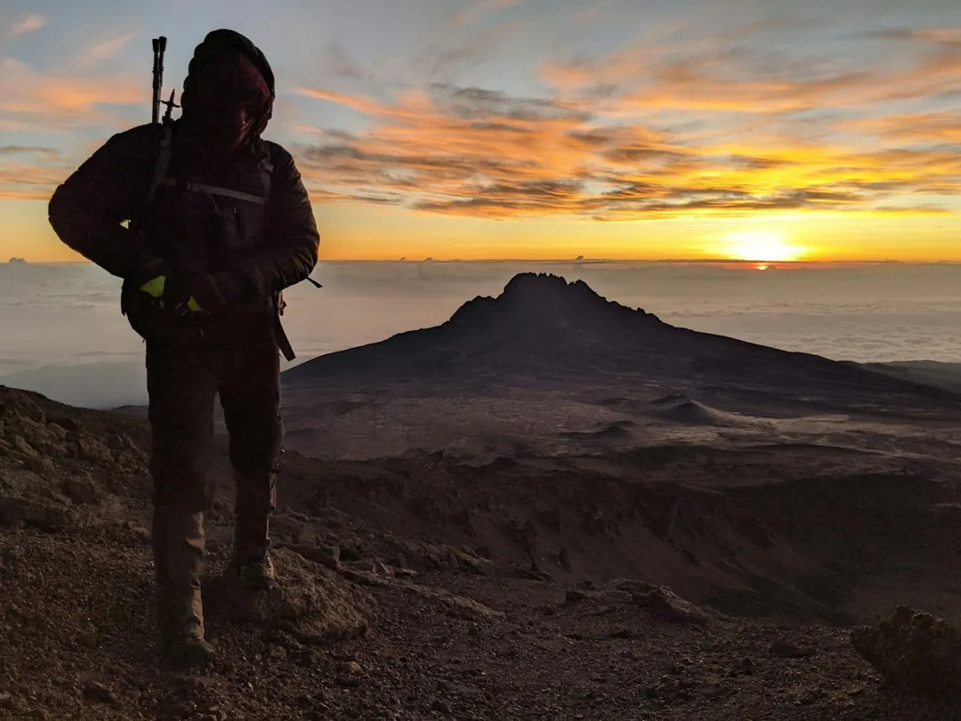
Altitude sickness is the real gatekeeper, and it can hit above 14,000 feet no matter how fit you are. Guides repeat the Swahili phrase pole pole, meaning slowly, until it becomes a mantra. Summit night usually starts around midnight so you can reach the top near sunrise, and many climbers call it the hardest few hours of their lives.
Next up is a trek with another famous name, and it comes with a twist most hikers don’t see coming.
#8 – Everest Base Camp Trek, Nepal
🔥 Would you like to save this?
We'll email this post to you, so you can come back to it later!
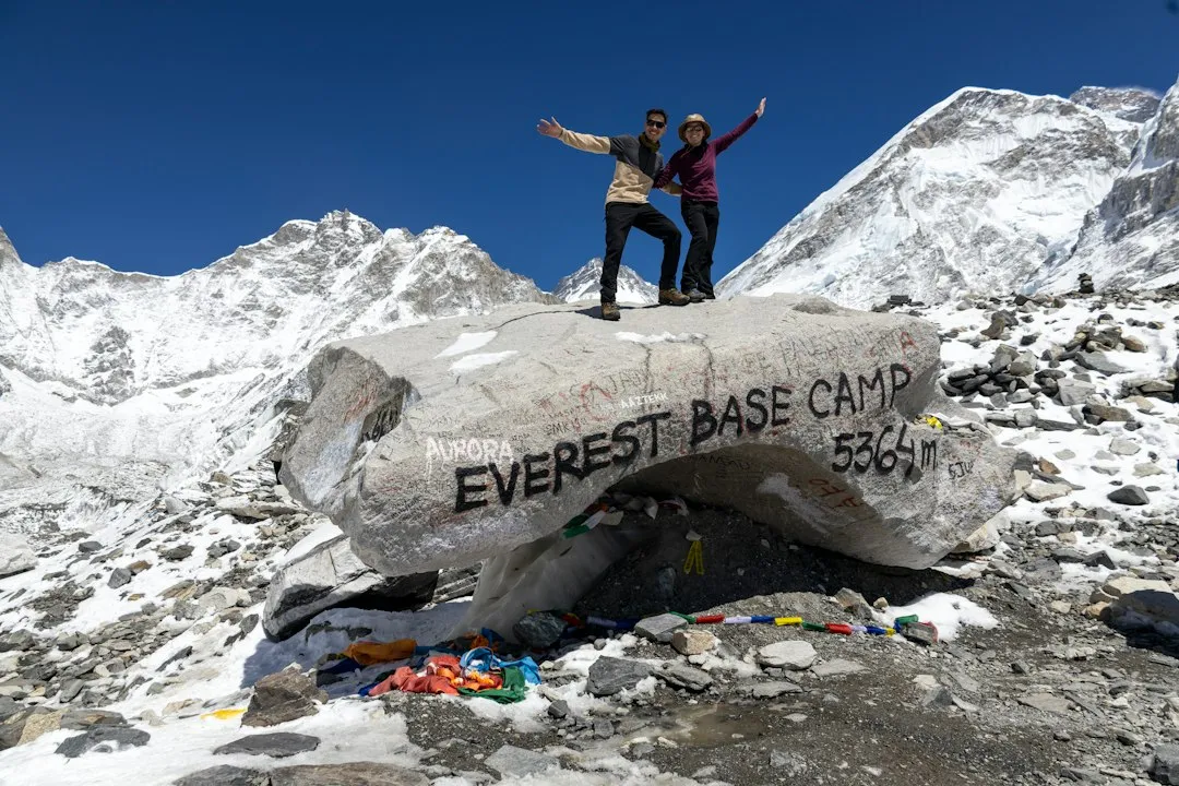
Here’s the twist: you can hike all the way to Everest Base Camp and still not see the top of Everest. Nearby Nuptse blocks the view, so many trekkers climb Kala Patthar, at about 18,192 feet, for the classic panorama. Even so, the 80-mile round trip through the Khumbu draws Americans who want the Everest name without technical climbing.
The route is a moving postcard of Sherpa culture. You cross swaying suspension bridges, pass prayer wheels and Buddhist monasteries, and share trails with yak trains hauling supplies uphill. The base camp itself, at about 17,600 feet, is a tent city that fills with expeditions during spring climbing season.
- Key stop: Namche Bazaar, where trekkers rest and take acclimatization hikes.
- Peak seasons: March to May and September to November.
- Time needed: typically around two weeks round trip.
The walking itself is steady and long rather than technical, and the thin air does most of the damage. Many Americans cut the long descent short by flying out on a helicopter. After days of uphill, it’s a very tempting luxury.
Quick Compare
- Dead Woman’s Pass (Inca Trail): roughly 13,800 feet.
- Everest Base Camp: about 17,600 feet.
- Kala Patthar: about 18,192 feet, the classic Everest viewpoint.
- Uhuru Peak (Kilimanjaro): 19,341 feet, the highest of the bunch.
The next trail is famous for beauty, and for a force of nature that decides how your day goes.
#7 – W Trek in Torres del Paine, Chile
🔥 Would you like to save this?
We'll email this post to you, so you can come back to it later!
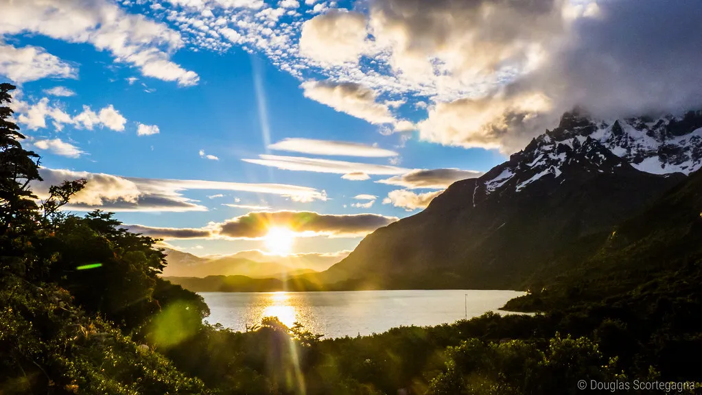
Glossy brochures sell Torres del Paine as untouched wilderness. The truth is that the W Trek’s popularity means campsite and refugio reservations vanish early, and the busiest sections can feel crowded in peak season. Still, few places deliver granite spires, turquoise lakes, and glaciers within a few days of walking.
The roughly 50-mile route traces the shape of a W across three highlights: the French Valley, Grey Glacier, and the base of the towering granite Torres. On a clear morning, those spires can glow orange at sunrise, and hikers talk about it for years. Wind gusts here can top 60 mph, so the forecast often decides your schedule more than your fitness does.
- Length: about 50 miles, usually 4-5 days.
- Big payoff: views of the Southern Patagonian Ice Field, one of the largest ice masses outside Antarctica and Greenland.
- Crowd escape: add the backside of the full circuit, known as the O, for quieter trails.
Rangers manage trail traffic and camping to limit erosion, so book early and expect rules. The reward is a landscape that looks edited but isn’t.
The next trail has the opposite problem: too much water, and that’s exactly what makes it unforgettable.
#6 – Milford Track, New Zealand
🔥 Would you like to save this?
We'll email this post to you, so you can come back to it later!
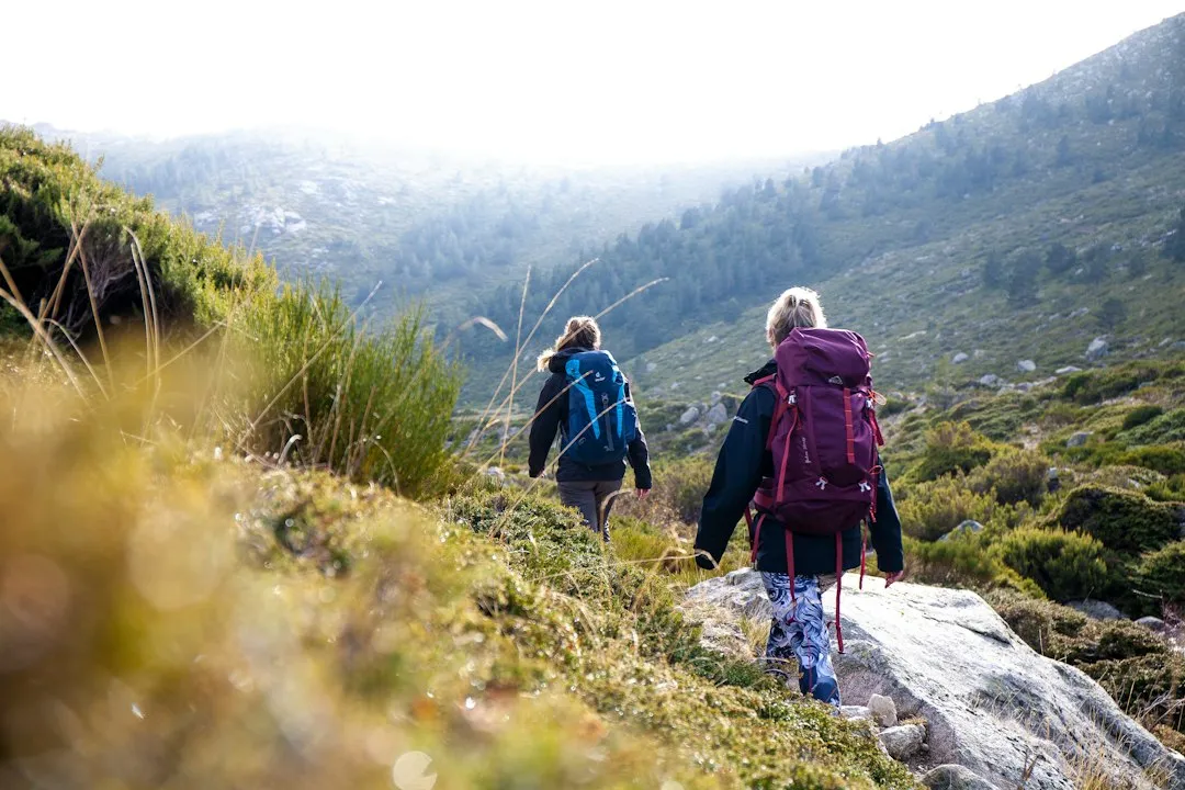
The Milford Track has been called the finest walk in the world, yet it often delivers rain-soaked drama more than postcard sunshine. Fiordland sees 200-plus inches of rain a year, and when a storm rolls through, waterfalls pour off cliffs right beside the path. Many hikers say the wet days are the best days.
The 33-mile route runs four days through glacier-carved valleys and rainforest. It climbs to Mackinnon Pass at about 3,800 feet, then drops toward Sutherland Falls, which plunges nearly 1,900 feet. The walk ends at Sandfly Point, where a boat carries you to Milford Sound, so you finish on the water.
- Distance: about 33 miles, walked in one direction only.
- Guided option: lodges with hot meals and dry beds.
- Independent option: basic huts, carry-your-own-food, bookings fill months ahead.
Americans love the guided version for obvious reasons: a hot dinner and dry socks matter a lot in one of the wettest places on Earth. Many time their trips for shoulder months to dodge peak summer crowds. Either way, pack like you expect rain, because you probably will get it.
Why It Stands Out
- Rain is the show: 200-plus inches a year turns cliffs into temporary waterfalls.
- Big drop: Sutherland Falls plunges nearly 1,900 feet.
- High point: Mackinnon Pass, at about 3,800 feet.
- Finish line: a boat ride from Sandfly Point to Milford Sound.
Next we leave the wilderness for a trail that looks easy on a postcard and hurts on the way up.
#5 – Cinque Terre Coastal Trail, Italy
🔥 Would you like to save this?
We'll email this post to you, so you can come back to it later!
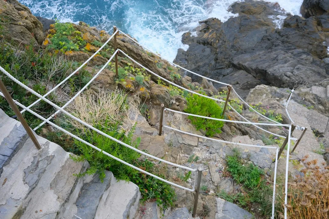
Most Americans expect a leisurely seaside stroll in Cinque Terre. Then they meet the stairs. The cliffside paths linking the five villages of Monterosso, Vernazza, Corniglia, Manarola, and Riomaggiore are steep, stony, and busy, and the walk up to Corniglia from the train station alone involves 382 steps.
The network totals about 7.5 miles of trail through terraced vineyards, lemon groves, and sea views that earned the area UNESCO World Heritage status. Landslides and storm damage have repeatedly closed sections, including the famed Via dell’Amore, which was shut for years after a 2012 landslide. Always check trail status before you go.
- Total trail network: about 7.5 miles linking five villages.
- Bailout plan: trains connect each village if your legs give out.
- Best seasons: spring and fall for milder temperatures and thinner crowds.
Overtourism is a real tension here, and local authorities keep wrestling with how to manage visitor numbers. Hikers who start early and walk midweek usually get a calmer experience. Plenty of Americans pair it with Portofino or Florence, but the coast alone can fill a long weekend.
The next route is a legend that now carries a hard question: did progress ruin it?
#4 – Annapurna Circuit, Nepal
🔥 Would you like to save this?
We'll email this post to you, so you can come back to it later!
The Annapurna Circuit once ranked as Nepal’s top trek for Americans chasing variety, and then the roads arrived. Jeep tracks now run along parts of the route, and veteran hikers argue about whether the remote feel is gone. Others say the circuit has adapted, with trekkers using side trails and skipping road stretches.
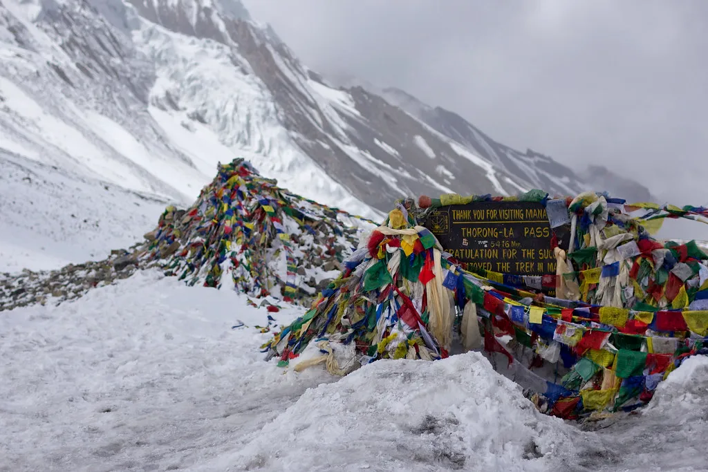
Whatever you decide, the scenery still delivers. The loop circles the Annapurna massif for roughly 100-plus miles and crosses Thorong La, at 17,769 feet, one of the world’s highest trekking passes. You walk from subtropical valleys to a barren high desert, passing Hindu and Buddhist villages along the way.
- Big moment: crossing Thorong La, then descending to the pilgrimage site of Muktinath.
- Side trip: Poon Hill, famous for sunrise over the peaks.
- Shorter option: Annapurna Base Camp, popular when time is tight.
Teahouses mean you can pack light and still eat well. The village of Marpha is known for its apples and apple-based treats, a surprising comfort in the Himalayas. The circuit is a lesson that a trail can change and still earn its spot.
The next one is less about mountains and more about what happens inside your head after weeks of walking.
#3 – Camino de Santiago, Spain
🔥 Would you like to save this?
We'll email this post to you, so you can come back to it later!
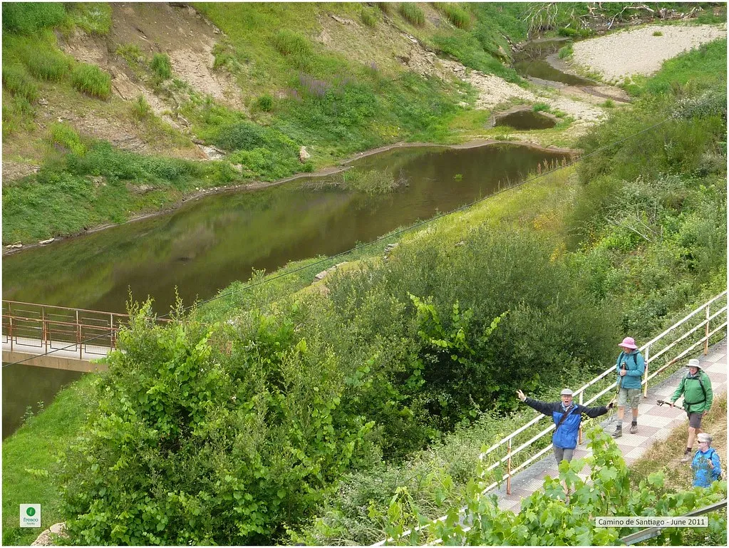
Many Americans see the Camino as a spiritual pilgrimage. The surprise is how many walk it for reasons that have nothing to do with religion. They come for the rhythm of walking, eating, and sleeping in simple hostels called albergues, and the strangers who turn into friends along the way.
The French Way runs about 500 miles from the Pyrenees to Santiago de Compostela, usually in around a month. Most walkers cover 12-15 miles a day. The first day over the Pyrenees is a brutal opener, but the daily routine of stamps in your pilgrim passport and a cheap pilgrim’s dinner soon takes over.
- Proof of completion: walk at least the last 100 km to earn the Compostela certificate.
- Lodging: albergues, small hotels, and guesthouses.
- Extension: add Finisterre for the “end of the world” coastline finish.
More U.S. companies now offer supported options with luggage transfers, which lets people try the Camino without carrying everything on their backs. Arriving at the cathedral in Santiago, where the giant botafumeiro incense burner is swung during certain Masses, is a moment many hikers say they didn’t expect to cry through. Spring and fall keep temperatures comfortable.
Next is a trail most Americans skip because they’ve already booked New Zealand.
#2 – Overland Track, Australia
🔥 Would you like to save this?
We'll email this post to you, so you can come back to it later!
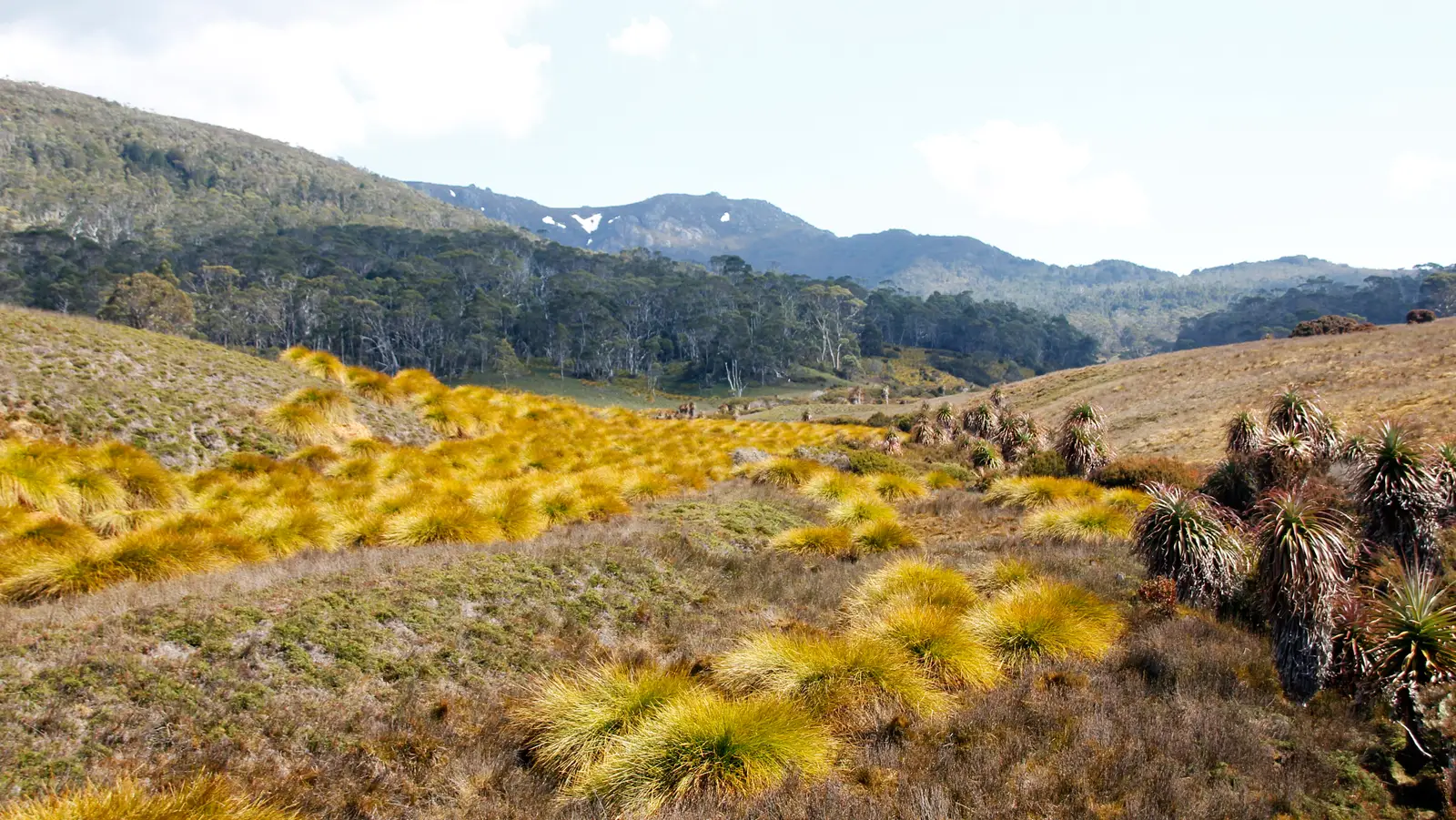
Americans who crave remote wilderness often default to New Zealand and miss Tasmania entirely. That’s a mistake. The Overland Track covers about 40 miles through Cradle Mountain-Lake St Clair National Park, and the scenery feels like a different planet: ancient rainforest, alpine plateaus, glacial lakes, and wombats waddling past the huts.
The trek usually takes six days, running north to south from Cradle Mountain to Lake St Clair. The weather can swing from sun to snow in a single afternoon, even in summer, so you need layers for every season. Boardwalks protect fragile ground while keeping you moving, and the nearby peak of Mt Ossa, at about 5,300 feet, is Tasmania’s highest.
- Booking: required during the peak season, roughly October through May.
- Wildlife: wombats, pademelons, echidnas, and, if you’re lucky, a Tasmanian devil.
- Bonus: low light pollution makes the night sky a highlight.
Huts provide shelter along the way, and side trips to waterfalls and summits can stretch the trek into a full week. Americans often tack on a visit to Hobart afterward. The track rewards anyone willing to travel farther than the tourist crowds.
The last trail has no altitude record, no permit lottery, and no huge crowds, and that’s exactly the point.
#1 – Lycian Way, Turkey
🔥 Would you like to save this?
We'll email this post to you, so you can come back to it later!
The Lycian Way stands out as the hike Americans are quietly falling in love with. It combines ancient ruins, Mediterranean swimming stops, and village hospitality without the permit headaches of South America or the altitude risks of the Himalayas. The long-distance path stretches about 335 miles along Turkey’s southwest coast, from near Fethiye to Antalya.
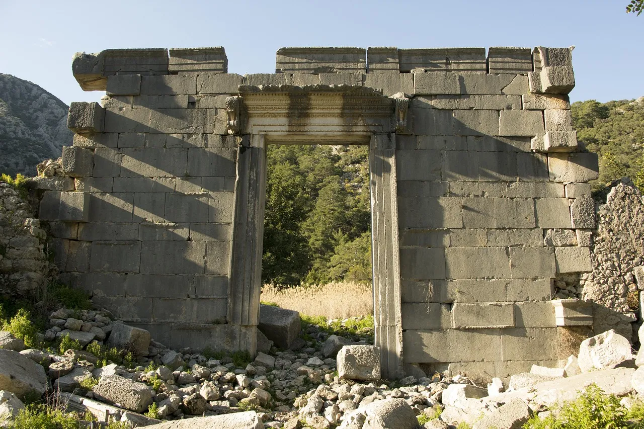
You walk past cliff-carved Lycian tombs, ruined cities, olive groves, and hidden coves. At Patara, you can walk a long, empty beach known for nesting sea turtles, and at Olympos, natural gas flames called the Chimaera have been burning on a hillside for thousands of years. It’s the rare hike where history and beach time share the same afternoon.
- Pace: most days run roughly 8-15 miles, with frequent guesthouse options.
- Best seasons: spring wildflowers and fall harvest, when temperatures are comfortable.
- Fitness level: lower elevations make it accessible to a wider range of hikers.
Many U.S. hikers say the combination of history, swimming, and local hospitality makes it more repeatable than one-and-done high-altitude treks. You can do a week, a month, or just a few stages and still feel like you’ve discovered something.
Worth Knowing
- No lottery: there’s no permit scramble like the Inca Trail’s.
- No altitude gamble: you’re not racing thin air like on Kilimanjaro or Thorong La.
- Flexible by design: the full 335 miles can be split into short stages.
- Built-in rest stops: guesthouses and coastal swimming breaks are part of the rhythm.
Here’s our take: the Inca Trail and Kilimanjaro are about trophies, and that’s fine, but the trails that stay with you are the ones that give you time to feel something. The Camino, the Overland Track, and the Lycian Way do that better than any summit photo can. Altitude records fade, but the memory of a long walk, a cold swim, and a stranger’s kindness at the end of the day won’t.
If you can only afford one plane ticket, skip the line of people chasing the same famous picture. Pick the trail that gives you the most days of being fully, happily lost in a place that isn’t home.

- 7 Everyday Habits That Can Make Your Senior Dog Happier - November 5, 2026
- 10 Enigmatic Structures That Continue to Puzzle Scientists Today - November 5, 2026
- 10 Strange Ruins in the Americas That Challenge What We Know About Early History - November 5, 2026