
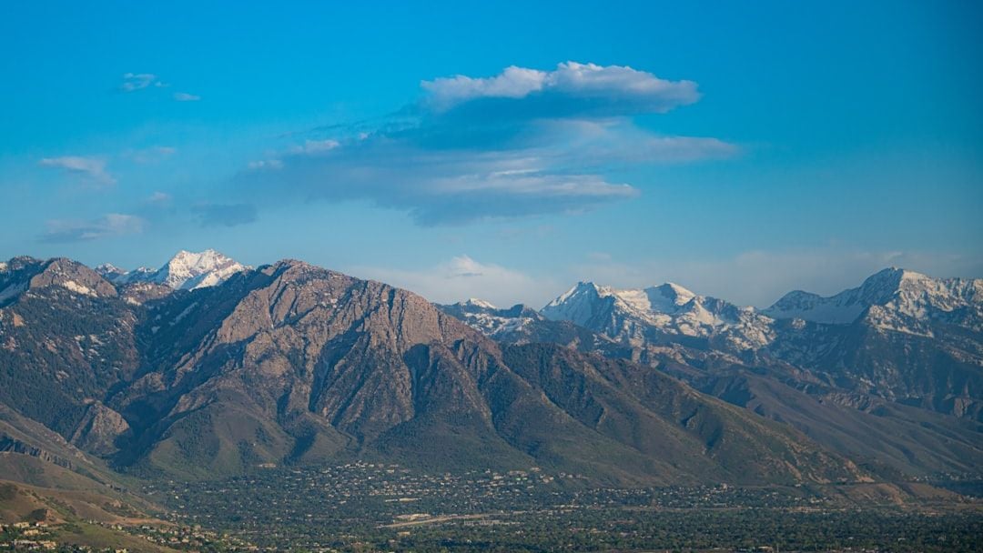
Most people immediately think of California when they hear the words earthquake and fault line. The San Andreas gets all the publicity, all the Hollywood disaster movies, and nearly all the attention from East Coast residents who thank their lucky stars they don’t live out west. Yet here’s the thing: some of the most menacing seismic threats in America aren’t along the Pacific coastline at all. They’re hiding beneath Midwest farms, slicing through Rocky Mountain valleys, lurking under bustling northeastern cities, and creeping along the seemingly quiet Pacific Northwest shoreline.
These lesser known fault zones don’t make headlines every year. Many haven’t moved violently in decades, some in centuries. That long silence, though, can be deceiving. The stress builds, the pressure mounts, until one day the ground decides it’s had enough. What makes these faults especially unnerving is how unprepared we are for them compared to California. Buildings weren’t constructed with earthquakes in mind. Emergency plans sometimes don’t exist. People simply don’t expect the earth to shake where they live.
So let’s dive in.
The New Madrid Seismic Zone: America’s Heartland Nightmare
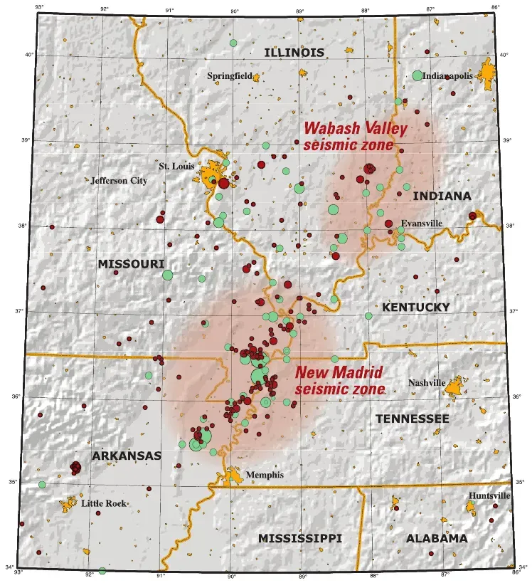
While not as well known for earthquakes as California or Alaska, the New Madrid Seismic Zone (NMSZ), located in southeastern Missouri, northeastern Arkansas, western Tennessee, western Kentucky and southern Illinois, is the most active seismic area in the United States, east of the Rocky Mountains. This is the fault system that literally made the Mississippi River run backward. The zone had four of the largest earthquakes in recorded North American history, with moment magnitudes estimated to be as large as 7 or greater, all occurring within a 3-month period between December 1811 and February 1812.
Think about that for a moment. Four massive quakes in just three months, and they were felt hundreds of miles away in places like Boston and Charleston. Due to the nature of the bedrock in the earth’s crust in the central United States, earthquakes in this region can shake an area approximately 20 times larger than earthquakes in California. The geology here amplifies seismic waves rather than dampening them. Buildings in Memphis, St. Louis, and Nashville sit atop soft sediment that would liquefy and ripple like water during a major event.
Depending on which agency you ask, the estimates are that there’s better than a 30% chance that a magnitude 6 or greater earthquake will strike Missouri and/or Illinois in our lifetime. The scary part? Most structures in the region were not built to withstand earthquake shaking, as they have been in more seismically active areas like California.
The Cascadia Subduction Zone: The Pacific Northwest’s Sleeping Giant
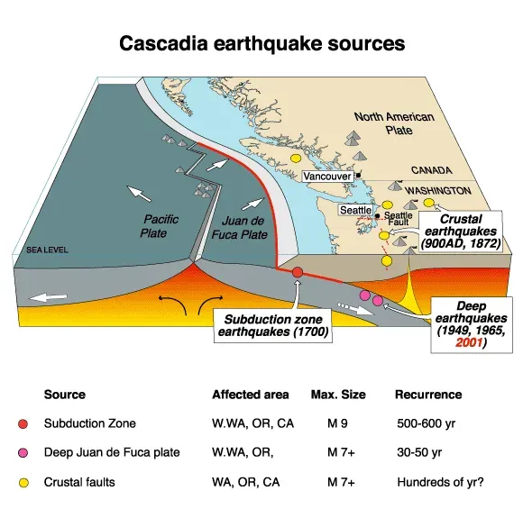
Lying just off the coasts of Northern California, Oregon, Washington, and British Columbia, the Cascadia Subduction Zone is the most dangerous fault line you’ve never heard of – unless you live in the Pacific Northwest. This isn’t your typical fault where plates grind past each other horizontally. This is a subduction zone where one massive tectonic plate is diving beneath another, building up unimaginable amounts of energy.
The original magnitude 9.0 earthquake in the Pacific Northwest had thus occurred around 9 pm Pacific Standard Time on 26 January 1700. Japanese records documented the resulting tsunami that crossed the entire Pacific Ocean. Scientists have determined that over the last 10,000 years, more than 40 earthquakes greater than magnitude 8 occurred somewhere along the Cascadia subduction zone. That’s roughly one massive quake every couple centuries.
Oregon has the potential for a 9.0+ magnitude earthquake caused by the Cascadia Subduction Zone and a resulting tsunami of up to 100 feet in height that will impact the coastal area. There is an estimated five to seven minutes of shaking or rolling that will be felt along the coastline with the strength and intensity decreasing the further inland you are. Cities like Portland and Seattle would face devastation on a scale never before witnessed in modern American history.
The Wasatch Fault: Utah’s Urban Earthquake Time Bomb
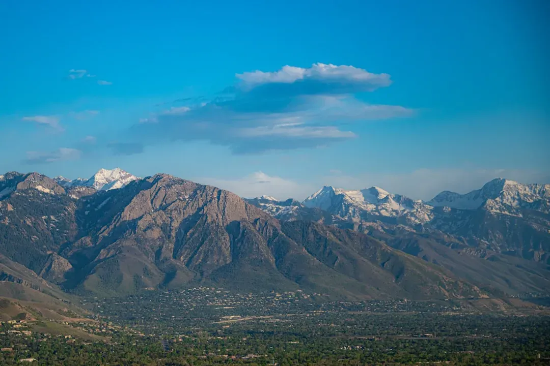
Stretching along the western edge of the majestic Wasatch Mountains, this fault is hiding in plain sight beneath one of America’s fastest growing urban corridors. Currently, about 80% of Utah’s population live along the Wasatch Fault, representing the largest earthquake threat in the interior Western U.S. Salt Lake City, Provo, and Ogden all sit directly atop different segments of this roughly 240-mile long fracture zone.
During the past 10,000 years, major earthquakes (magnitude 7.0 or greater) occur about every 900–1,300 years along any one of the five central segments of the Wasatch Fault. However, the average time-span between earthquakes along the entirety of the central segments is about 300 years. Here’s the kicker: Statistically, the Wasatch Fault is overdue for another major earthquake. Experts have given a 57% probability of an earthquake magnitude 6.0 or greater occurring within the next 50 years.
The mountains themselves are evidence of this fault’s violent history, having been uplifted and tilted over millennia of repeated ruptures. A report released by Bob Carey of Utah’s Office of Emergency Services and published by the Deseret News in April 2006 predicts that a strong earthquake occurring in Salt Lake City could kill up to 6,200 people, injure 90,000, and cause US$40 billion in economic losses.
The Ramapo Fault: New York’s Hidden Threat
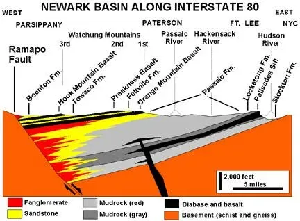
Manhattan. Brooklyn. Newark. Philadelphia. All these densely populated urban centers sit uncomfortably close to the Ramapo Fault system, yet few residents have any idea it exists. Spanning more than 185 miles (298 km) in New York, New Jersey, and Pennsylvania, it is perhaps the best known fault zone in the Northeastern/Mid-Atlantic region, and some small earthquakes have been known to occur in its vicinity.
Eastern earthquakes are strange beasts. When these rare eastern U.S. events do occur, the areas affected by them are, on average ten times as large as western ones for events of the same magnitude. The ancient, cold bedrock of the East Coast transmits seismic energy much more efficiently than California’s fractured crust. A moderate earthquake here could rattle buildings from Boston to Baltimore.
A 2008 study argued that a magnitude 6 or 7 earthquake was destined to originate from the Ramapo fault zone, which would almost definitely spawn hundreds or even thousands of fatalities and billions of dollars in damage. The problem? Most buildings were built before the seismic code was put in place in 1995. Unreinforced masonry and old infrastructure simply weren’t designed for shaking ground.
The Eastern Tennessee Seismic Zone: Appalachia’s Quiet Rumbler
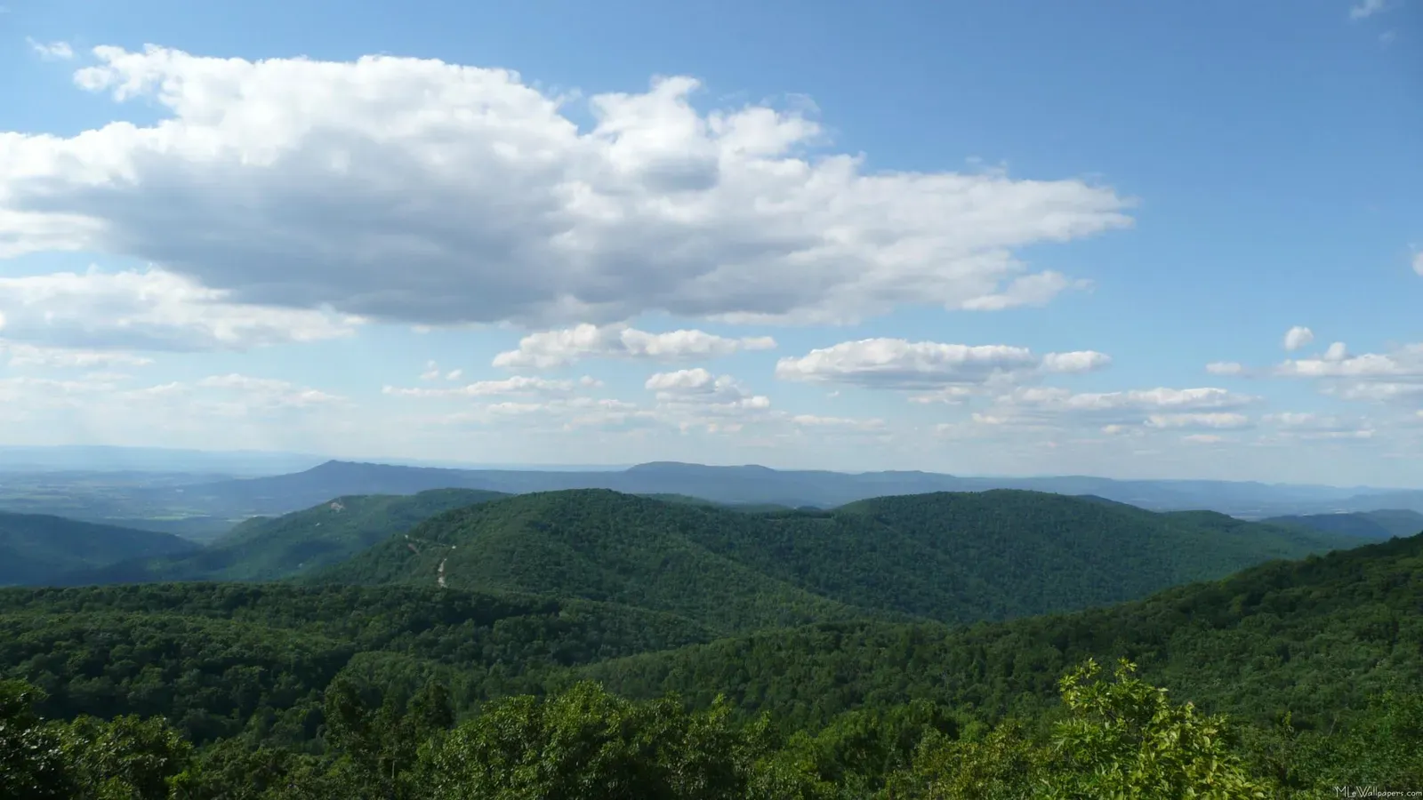
Stretching from northeastern Alabama through eastern Tennessee into southwestern Virginia, the Eastern Tennessee Seismic Zone (ETSZ) is one of the most active regions in the eastern US, despite its low profile. It produces hundreds of small quakes a year, most too minor to feel – but occasionally enough to rattle windows and nerves. This zone doesn’t get much press, mainly because it hasn’t produced a truly devastating earthquake in recorded history.
What makes this fault system particularly mysterious is its location. What’s curious about this fault system is that it’s not on a plate boundary. Scientists still debate exactly why earthquakes happen here at all, since we’re thousands of miles from the nearest edge of a tectonic plate. The stress appears to be transmitted through the continental interior, reactivating ancient zones of weakness formed hundreds of millions of years ago.
The risk here isn’t necessarily a magnitude 8 monster, but rather a moderate earthquake striking near population centers like Knoxville or Chattanooga. Older Appalachian structures weren’t built with seismic activity in mind. Even a magnitude 5 or 6 quake could cause significant damage and disruption across the region.
The Charleston Seismic Zone: The South’s Forgotten Fault
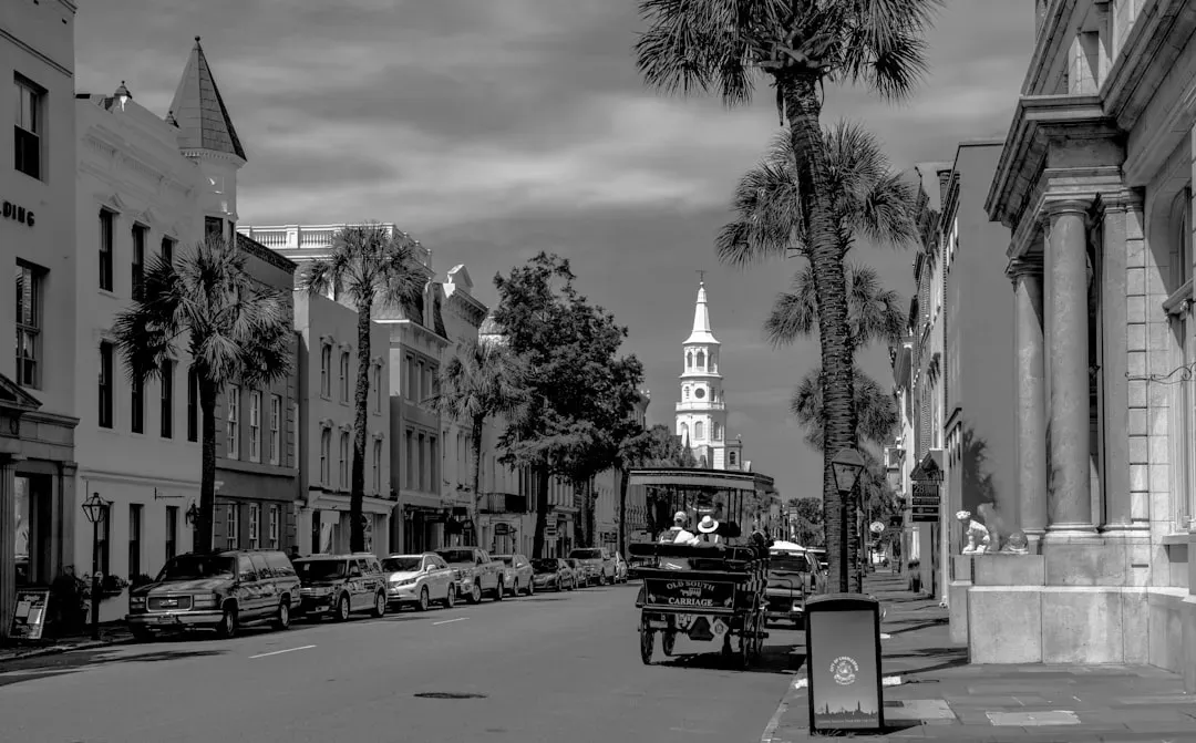
Charleston, South Carolina seems like the last place you’d worry about earthquakes. Palm trees, historic architecture, coastal charm. Yet in 1886, the city was nearly destroyed by a massive earthquake estimated around magnitude 7. The 1895 event had its epicenter near Charleston, Missouri. The quake damaged virtually all the buildings in Charleston, created sand blows by the city, cracked a pier on the Cairo Rail Bridge, and toppled chimneys in St Louis.
The trouble with the Charleston area is that geologists still don’t fully understand where the fault actually is or how it works. Unlike western faults that are clearly visible as surface ruptures, the Charleston seismic zone remains elusive. Earthquakes here seem to originate from deeply buried faults that don’t reach the surface. This makes predicting their behavior incredibly difficult.
Modern Charleston is a thriving coastal city with a booming tourism industry and rapidly growing population. Historic buildings that survived the 1886 quake now share streets with modern high rises. A repeat of that 19th century disaster would cause catastrophic damage to irreplaceable architecture and modern infrastructure alike. Scientists know another major quake will happen eventually. They just can’t say when.
Conclusion: The Fault Lines We Ignore
These six fault zones represent some of America’s most underestimated seismic threats. They don’t generate the constant stream of minor earthquakes that keep California residents perpetually earthquake aware. Their silence breeds complacency. Communities grow, buildings rise, infrastructure expands, all without the earthquake preparedness mindset that’s second nature on the West Coast.
The New Madrid could devastate the American heartland. Cascadia could unleash a magnitude 9 megaquake and tsunami. The Wasatch threatens Utah’s population centers. The Ramapo lurks beneath the nation’s most densely populated corridor. Eastern Tennessee quietly rumbles. Charleston holds secrets about southern seismicity we still don’t understand.
Earthquakes don’t care about frequency or expectations. They care about physics and accumulated stress. These faults will move again. The only question is when. Are we prepared? Do we even know they exist? What surprises you most about where earthquakes can strike in America?

- America’s Most Dangerous Fault Lines You’ve Probably Never Heard Of - July 14, 2026
- Animal Psychology Says If You See a Large Gathering of Crows in Your Yard at Dawn It Is a Sign of Complex Social Behaviour – and the Cognitive Power Required for It Belongs to an Elite Group of Species - July 14, 2026
- 10 World’s Most Beautiful Gardens - July 14, 2026