Flooding Takes Center Stage Amid Heavy Rains (Image Credits: Static.fox4news.com)
Dallas-Fort Worth – Heavy downpours from a sprawling storm system soaked North Texas on Saturday morning, yet risks for severe weather began to wane by afternoon.[1]
Flooding Takes Center Stage Amid Heavy Rains
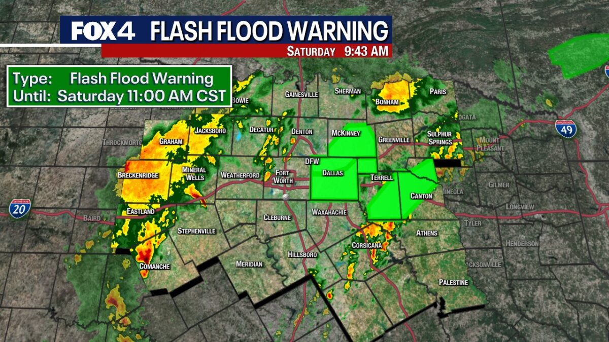
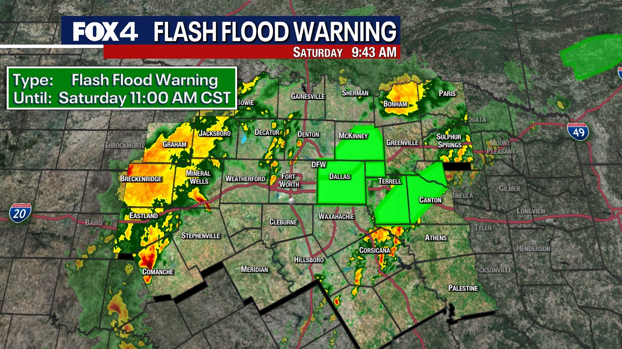
Flash flood warnings blanketed parts of the region early Saturday. Authorities issued alerts for Dallas, Collin, Rockwall, Kaufman, Rains, and Van Zandt counties, with some extending until noon.[1] A river flood warning persisted in Dallas County through evening.
Rainfall rates hit 1 to 3 inches per hour in spots. Radar data indicated several inches had already accumulated, prompting flooded road reports across the metro area. The National Weather Service highlighted isolated heavy downpours as the primary hazard.[2]
Friday’s earlier storms set the stage, delivering hail up to 2 inches and prompting a brief tornado watch north of the metroplex. That watch lifted early evening as activity shifted eastward.[3]
Cold Front Ushers Gusts and Chilly Shift
A robust cold front fueled the system, whipping up north winds gusting to 40 mph at DFW Airport. Western North Texas saw even stronger bursts beyond 40 mph.
Temperatures plunged behind the front. Readings dipped into the 40s out west, hovered near 50 degrees in the Dallas-Fort Worth core, and lingered in the low 70s southeastward. Afternoon highs stalled in the 40s and 50s regionwide.[1]
- Sustained winds: 15-25 mph post-front.
- Friday severe risks: Large hail, damaging winds, low tornado chance.
- Saturday focus: Heavy rain over severe storms.
Afternoon Clears as Threats Subside
Steady rain dominated mid-morning but transitioned to scattered showers by afternoon. Isolated thunderstorms lingered into evening, carrying minor risks of small hail, gusty winds, and brief heavy bursts.[2]
Severe potential remained limited overall. The storm system’s southern fringe spared North Texas its worst, with activity tapering significantly later Saturday. Breezy, soggy conditions prevailed, yielding to gradual clearing overnight.
Sunday Relief, New Storms Loom Midweek
Sunday promised a welcome turnaround. Partly sunny skies returned, pushing highs into the 70s. Only stray showers threatened south of the metroplex.
Rain chances climbed again Tuesday. Forecasters eyed strong to severe storms from an incoming upper-level system, potentially packing familiar hazards. Residents faced daily shower threats through midweek before drier air arrived.[1][4]
| Day | High/Low | Conditions |
|---|---|---|
| Saturday | 40s-50s / 40s | Breezy, showers tapering |
| Sunday | 70s / 40s | Partly sunny |
| Tuesday | 70s-80s / 60s | Storms possible |
Key Takeaways
- Flooding posed the top Saturday risk; drive cautiously on wet roads.
- Cold front dropped temps 20+ degrees; bundle up afternoon.
- Severe weather odds low now, but monitor Tuesday developments.
North Texas navigated another volatile spring day, emerging with manageable impacts from the storm. Brighter weather offers respite, though vigilance remains key for midweek threats. What impacts did you see from Saturday’s rains? Share in the comments.
- Urban Coyotes Show Remarkable Adaptability, Learning to Thrive in City Environments - July 22, 2026
- Beavers Are Nature’s Engineers, Creating Vital Habitats for Other Wildlife Species - July 21, 2026
- The Recovery of the California Condor Offers Hope for Other Critically Endangered Birds - July 21, 2026