
There is a fault running directly beneath some of the most densely populated cities in America. It passes under university campuses, hospital complexes, BART stations, and hundreds of thousands of homes. Most days, people go about their lives without giving it a second thought. Yet seismologists have been watching it closely for decades, and what they see is not reassuring.
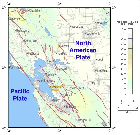
The Hayward Fault is a 74-mile-long strike-slip fault running through the East Bay of the San Francisco Bay Area, running directly under densely populated cities. The USGS has called it “a tectonic time bomb” and one of the most dangerous urban faults in America. The fault last ruptured in 1868 with a magnitude 6.8 quake, and according to a 2023 report by the California Geological Survey, it’s considered overdue for another major event. What follows is a clear-eyed look at what science tells us would actually happen if that rupture came today.
A Fault That Is Long Overdue
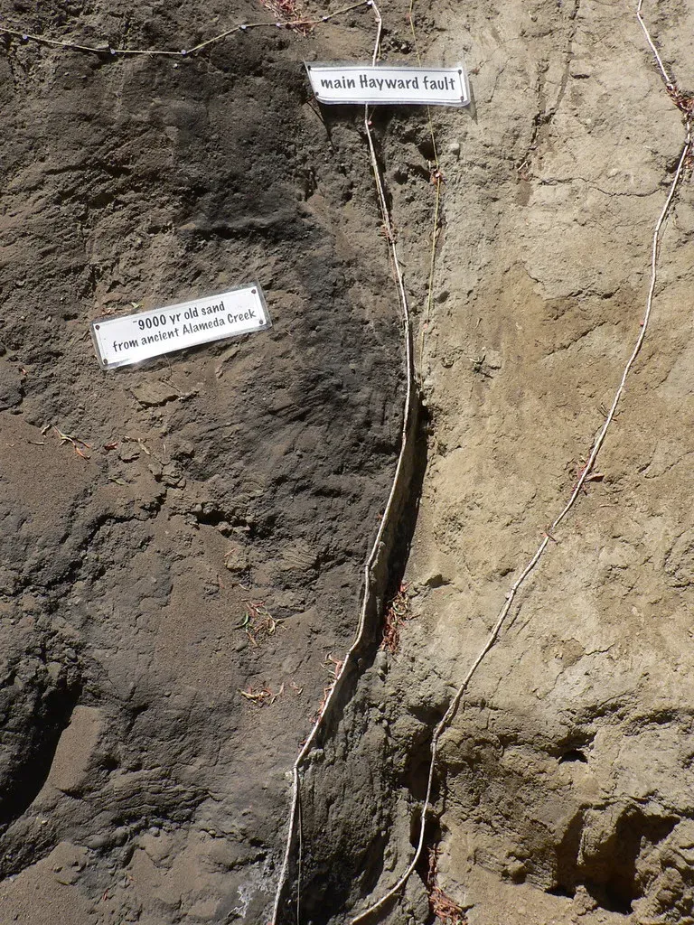
The timing alone is enough to give seismologists pause. Geological data shows a roughly 140 to 160-year recurrence interval for major ruptures on the Hayward Fault, based on patterns stretching back nearly two millennia. The gap since 1868 now stands at over 157 years, placing the fault squarely in a late stage of its earthquake cycle.
Scientists have studied the faults of the Bay Area extensively and determined that the Hayward is probably the most dangerous. It carries a roughly one-in-three chance of rupturing in a magnitude 6.7 or greater earthquake before 2043, and the broader Bay Area faces a nearly three-in-four chance of experiencing at least one such event in the same window.
The Hayward Fault is the single most urbanized earthquake fault in the United States. Back in 1868, only about 24,000 residents lived in Alameda County. Today that number has grown to more than 2.4 million people. The fault has not changed. The world around it has changed almost beyond recognition.
The First 60 Seconds: Ground Shaking and Surface Rupture

In the USGS HayWired scenario, a hypothetical earthquake centered in Oakland ruptures both northward and southward along the Hayward Fault for about 52 miles. East Bay cities from Richmond in the north to Fremont in the south would be hardest hit by violent ground shaking lasting more than a minute, with strong shaking felt throughout the broader region.
A large Hayward Fault earthquake would produce strong ground shaking, permanent displacement of the Earth’s surface, landslides, and liquefaction, where soils become liquid-like during shaking, along with subsequent fault slip and aftershocks. In some locations, the fault itself could shift horizontally by more than six feet in an instant.
Simulations specifically show stronger ground motions on the eastern side of the fault, in places like Orinda and Moraga, compared to the western side. This results from different geologic materials, specifically the deep, weaker sedimentary rocks that form the East Bay Hills. Where the ground is soft, the shaking amplifies dramatically.
Casualties, Displacement, and the Human Cost
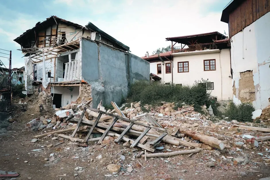
The HayWired scenario estimates roughly 800 deaths and approximately 18,000 nonfatal injuries from building and structural damage caused by ground shaking and liquefaction hazards alone. Those numbers, sobering as they are, assume a specific time of day. A nighttime event, when more people are home in older residential buildings, could significantly alter the toll.
California Geological Survey earthquake planning scenarios for a higher-magnitude event on the Hayward Fault have anticipated anywhere from 1,500 to 4,500 deaths, depending on the time of occurrence, and roughly three times that number in nonfatal casualties. The range is wide precisely because timing matters so much.
Emergency planning documents note that an earthquake along the Hayward Fault would cause significant loss of life and injuries, and extensive damage to homes, businesses, and infrastructure such as transportation and utility systems. Several hundred thousand people would likely be left homeless in the aftermath.
Infrastructure Collapse: Roads, Water, and Power
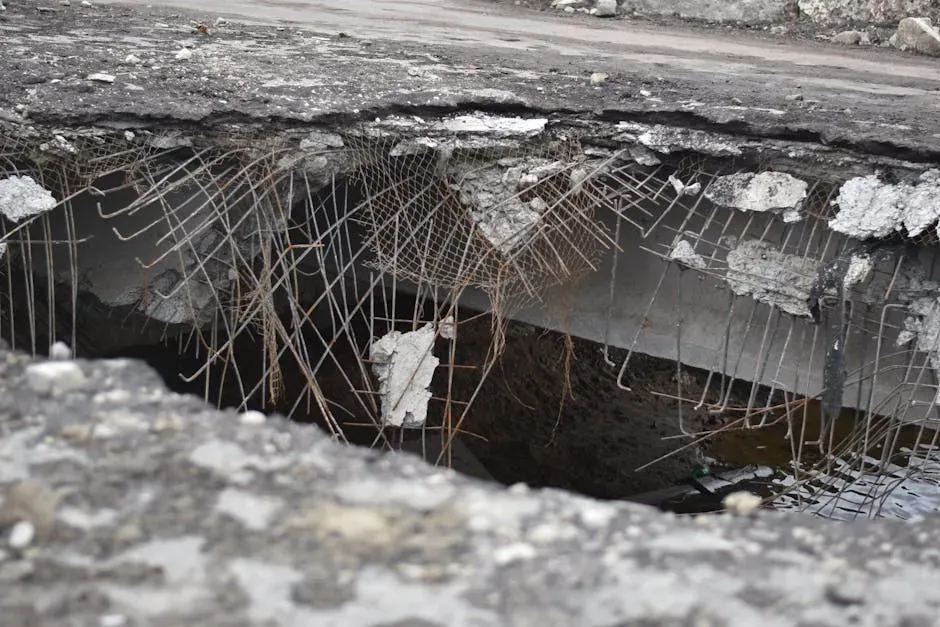
A number of major roadways, including interstates 580, 680, and 80 as well as Highway 24, all traverse the fault. In addition, the bulk of the water supply for the region flows from the east through pipelines that bisect the Hayward Fault. When the ground moves, all of those lifelines move with it.
Potable water systems in most of the region would be affected, and East Bay residents could lose water service for six weeks, with some areas potentially without service for as long as six months. That is not simply an inconvenience. It becomes a public health crisis almost immediately.
Strong shaking and fault rupture can lead to many serious secondary problems, including landsliding, liquefaction, fires, disrupted transportation routes, broken water and gas pipes, downed electrical and phone lines, and many other dangerous conditions. The net effects of these secondary hazards are often more severe and more widespread than the damage directly caused by the shaking itself, and they significantly complicate emergency response.
Fire, Liquefaction, and the Cascade of Secondary Hazards
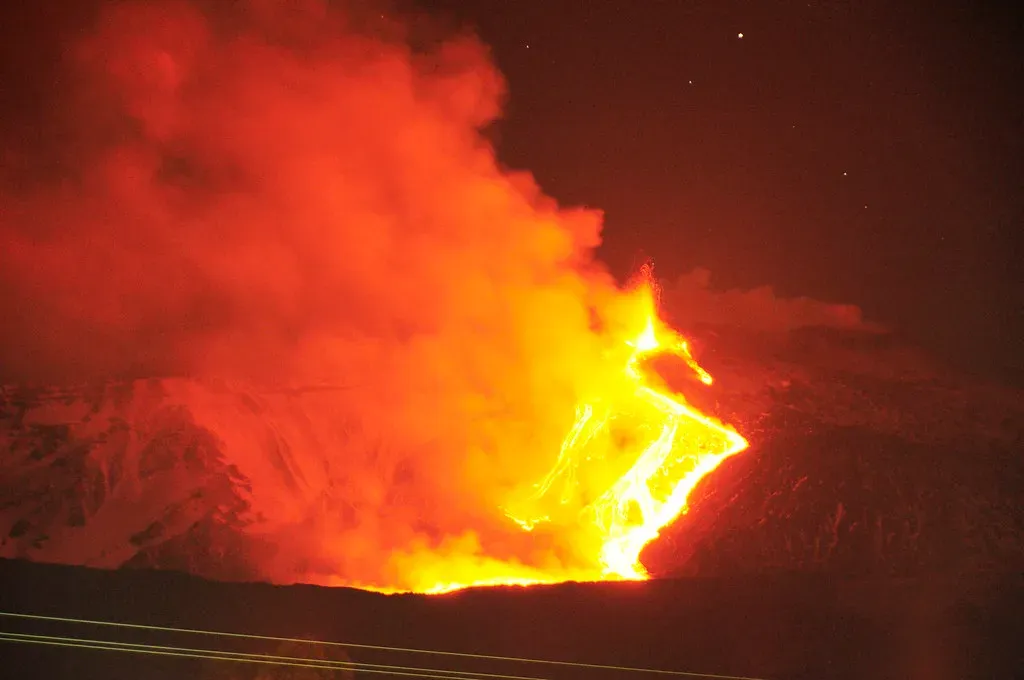
The HayWired scenario estimates that damage from the mainshock could lead to widespread fires throughout the San Francisco Bay region, with more than 400 gas and electric-related fires potentially igniting. The effects would be most severe near the Hayward Fault itself. Broken water mains mean firefighters may arrive to find no pressure in the hydrants.
Depending on seasonal weather conditions at the time of a major event, a seismic event could be followed by urban wildfires compounded by damage to water systems, or by massive landslides in saturated soils. A dry autumn wind combined with ruptured gas lines would be among the worst-case combinations.
Ongoing slip and aftershocks along the Hayward Fault may last for months, further damaging buildings and infrastructure that straddle the fault. Recovery would not begin cleanly the day after. It would unfold in waves, with each aftershock threatening already-weakened structures.
The Economic Fallout: Billions Lost, Recoveries Measured in Years
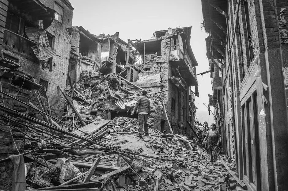
Property damage and direct business disruption losses from ground shaking, liquefaction, and landslides alone are estimated to be more than $82 billion in 2016 dollars. Adjusted for current property values and population growth, that number would be considerably higher today.
In the six months following such an earthquake, total gross regional product losses are estimated at more than $44 billion, representing roughly four percent of California’s projected baseline economic output over that period. That is an enormous blow to one of the world’s largest regional economies.
Only about nine percent of residential building damage and twenty percent of commercial building damage due to earthquake shaking would be covered by insurance. Even with a federal disaster declaration, tens of billions of additional dollars would be needed to finance recovery. The lack of insurance resources would make it particularly difficult for many building owners to repair and replace damaged housing, especially affordable housing.
Preparation, Early Warning, and What Can Still Be Done
The ShakeAlert Earthquake Early Warning System, managed by the U.S. Geological Survey, detects significant earthquakes quickly enough that alerts can be delivered to people and automated systems potentially seconds before strong shaking arrives. ShakeAlert serves more than 50 million residents and visitors in California, Oregon, and Washington.
According to HayWired scenario modeling, up to 1,500 of the estimated 18,000 nonfatal injuries from the mainshock could be prevented if the ShakeAlert system were combined with the Drop, Cover, and Hold On protocol. A few seconds of warning, used correctly, can genuinely save lives.
California’s earthquake preparedness presents a notable paradox: world-leading seismic building codes and scientific understanding exist alongside persistent vulnerabilities from aging infrastructure and unreinforced masonry buildings in historic districts. The state requires comprehensive seismic retrofitting of critical infrastructure and maintains the ShakeAlert early warning system providing seconds to tens of seconds of warning before strong shaking arrives. Progress is real, but the gap between current readiness and what a magnitude 7.0 event would demand remains significant.
Conclusion: Living With a Fault That Will Not Wait Forever
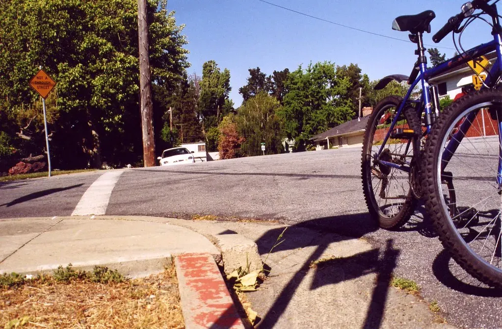
The Hayward Fault does not ask for permission. It moves on geological time, indifferent to city plans, property values, or emergency budgets. Everything we know about it points to one clear conclusion: the question is not whether it will rupture again, but how prepared the region will be when it does.
The USGS and its partners developed the HayWired scenario specifically as a tool to enable further actions such as seismic upgrades and retrofits that can change the outcome when the next major earthquake strikes. The science exists. The plans exist. What remains is the sustained will to act on them.
Across the Bay Area, millions of people go to sleep each night a few miles from one of the most studied and most dangerous faults on Earth. That proximity is not going to change. What can change is how seriously individuals, institutions, and governments take the window of time they still have. Preparation is not pessimism. In this case, it is simply the most rational thing a person can do.