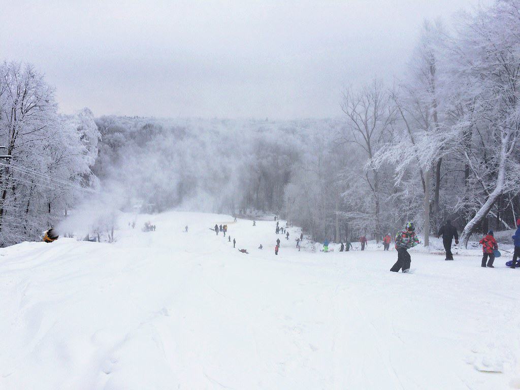
A formidable winter storm is sweeping across broad swaths of the United States this weekend, prompting urgent advisories and winter storm warnings from the National Weather Service (NWS). Meteorologists are forecasting up to 13 inches of snow in some locations, fierce winds, blizzard-level visibility reductions, and potentially life-threatening travel conditions over the next few days. Officials are advising residents to prepare now—before roads become treacherous and essential services are strained.
This system is not just a coastal or mountain event—it’s sprawling, complex, and packed with hazards. Heavy snowfall bands extend from the South into the Mid-Atlantic and beyond, with strong gusts, near-whiteout conditions, and dangerously cold temperatures accompanying the snow. From Georgia to North Carolina, Virginia to Kentucky and points north and west, millions of Americans are under heightened winter weather alerts.
North Carolina: Snow, Wind and Whiteout Danger

In North Carolina, the storm’s heaviest impacts are forecast, with winter storm warnings stretching from the mountains to the Outer Banks. Eastern and coastal counties—including Pamlico, Craven, and Onslow—are expected to see 8-13 inches of snow, with the highest totals along the central coast. Fierce winds gusting as high as 65–70 mph could create blizzard-like conditions in parts of the state, dramatically reducing visibility and piling snow into drifts.
Residents across the Piedmont and Sandhills face snow totals of 3–7 inches, while higher elevations are bracing for even more. Authorities have stressed that roadways may become impassable, urging people to delay non-essential travel and stock up on supplies in case of prolonged isolation.
Kentucky: Slick Roads and Ongoing Snow
Eastern Kentucky is also under warning, particularly in counties like Harlan, Letcher, and Pike. Although snow totals here are generally lighter than in the Carolinas, continuous snowfall and slick road conditions are expected through Saturday afternoon. Emergency planners are cautioning drivers to slow down and prepare for winter hazards.
In nearby counties such as Bell, a winter weather advisory remains in effect, signaling continued snow accumulation—especially in higher elevations above 1,500 feet. State transportation agencies are deploying crews to keep major routes treated and passable, but treacherous patches of ice and slush remain likely.
Virginia: Broad Blizzard-Risk Conditions Across Commonwealth

Across Virginia, expansive winter storm warnings cover southwest, south-central, and eastern regions through Sunday. Snowfall could be heavy in mountain and coastal counties alike, with gusts up to 60 mph expected in areas such as Norfolk, Suffolk, and the Eastern Shore. Forecasters warn that wind-driven snow could quickly reduce visibility and lead to hazardous travel.
Further inland, from Roanoke to Lynchburg, lighter snow is expected—but still enough to create slippery roads and travel headaches. State emergency management officials advise motorists to carry blankets, water, and food in vehicles if travel is unavoidable.
South Carolina: Central and Coastal Snowfall Hits Hard
South Carolina finds itself directly in the storm’s path as well. Central counties like Lexington, Richland, and Sumter are forecast to receive 6–9 inches of snow, while coastal areas including Charleston and Dorchester could see 3–6 inches. Gusty winds up to 35 mph will worsen conditions, blowing snow across highways and city streets.
Travel officials have reported rapid deterioration in driving conditions across the Midlands and coastal plains, with visibility dropping sharply in heavy snow bands. Emergency responders are positioned for rapid assistance, but residents are urged to stay off the roads until conditions improve.
Georgia: Northern Counties Brace for Accumulation
In Georgia, winter storm warnings extend across a large portion of the state. Northeastern counties—such as Fannin, Union, and Towns—are expecting 4–6 inches of snow along with bitter below-zero wind chills, an unusual but impactful winter scenario.
Central counties including Forsyth and Hall are bracing for 3–5 inches, while areas farther south are under warnings for 1–3 inches. Near the coast, advisories are in place for lighter accumulations, but even small amounts of snow can lead to dangerous travel conditions where residents may be unaccustomed to winter weather.
Tennessee: Snow in the Smokies and Valley Locations
East Tennessee remains under winter storm warnings into early Sunday. Valley areas in the Smoky Mountains could see up to 12 inches of snow, with lower elevations expecting between 2 and 10 inches. Even outside of the high country, roads are expected to turn icy as temperatures plunge into the single digits.
Middle and southern counties are also under winter weather advisories, which signal hazardous but lighter snow and slush. Drivers should anticipate slippery bridges, highway ruts, and potential delays as plows work to clear major routes.
West Virginia: Persistent Winter Weather Impacts
In West Virginia, conditions remain treacherous as well. Counties like McDowell are under storm warnings through Saturday night, where another two inches of snow could fall in addition to existing accumulations. Surrounding areas under advisories will see continued slick, icy road conditions.
State travel officials have emphasized that even minimal new snowfall can exacerbate already challenging roadways, especially where temperatures are well below freezing. Drivers are advised to check real-time road conditions before heading out.
Midwestern and Northern Advisory Areas
Beyond the core Southern and Mid-Atlantic states, the storm’s reach extends into parts of the Upper Midwest and Northern Plains. States such as South Dakota and North Dakota are currently under winter weather advisories, with lighter snow, patchy ice, and strong winds making travel tricky in open areas.
In Montana, freezing rain and gusty winds are creating slippery surfaces and visibility challenges. Meanwhile, lake-effect snow continues along parts of *Illinois and Indiana’s shoreline, adding a few additional inches where snow bands persist.
Prepare, Stay Informed, Avoid Travel
This expansive winter storm is shaping up to be one of the most widespread and disruptive of the season, with heavy snow, strong winds, and dangerous travel conditions affecting a swath of states from the South into the North. With up to 13 inches of snow possible in key regions and whiteout conditions forecast in others, the advice from forecasters is consistent: stay off the roads, heed official warnings, and prepare for potentially prolonged winter weather impacts.
As the system continues to move through the U.S., residents should monitor the latest advisories from the National Weather Service, keep emergency supplies on hand, and avoid non-essential travel until weather conditions improve.
- What It Actually Means When a Hummingbird Visits You - July 25, 2026
- Which Ocean Animal Are You Based on Your Zodiac Sign? - July 25, 2026
- 12 Powerful Dog Breeds that Can Take Down a Wolf - July 24, 2026