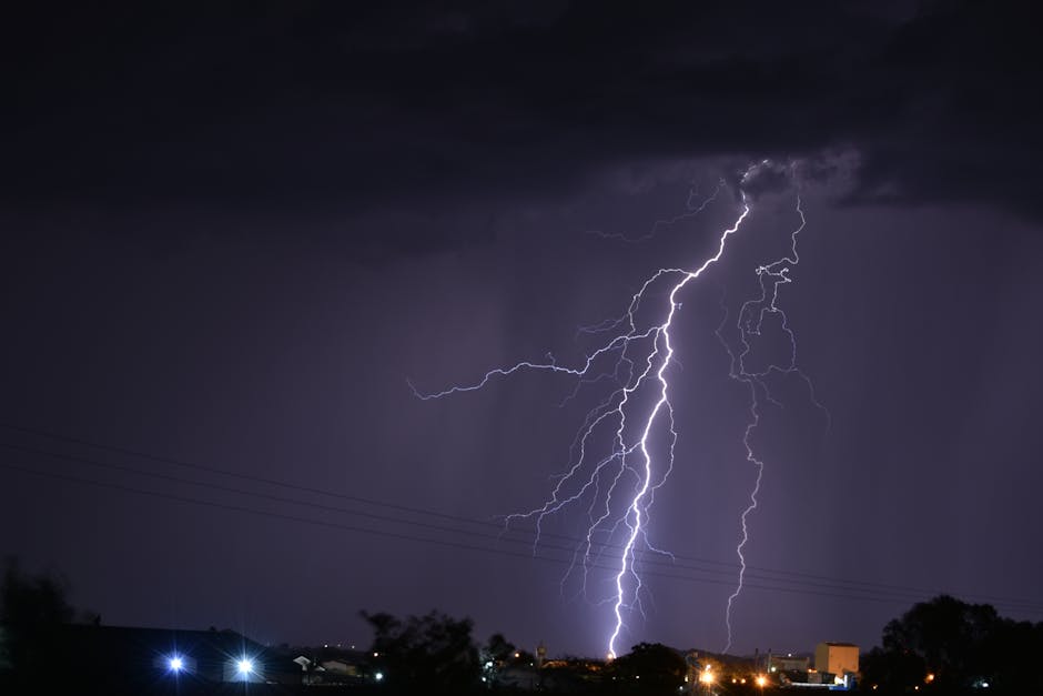
Dallas – Widespread showers and flashes of lightning swept through North Texas on Tuesday, capping daytime highs around 60 degrees.[1][2] The stormy weather prompted caution for commuters and outdoor plans alike. Forecasters noted a transition to milder conditions midweek, with temperatures climbing and a possible return of severe storms by the weekend.[1]
Storms Dominate Tuesday’s Skyline
Showers and thunderstorms arrived early Tuesday across the Dallas-Fort Worth area, with radar images showing bands of rain pushing eastward.[1] Highs struggled to reach the low 60s amid persistent cloud cover and precipitation, a noticeable dip from recent warmer days. South-southeast winds gusted up to 20 mph, adding to the blustery feel.[2]
Lightning accompanied many of the heavier downpours, raising brief concerns for localized flash flooding in low-lying spots. The National Weather Service reported chances of rain exceeding 90 percent through the afternoon, tapering slightly by evening.[3] Overnight lows hovered near 59 degrees under mostly cloudy skies. While non-severe overall, the system kept emergency services on alert throughout North Texas.[4]
Midweek Shift Promises Sunnier Skies and Rising Mercury
Relief appeared on the horizon Wednesday, as the rainy pattern gave way to partial clearing and warmer air. Daytime highs climbed into the upper 70s, with morning showers fading quickly.[3] Southerly winds strengthened to around 15-18 mph, ushering in more comfortable conditions for the Dallas metroplex.
Thursday brought further warming, with forecasts calling for highs near 82 degrees under partly sunny skies. Lows remained mild in the upper 60s. This brief respite offered residents a chance to dry out after Tuesday’s deluge. However, humidity began building again, setting the stage for later developments.
Weekend Forecast Hints at Renewed Storm Activity
Temperatures peaked Friday near 87 degrees, but scattered clouds hinted at instability returning. The warming trend persisted into the weekend, with highs in the mid-80s both Saturday and Sunday.[5] Forecasters eyed a potential severe weather setup, echoing patterns seen earlier in the month.
Isolated thunderstorms could pack heavy rain, hail, or gusty winds, particularly late in the weekend. The FOX 4 team highlighted this threat as rain chances ticked up to 20-30 percent by Sunday.[1] Monitoring radar remained essential for anyone planning outdoor events.
Weekly Outlook at a Glance
North Texas residents can reference this snapshot of the coming days for planning:
| Day | High/Low (°F) | Conditions |
|---|---|---|
| Tuesday | 63/59 | Showers, thunderstorms likely[2] |
| Wednesday | 79/66 | Chance early showers, then warming[3] |
| Thursday | 82/68 | Partly sunny |
| Friday | 87/66 | Mostly sunny, humid[5] |
| Saturday | 86/68 | Partly cloudy |
This table draws from National Weather Service and local outlets, underscoring the volatile spring pattern.
- Tuesday’s rain limited highs to the 60s; grab an umbrella for travel.
- Midweek highs soar to the 80s, ideal for outdoor activities.
- Watch for severe storms over the weekend—stay weather-aware.
April’s unpredictable weather in North Texas serves as a reminder of spring’s dual nature: refreshing rains followed by building heat and storm potential. Keep apps updated and have a plan ready. What are your weekend plans amid this forecast? Share in the comments.
- Urban Coyotes Show Remarkable Adaptability, Learning to Thrive in City Environments - July 22, 2026
- Beavers Are Nature’s Engineers, Creating Vital Habitats for Other Wildlife Species - July 21, 2026
- The Recovery of the California Condor Offers Hope for Other Critically Endangered Birds - July 21, 2026