
Storm Builds Momentum for Holiday Disruption (Image Credits: Flickr)
Southern California – Residents and travelers prepared for a significant weather event as a potent atmospheric river storm barreled toward the region, promising heavy rainfall and strong winds over the holiday period.
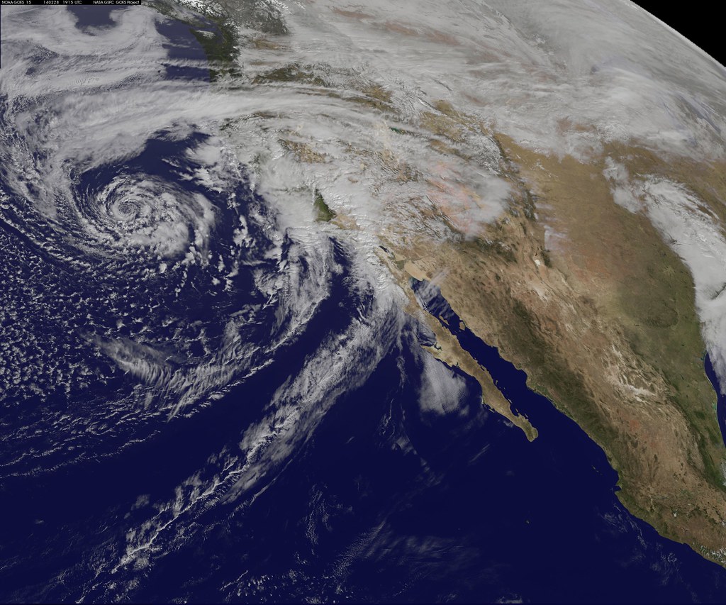
Storm Builds Momentum for Holiday Disruption
The National Weather Service issued warnings about the incoming system, which forecasters described as one of the strongest to target the area during Christmas week in recent years. This atmospheric river, drawing moisture from the Pacific, began influencing Northern and Central California on Monday before shifting southward. Officials noted a 90 percent chance of moderate to heavy rain across Southern California, with the storm’s core expected to linger through Saturday.
By Tuesday morning, scattered showers had already dotted the landscape, but the real intensity arrived later that day. Winds gusting up to 50 miles per hour accompanied the downpours, raising concerns for power outages and structural damage in exposed areas. Meteorologists emphasized that the system’s prolonged nature set it apart from typical winter fronts, potentially leading to saturated soils and heightened flood risks.
Timeline of the Approaching Onslaught
The storm unfolded in phases, starting with lighter precipitation on Christmas Eve that escalated overnight. Heaviest rainfall rates, reaching half an inch to one inch per hour, struck between midnight Tuesday and noon Wednesday, according to the latest models from the National Weather Service’s Oxnard office. This peak period targeted coastal and foothill communities, where urban runoff could overwhelm storm drains.
Rainfall eased somewhat on Christmas Day but persisted into Thursday, with totals projected at 4 to 8 inches in many spots. Lingering showers extended into Friday and Saturday, while mountain areas faced additional snow accumulation above 5,000 feet. The extended duration meant cumulative effects, such as river swelling and mudslide threats in burn scar regions.
- Tuesday: Initial bands of rain and gusty winds arrive, with 80-100 percent chance in Los Angeles County.
- Wednesday: Peak intensity brings flash flood potential, especially in Southern Foothills.
- Thursday-Christmas Day: Steady rain continues, tapering in the afternoon.
- Friday-Saturday: Scattered showers possible, with southerly winds maintaining moisture.
Travel and Safety Challenges Intensify
Officials urged holiday travelers to reconsider plans, citing hazardous road conditions from flooding and reduced visibility. Major routes like Interstate 5 over the Grapevine risked closures due to snow and ice at higher elevations. Airports in Los Angeles and surrounding areas reported delays, while coastal ports braced for rough seas that could disrupt shipping.
Evacuation warnings activated in vulnerable zones, including recent wildfire burn areas prone to debris flows. Emergency services highlighted the dangers of driving through flooded streets, where even shallow water could sweep vehicles away. Power companies readied crews for widespread outages, as the combination of rain and wind strained infrastructure across the Southland.
Preparation Steps for Residents
Local authorities recommended stocking essentials like non-perishable food, water, and flashlights in advance of potential isolations. Clearing gutters and securing outdoor items helped mitigate property damage from winds and heavy rain. Those in flood-prone neighborhoods monitored alerts via apps from the National Weather Service and local emergency management.
Community centers opened as warming stations, and sandbag distribution points proliferated to combat rising waters. Forecasters advised against unnecessary travel, particularly over passes where black ice posed silent threats. Pet owners and farmers took extra precautions to protect animals from the elements during this festive yet fraught time.
Key Takeaways
- Expect 4-8 inches of rain, with flash flooding as the primary hazard.
- Strong winds up to 50 mph could cause outages and travel disruptions.
- Monitor updates from the National Weather Service for real-time changes.
As the storm unfolded, its impacts underscored the unpredictable power of California’s winter weather, turning holiday cheer into a test of resilience. Communities that heeded the warnings stood better prepared to navigate the deluge and emerge stronger. What preparations have you made for this holiday weather? Share your thoughts in the comments below.
- Urban Coyotes Show Remarkable Adaptability, Learning to Thrive in City Environments - July 22, 2026
- Beavers Are Nature’s Engineers, Creating Vital Habitats for Other Wildlife Species - July 21, 2026
- The Recovery of the California Condor Offers Hope for Other Critically Endangered Birds - July 21, 2026