
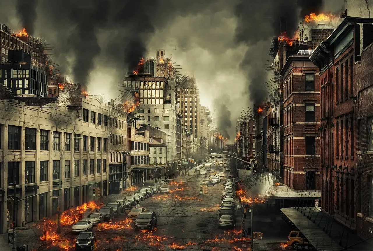
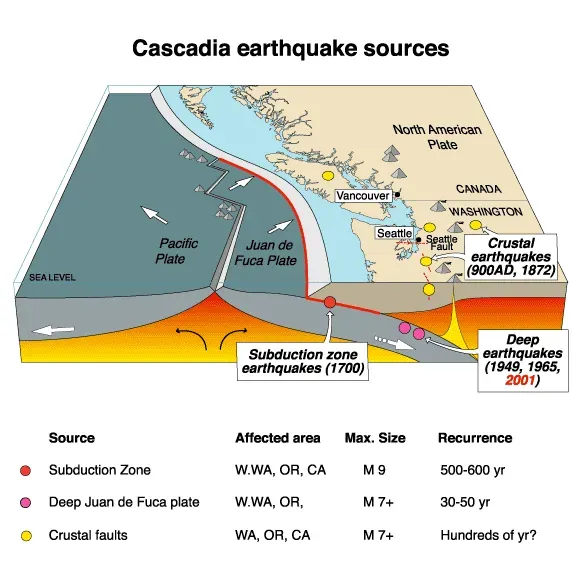
People living along the Pacific Northwest coast tend to think about earthquakes occasionally, maybe during a tremor here or there. Yet what lies dormant beneath the ocean floor off their shores is a beast of a different magnitude entirely. The Cascadia Subduction Zone has not produced an earthquake since 1700 and is building up pressure where the Juan de Fuca Plate is subsiding underneath the North American plate. That’s over three centuries of stress accumulating along a fault capable of unleashing one of the most catastrophic natural disasters the continent has ever witnessed.
The question is no longer if this fault will rupture, but when. Scientists have been sounding alarms for years, and recent research continues to add layers of complexity to an already terrifying scenario. Let’s dig into what would actually happen if Cascadia finally snapped.
The Fault That Time Almost Forgot
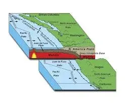
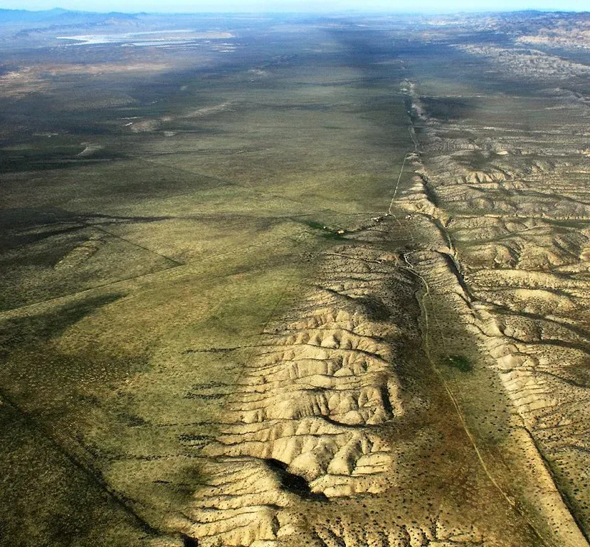
The Cascadia Subduction Zone “megathrust” fault is a 1,000 km long plate boundary that stretches from Northern Vancouver Island, British Columbia to Cape Mendocino, California. Think of it as a sleeping giant lying just offshore, roughly seventy to one hundred miles from the coast. This isn’t your typical earthquake fault that shakes things up and calls it a day.
Subduction zone megathrust faults are the only faults on Earth that can produce earthquakes greater than M8.5. The Cascadia Subduction Zone has produced magnitude 9.0 or greater earthquakes in the past, and undoubtedly will in the future. That magnitude difference matters more than you might think. A magnitude 9 quake releases roughly a thousand times more energy than a magnitude 7. Honestly, it’s difficult to even comprehend that scale of power.
The 1700 Cascadia earthquake occurred along the Cascadia subduction zone on January 26, 1700, with an estimated moment magnitude of 8.7–9.2. Japanese tsunami records, along with reconstructions of the wave moving across the ocean, put the earthquake at about 9:00 PM Pacific Time on the evening of 26 January 1700. The fact that Japanese historical records captured a tsunami from an earthquake nobody in North America documented tells you everything about the remoteness and vulnerability of the region back then.
The Minutes of Terror
When this fault finally ruptures, those living along the coast will experience something profoundly unsettling. There is an estimated five to seven minutes of shaking or rolling that will be felt along the coastline with the strength and intensity decreasing the further inland you are. Imagine standing on solid ground that suddenly feels like you’re on a boat in rough seas, except it lasts for an eternity.
During a subduction zone earthquake, intense ground shaking will likely occur for four to six minutes whereas a local earthquake is likely to produce shaking lasting 30 seconds or less. Let’s be real, thirty seconds of shaking is terrifying enough. Four to six minutes is a lifetime when buildings are crumbling and the earth beneath your feet refuses to settle.
A subduction zone earthquake will produce a type of shaking (low frequency) to which “long and tall” structures are more vulnerable. Bridges, high-rises, and long-span structures would face tremendous stress. Even inland areas would feel the rolling motion, like being inside a snow globe that someone won’t stop shaking. The psychological impact alone would be devastating.
The Wave That Follows the Shaking
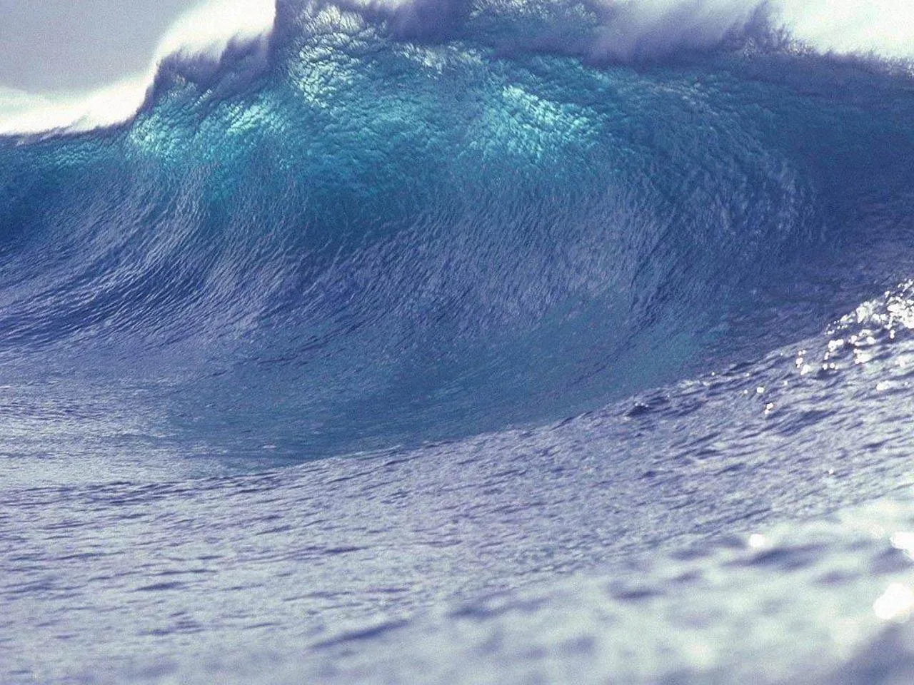
Here’s the thing that keeps emergency planners awake at night. The earthquake is only the opening act. A tsunami will reach the coast in 15 to 30 minutes in some locations. It may be as high as 30 to 40 feet (9 to 12 meters) in some places. Coastal residents will have barely recovered from the violent shaking when they need to evacuate to higher ground immediately.
Due to the proximity of the expected earthquake, coastal communities may have as little as 5 minutes of warning before a tsunami arrives following the initial several minutes of ground shaking. Five minutes. That’s how long people in some areas would have between when the shaking stops and when walls of water come crashing inland. Roads will be damaged, bridges may have collapsed, and panic will be setting in.
People living along the coast will have around 20 minutes to react. However, at 10 to 15 meters, it’s still high enough to completely inundate low-lying coastal communities and cause flooding up rivers more than 50 kilometers from the coast. The tsunami wouldn’t just hit the beach and stop. It would surge up river valleys, turning peaceful waterways into destructive torrents carrying debris, vehicles, and anything else in its path.
Infrastructure Collapse and Isolation
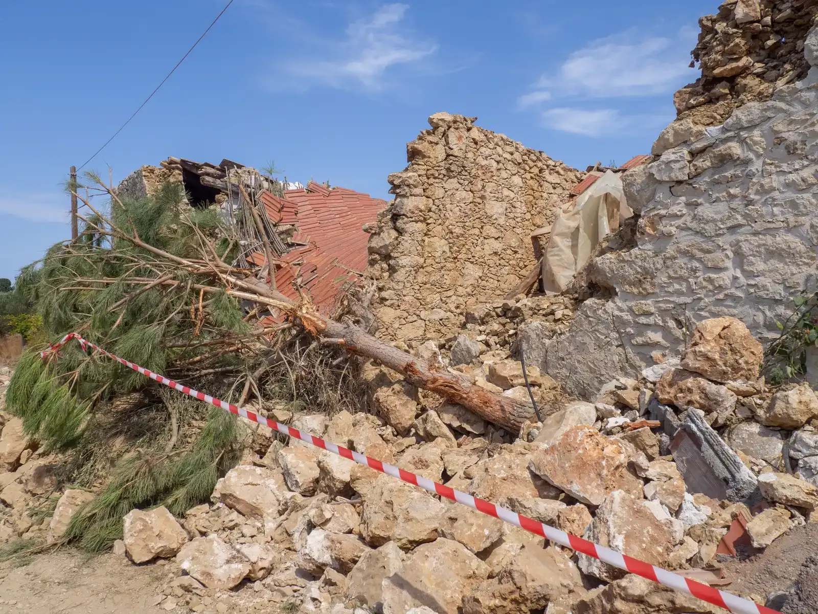
The immediate destruction would be staggering, yet what comes after might be even worse. With the current preparedness levels of Oregon, we can anticipate being without services and assistance for at least two weeks, if not longer, when the Cascadia Subduction Zone earthquake occurs. Two weeks sounds manageable until you realize that means no electricity, no running water, no communication networks, and no grocery stores.
Essential services in Washington County will likely be offline for extended periods of time – water and sewer systems for one month to one year, electricity for one to three months, police and fire stations for two to four months, top-priority highways from six to twelve months, and healthcare facilities for 18 months. Healthcare facilities down for eighteen months during a disaster is a nightmare scenario. People with chronic conditions requiring regular treatment would face life-threatening situations.
In the event of a Cascadia Subduction Zone earthquake and/or tsunami, coastal populations will become isolated into “islands” due to landslides, liquefaction, and damaged infrastructure like bridges. Communities that were once connected by Highway 101 would become isolated pockets, cut off from help and unable to reach the outside world. Emergency responders would struggle to even reach affected areas, let alone provide meaningful assistance.
The Human Cost Nobody Wants to Discuss
Behind every statistic lies unimaginable human suffering. FEMA estimates some 13,000 fatalities from such an event, with another 27,000 injured, which would make it the deadliest natural disaster in American, and North American, history. FEMA further predicts that a million people will be displaced, with yet another 2.5 million requiring food and water. Read those numbers again. Over ten thousand dead, hundreds of thousands homeless, millions needing basic supplies.
Fatalities in Oregon may range from 650 to 5,000, and over 27,000 may be displaced from their homes. Completely destroyed buildings could reach 24,000 with another 85,000 sustaining extensive damage and requiring months to years to repair. Entire neighborhoods would cease to exist. Families would lose not just their homes, but their communities, their schools, their workplaces.
Total economic losses in Oregon are projected to exceed $32 billion (close to one-fifth of Oregon’s gross state product). I know it sounds crazy, but that’s just Oregon. Washington, British Columbia, and Northern California would face similar devastation. The economic ripple effects would reverberate across the entire continent for years, possibly decades.
The Coastline That Sinks Forever
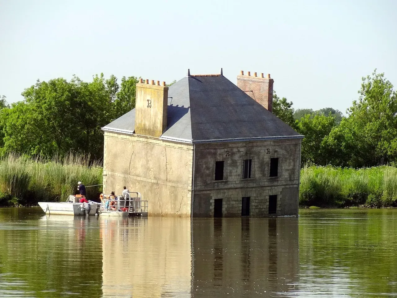
Most people assume that once the shaking stops and the tsunami recedes, things eventually return to normal. Here’s what makes Cascadia uniquely terrifying: the land itself will permanently drop. Geologic fossil evidence shows that previous Cascadia earthquakes immediately dropped the land level and turned dry ground into tidal mudflats in estuaries along the Pacific Northwest. That’s going to happen again and we’ve built up a lot of those areas.
Dura and their team also suspect the land will subside by at least 1 meter (3.3 feet) following the next major Cascadia earthquake. Picture entire coastal communities suddenly sitting three feet lower than they were before. That means permanent increased flooding risks, higher storm surges, and areas that were once habitable becoming perpetually waterlogged.
The effect will also worsen over time, as intensifying climate change raises sea levels further. “This lesser talked about hazard is going to persist for decades or centuries after the earthquake.” This isn’t temporary damage that can be rebuilt. The physical geography of the coast would be fundamentally altered. Ports, airports, water treatment facilities built at current sea level would find themselves fighting a losing battle against the ocean.
The Domino Effect: San Andreas Awakens
As if the Cascadia scenario wasn’t terrifying enough, recent research has uncovered something even more alarming. They found the deposits were formed at similar times and had similar structural characteristics, indicating that quakes in the Cascadia Subduction Zone triggered quakes in the San Andreas Fault System. The two most dangerous faults on the West Coast might be seismically linked.
In most cases, it’s difficult to determine the time separation between the Cascadia subduction zone and northern San Andreas fault ruptures, but Goldfinger said there are three instances in the past 1,500 years, including a most recent one from 1700, when the researchers believe the ruptures were just minutes to hours apart. Minutes to hours. One catastrophic earthquake potentially triggering another hundreds of miles away.
We could expect that an earthquake on one of the faults alone would draw down the resources of the whole country to respond to it. And if they both went off together, then you’ve got potentially San Francisco, Portland, Seattle and Vancouver all in an emergency situation in a compressed timeframe. The entire West Coast simultaneously experiencing mega-earthquakes would overwhelm every disaster response system in North America. Resources that would normally be mobilized to help one region would instead be stretched impossibly thin across thousands of miles.
Conclusion: Living With the Inevitable
The Cascadia Subduction Zone will rupture again. It is not a matter of if but when the next significant Cascadia earthquake and tsunami event will occur. Every year that passes without the big one striking adds another year of pressure building along that locked fault zone. Geologists estimate probabilities, but the earth operates on its own timeline, indifferent to our preparations or fears.
What separates the Pacific Northwest from other earthquake-prone regions isn’t the size of the threat, but the level of preparedness. Much of the infrastructure predates our understanding that these megathrust earthquakes even happen here. Buildings, bridges, hospitals, and water systems were designed for a world where magnitude 9 earthquakes were thought impossible in this region. It’s hard to say for sure, but changing that reality requires political will, substantial funding, and years of retrofitting work.
The scenario outlined here isn’t science fiction or doomsday prophecy. It’s the scientific consensus based on geological evidence, historical records, and our understanding of plate tectonics. Communities are making progress on tsunami evacuation routes, seismic building codes, and emergency preparedness, yet the scale of the challenge remains overwhelming.
What do you think about living in an area facing such a massive threat? Would knowing these details change how you prepare, or where you choose to live? Tell us in the comments.