Weather forecasting has come an incredibly long way. Satellites, supercomputers, drone aircraft, ocean buoys, and artificial intelligence are all working overtime just to keep us a few days ahead of nature’s most terrifying tantrums. Yet for all that jaw-dropping technology, the atmosphere keeps throwing curveballs that leave even the world’s sharpest meteorologists scratching their heads.
It’s humbling, really. We can land robots on Mars, yet predicting what a storm will do in the next 24 hours can still feel like reading tea leaves. Some of nature’s most dangerous weather patterns remain stubbornly, almost defiantly, unpredictable. So what exactly keeps scientists up at night? Let’s dive in.
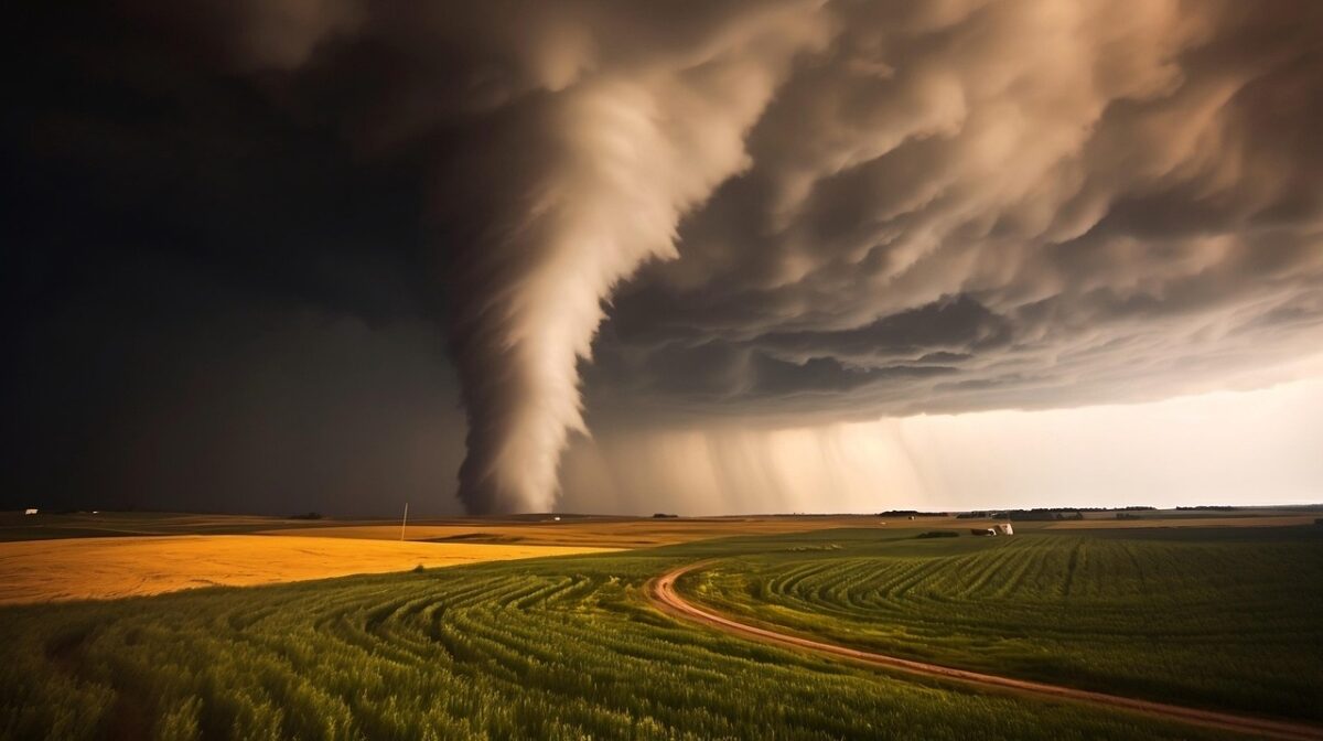
Rapid Intensification: The Storm That Goes From Mild to Monster Overnight
Imagine being told you’re about to face a moderate Category 2 hurricane, only to wake up and discover it has become a ferocious Category 5 by morning. That’s not a nightmare scenario. That’s rapid intensification, and it happens more than most people realize.
Hurricanes that rapidly intensify for mysterious reasons pose a particularly frightening threat. Forecasters have struggled for many years to understand why a seemingly commonplace tropical depression sometimes blows up into a major hurricane, packing catastrophic winds and driving a potentially deadly surge of water toward shore.
Roughly one in five to one in four of all tropical cyclones undergo rapid intensification, including the majority of tropical cyclones with peak wind speeds exceeding 110 mph. Rapid intensification constitutes a major source of error for tropical cyclone forecasting, and its predictability is commonly cited as a key area for improvement.
Until very recently, it’s been difficult to forecast rapid intensification, which can emerge suddenly, partly because so many shifting conditions need to align in order to trigger it. Much also depends on activity in the very core of the hurricane, from where it is notoriously difficult to gather data. Think of it like trying to predict the mood of a crowd by only watching people outside the stadium. You’re simply missing too much.
The intensity forecast errors for rapid intensification events are still approximately two to three times larger than for non-rapidly intensifying events, depending on forecast lead time. That gap is shocking given all the technology we have. Hurricane Otis in 2023 was perhaps the most haunting recent example. It was originally predicted to be a weak offshore storm, but over a 24-hour period it grew quickly, putting more than a million people at risk with little time to prepare. The storm caused billions of dollars in damage and resulted in 52 deaths, and today it is known as one of the biggest forecasting misses.
The Polar Vortex: When the Arctic Forgets Its Boundaries
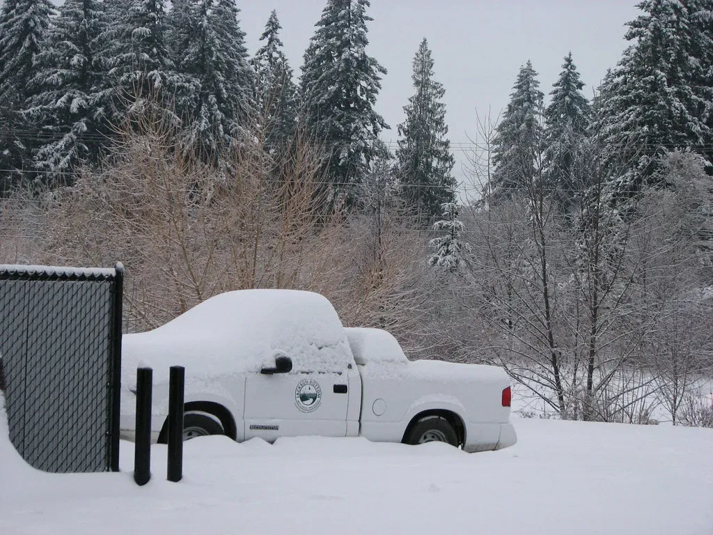
Here’s a weather pattern that sounds almost mythological but is terrifyingly real. The polar vortex is, at its core, a massive swirl of cold air that sits over the Arctic. Most of the time, it behaves itself. Then occasionally, without much warning, it breaks down and sends a frozen fist of air deep into the continental United States.
Usually, very cold air is contained in the Earth’s polar regions by the jet stream, a strong river of air high in the atmosphere. The jet stream periodically gets weak and wavy, and when that happens, very cold air moves south in what is called a polar vortex.
Winter weather patterns are shifting as the global climate warms, and scientists are working to understand those changes. Such research is crucial because it is the first step toward even more accurate weather forecasts. The relationship between a warming Arctic and these sudden cold-air invasions is still being actively debated in the scientific community. It is one of the most contested areas in modern meteorology.
Predicting jet stream changes is critically important for weather forecasts broadly, because weather systems move with the jet stream. Being able to better predict when and where severe weather will occur is crucial for keeping society running. Until scientists pin down exactly why the polar vortex collapses when it does, communities from Texas to New England will keep waking up to surprise deep freezes.
Flash Floods: When the Sky Drops Everything at Once
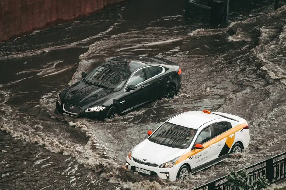
Flooding is the deadliest weather hazard in America. More people die from floods than from almost any other weather event, and the terrifying thing is that the most dangerous kind, the flash flood, is also the hardest to see coming. Predicting extreme rainstorms is a major scientific challenge. These storms form in a matter of hours, driven by complex moisture, temperature, and wind patterns.
What began as a routine day of meetings for one official in Broward County, Florida, turned into a struggle for survival as an unexpected “1,000-year” rainstorm deluged the county, dropping nearly 26 inches of water in just 24 hours. That was April 2023. Nobody saw it coming with any useful lead time.
Driving the more frequent events is what scientists describe as a “thirstier” atmosphere, one that is hotter and thus capable of holding more moisture. More moisture means when a storm finally releases, it releases everything at once. That’s the terrifying physics of our warming world. Every degree of global warming is projected to cause a roughly seven percent increase in extreme daily rainfall.
NOAA’s National Weather Service would like to predict major precipitation events weeks, months, and even years in advance. Lives, livelihoods, property, and critical infrastructure are at risk, and NOAA scientists have pursued the science of precipitation prediction for decades. Honestly, that goal still feels distant, especially for localized, fast-moving flood events.
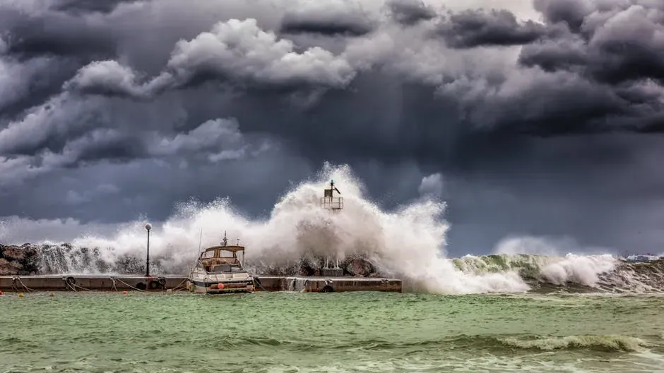
Hurricane Track and Landfall: Missing by Miles Can Cost Lives
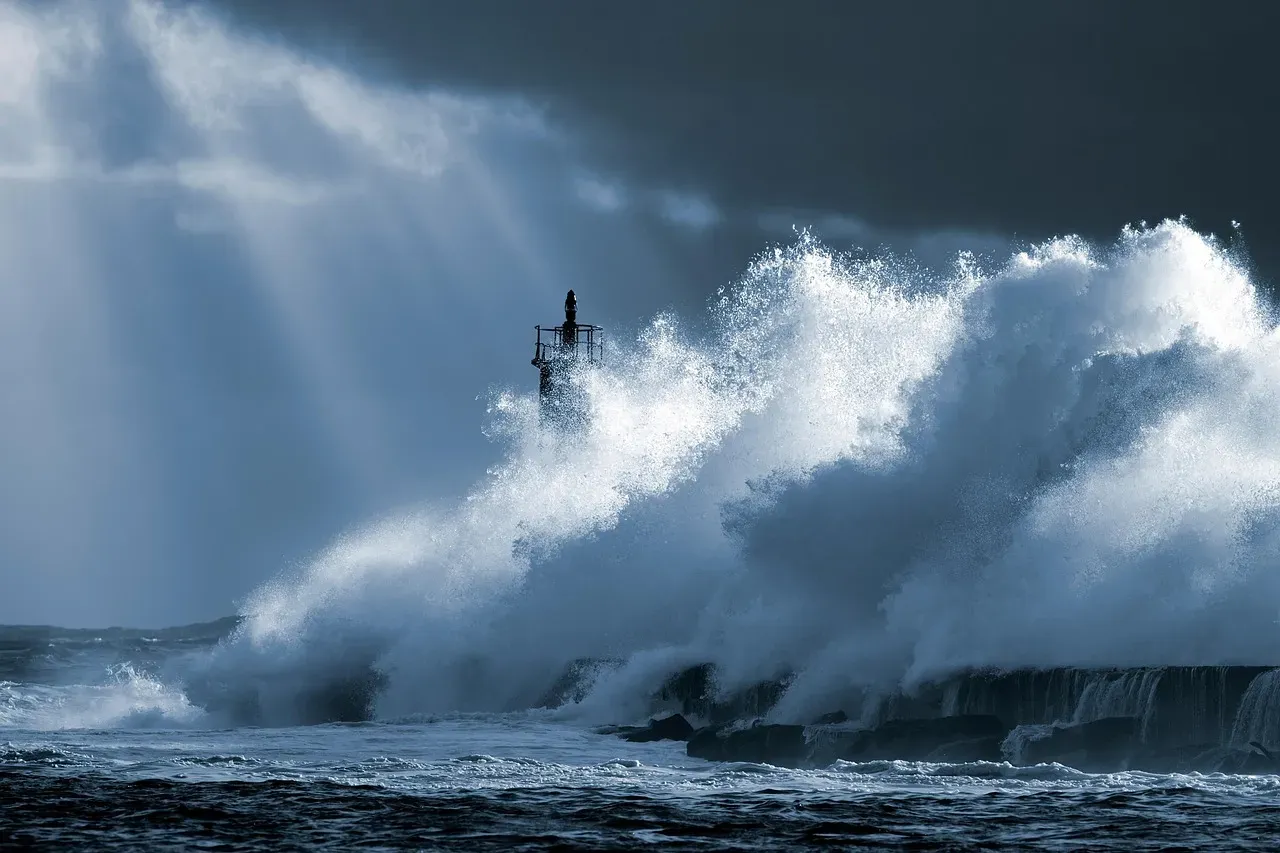
Scientists have gotten dramatically better at predicting where hurricanes are going. But “better” in this context still isn’t always good enough. When a storm is bearing down on a coastline, a miss of even a few dozen miles can mean the difference between catastrophe and a close call.
Pre-season forecasts are meant to give a sense of the season’s activity, not the number of storms that make landfall. The issue is that landfall activity is guided by local weather patterns as the hurricane approaches, and these are only known a few days in advance.
Hurricane Milton from 2024 illustrated the point vividly: by making landfall just south of Tampa Bay, a surge of the bay itself was avoided, and the densely populated Tampa region north of the bay missed a direct hit. Making landfall a few tens of miles south made a large difference to the economic and insured impact. We’re talking about billions of dollars, and thousands of lives, hinging on distances you could drive in under an hour.
A 2026 conference presentation found that the latitude at which Atlantic tropical cyclones attained their maximum winds has migrated northward at about 93 miles per decade since 1970. This research has not yet undergone peer review. The point is, storm tracks themselves may be shifting in ways our current models haven’t fully caught up to yet.
Mesoscale Convective Systems: The Giants Nobody Talks About
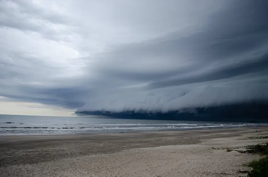
Most people have never heard of a mesoscale convective system, or MCS. Yet these sprawling clusters of thunderstorms, which can stretch for hundreds of miles, dump enormous quantities of rain over huge regions in a matter of hours. They are responsible for a vast share of summer rainfall and some of the worst flooding events in the central United States.
In general, the development of an extreme event depends on a favorable initial state, the presence of large-scale drivers, and positive local feedbacks, as well as stochastic processes. That word “stochastic” is essentially a scientific way of saying there’s an element of randomness involved. Great. A rain system covering hundreds of miles that also has a random component. Sleep well.
Research shows that there are large-scale circulation patterns associated with both winter and summer rainfall extremes, and important North Atlantic sea surface temperature anomalies associated with Gulf Stream variability that are a potential source of predictability. The hopeful word there is “potential.” Scientists are still working to translate that potential into actual usable forecasts for everyday people.
Think of an MCS like a slow-moving conveyor belt at a buffet, except instead of food, it’s dropping torrential rainfall. The belt keeps feeding. And feeding. And the models? They often misjudge the speed, the strength, and just how long that belt keeps running.
Tornado Formation: Nature’s Most Violent Short-Range Mystery
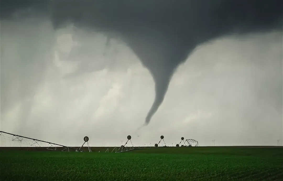
Tornadoes might be the most iconic and recognizable severe weather event in the world. They’re also, quite frankly, one of the least understood. Much about tornadoes remains a mystery. They are rare, unpredictable, and deadly, and the United States has more tornadoes than anywhere else in the world.
Here’s the thing that should genuinely unsettle you: scientists can identify the conditions that make tornadoes likely. Supercell thunderstorms, warm humid air, wind shear. But identifying which specific supercell will actually spawn a tornado, and exactly where it will touch down? That remains stubbornly out of reach. However much models improve, there will always be an irreducible level of uncertainty because of the chaotic nature of the system.
Rapid intensification can quickly transform a tropical cyclone from a relatively predictable natural hazard, like a heatwave with skillful long-range forecasts, to an unpredictable one, like a tornado, with reliable warnings only hours in advance. That’s essentially the forecasting ceiling for tornadoes right now. Hours. Not days. Hours.
Using 20 years of Storm Prediction Center mesoanalysis data of past events, researchers have reviewed observed tornadoes during that period to develop a new system for storm intensity called “Conditional Intensity Groups.” It’s real progress. But the fundamental question of which exact storm produces a tornado and when still eludes a clean answer.
“Hundred-Year” Storms: When Rare Events Stop Being Rare

The term “hundred-year storm” used to mean something simple: a storm so severe it statistically had only a one percent chance of happening in any given year. It was supposed to be the kind of event that most people would never see twice in a lifetime. That concept has quietly fallen apart.
By definition, a hundred-year storm has a roughly one percent likelihood of occurring in any one year. But every year the probability clock starts anew, and climate change is making the likelihood even higher. So the historical baseline that once made these predictions meaningful is now eroding beneath our feet, sometimes quite literally.
As climate change leads to greater meteorological volatility, the one-in-100 or one-in-500 or one-in-1,000 year events are occurring twice or three times or more in those windows. This creates an almost philosophical crisis for forecasters. How do you predict the recurrence of an event whose recurrence rate is itself changing?
Record-breaking heat waves on land and in the ocean, drenching rains, severe floods, years-long droughts, extreme wildfires, and widespread flooding during hurricanes are all becoming more frequent and more intense. The statistical models forecasters rely on are built from historical data. When history stops being a reliable guide to the future, prediction becomes incredibly difficult.
El Niño and La Niña: The Ocean’s Mood Swings That Rewrite the Weather Map

El Niño and La Niña are the great puppet masters of global weather. When the Pacific Ocean swings warmer or cooler than normal across its vast equatorial band, weather patterns shift around the entire planet. Droughts appear where there should be rain. Floods arrive in deserts. Hurricane seasons behave unpredictably. The problem is that even predicting these ocean mood swings themselves is fiendishly difficult.
There is decadal predictability in the climate system through phenomena such as the Atlantic multi-decadal oscillation and the Pacific decadal oscillation, but our understanding of these phenomena is still limited largely owing to the paucity of ocean observations. We simply don’t have enough eyes underwater to fully understand what’s driving these cycles.
A comparison of observed and modeled sea surface temperatures shows that the models have not correctly simulated the observed, more La Niña-like climate of recent decades. I think that sentence deserves a moment to sink in. The very models we use to forecast global storm activity have been getting the ocean’s baseline behavior wrong. That’s a significant problem.
Several studies in late 2025 found potential links between human-caused climate change and the increasing tendency toward La Niña, but the reason remains unknown. Among the research community’s priorities is an upcoming Tropical Pacific Observing System field campaign from 2026 to 2028, designed to investigate how ocean-atmosphere interactions in the tropical Pacific affect weather patterns around the world. It’s a hopeful step. Still, the Pacific will keep doing whatever it wants in the meantime.
Conclusion: The Humbling Frontier of Weather Science
We live in an age of extraordinary forecasting capability. Satellites ring the globe. Supercomputers run simulations at scales that would have seemed like magic even 30 years ago. It took decades of research and innovation to reach the level of accuracy in hurricane forecasting attained in recent years, with the National Hurricane Center making record-accurate track forecasts in 2024. That’s genuinely remarkable progress worth celebrating.
Yet the eight storm patterns above remind us that the atmosphere is not a machine that can be fully decoded. It is a chaotic, layered, ever-shifting system in which small changes ripple into massive consequences. As Lorenz put it, one flap of a seagull’s wing may forever change the future course of the weather. In 1963, Lorenz published his seminal paper on deterministic non-periodic flow, which embedded the theory of chaos at the heart of meteorology.
Climate change is not making this easier. It is rewriting the rulebook that forecasters spent generations building. Emerging research suggests that rapid intensification could increase with continued warming from carbon pollution. The storms are getting more complex just as the science needs them to behave more predictably.
Perhaps the most important takeaway is this: preparedness matters more than precision. Knowing the limits of forecast science is itself a form of knowledge, one that should make all of us take storm warnings seriously even when uncertainty is high. The weather doesn’t wait for perfect data. So, honestly, what storm on this list surprised you most?