Panhandle Hit First with Extreme Swings (Image Credits: Unsplash)
Texas – A potent cold front surged toward the state, setting the stage for sharp temperature declines of up to 40 degrees and a barrage of severe weather. Arctic air trailed the system, promising freezing conditions in the Panhandle while sparking thunderstorms farther south. Residents faced a volatile weekend starting Friday night, with hail, damaging winds, and flash flooding in the forecast.[1][2]
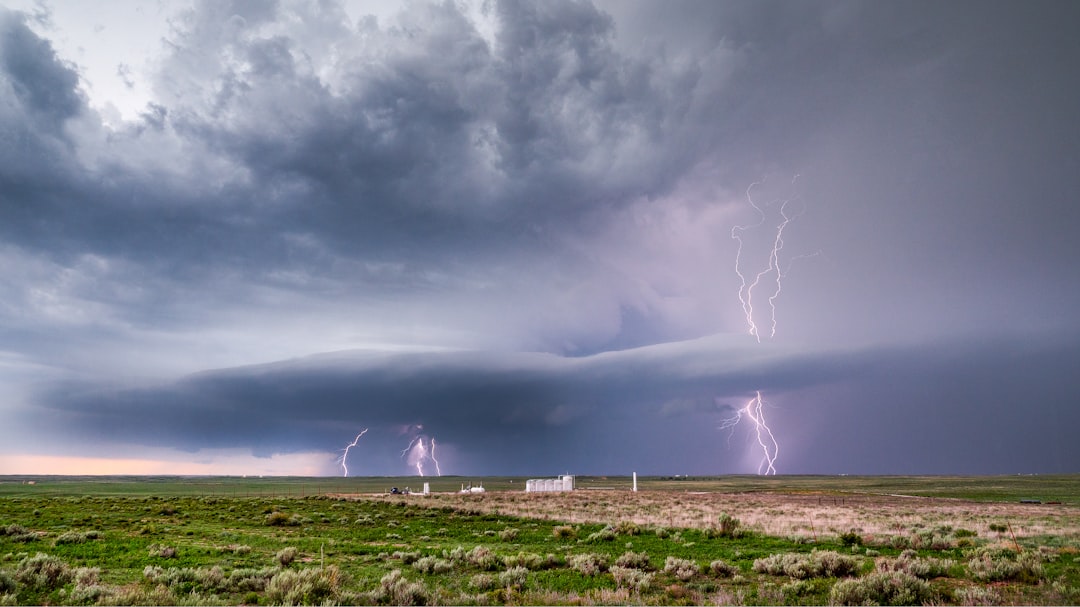
Panhandle Hit First with Extreme Swings
The Texas Panhandle stood on the front lines of the onslaught. Temperatures there plummeted in dramatic fashion, with a 42-degree swing recorded in less than 12 hours near the Texas-Oklahoma border Friday afternoon into evening. Overnight lows dipped into the low 30s in the northwest portions, flirting with freezing marks.[1]
Forecasters from the National Weather Service Amarillo office noted the front’s push through by Friday night. Some models indicated an earlier arrival Friday afternoon. While rain chances remained low around Amarillo, the raw chill dominated the outlook.
Severe Storms Target Central Regions
Farther southeast, the Dallas-Fort Worth metroplex braced for the heaviest action. Thunderstorm probabilities soared to 80 percent late Friday night into Saturday, accompanied by a 25-degree overnight temperature drop. Heavy rain became a near certainty at 100 percent by Saturday, with up to 1.8 inches possible in spots.[2]
The National Weather Service Dallas office highlighted the trailing front’s role. It warned of widespread convective coverage, with some storms escalating to severe levels featuring hail and wind gusts. Localized flash flooding emerged as a prime concern from midnight through noon Saturday as the boundary inched southward.[1]
South Texas Feels the Chill Later
South Central Texas and San Antonio experienced a delayed but noticeable impact. The front reached the Alamo City by Saturday afternoon, triggering a 15-degree drop from Saturday highs near 80 degrees to Sunday readings capped in the mid-60s. Breezy conditions preceded the change, with winds gusting to 30 mph Friday.[3]
Rain chances fluctuated wildly from 20 to 90 percent Friday night through Monday. Scattered showers approached from the west Friday evening at 30 percent odds, escalating to 70 percent Saturday afternoon. Heavier downpours threatened deeper South Texas areas like the Rio Grande Valley, heightening flood risks.
| Region/City | Temp Drop | Key Impacts |
|---|---|---|
| Panhandle (e.g., Dalhart) | Up to 42° | Low 30s overnight lows |
| Dallas-Fort Worth | 25° overnight | 80-100% storm chances, 1.8″ rain |
| San Antonio | 15° Sat-Sun | Mid-60s highs, 70% rain Sat |
Weekend Timeline and Broader Outlook
The system unfolded methodically across Texas. It crossed into the Panhandle Friday, hammered North Texas overnight, and swept South Texas Saturday. Lingering showers persisted into Easter Sunday morning before drier air filtered in.[4]
Post-frontal cooling ushered in a gloomy start to the workweek. Highs struggled in the 60s region-wide, a stark contrast to recent warmth. Thunderstorm threats tapered but moisture hung around, keeping umbrellas essential.
- Hail and damaging winds primary in severe storms, especially North Texas.
- Flash flooding risk peaked Saturday morning in metro areas.
- Temperature recovery slow, with layered clothing advised.
- Panhandle focused on chill; South Texas on rain volume.
- Monitor NWS updates for real-time shifts.
Key Takeaways
- Cold front delivers 15-42 degree drops region-by-region starting Friday.
- Severe thunderstorms, hail, winds threaten DFW most intensely.
- Flash flooding possible with 1-2 inches of rain in spots.
Texas navigated another classic spring weather rollercoaster, where warmth yielded swiftly to winter’s remnants. The front underscored the state’s unpredictable patterns, blending severe power with rapid recovery. What preparations are you making for the weekend shift? Share in the comments.
- Urban Coyotes Show Remarkable Adaptability, Learning to Thrive in City Environments - July 22, 2026
- Beavers Are Nature’s Engineers, Creating Vital Habitats for Other Wildlife Species - July 21, 2026
- The Recovery of the California Condor Offers Hope for Other Critically Endangered Birds - July 21, 2026