

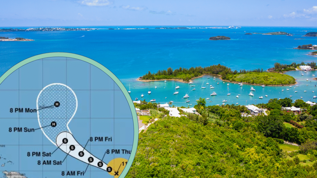
Tropical Storm Gabrielle formed on Wednesday over the central Atlantic, marking the seventh storm of the 2025 Atlantic hurricane season. It grew out of a tropical depression and quickly crossed the threshold into tropical storm status, with sustained winds measured at about 50 mph.
The system is fairly spread out, meaning its core structure is loose, which makes certain forecasts trickier, especially when it comes to strength and track.
The Battle Within: Dry Air, Wind Shear, and Potential Weaknesses
Gabrielle isn’t facing a clean runway. Dry air is encroaching on its center, and wind shear remains a hurdle. These unfriendly atmospheric conditions have kept the storm somewhat disorganized.
There’s even a chance it could degrade back to a tropical depression or a heavy rainstorm before reorganizing. Still, forecasts suggest a turn in its fortunes over the weekend — a re-organization and possible intensification may be in store.
Path Forward: Where Gabrielle’s Heading
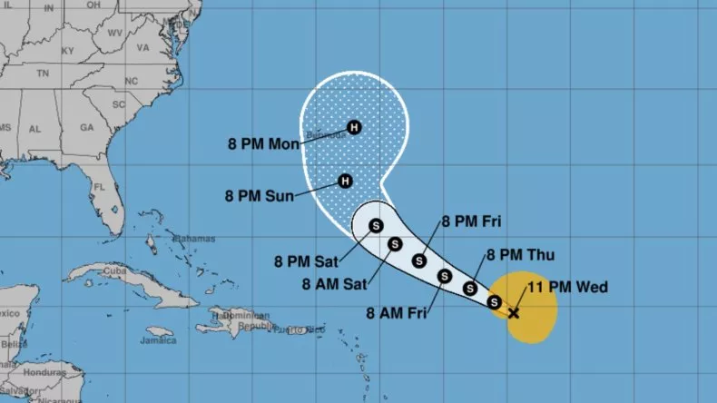
Gabrielle is generally tracking west-northwest (WNW) or northwest (NW) at around 13 mph. The forecast has it moving north of the Caribbean islands, which could spare those islands from the worst of it, though waves, surf, or rain could still reach them depending on the final track. Looking ahead, Bermuda is increasingly in Gabrielle’s projected path — potentially as a hurricane by early next week.
Strengthening Chances & Timing: Hurricane Potential
While Gabrielle is not a hurricane now, many models and forecasters expect it to strengthen this weekend.
The storm is likely to remain over open Atlantic waters for several days, which gives it room to intensify — if the environmental obstacles weaken enough. By Sunday or thereabouts, there’s a real possibility it could reach hurricane strength.
What Bermuda & the U.S. East Coast Could Expect

If Gabrielle follows the currently predicted path, Bermuda could see gusty winds, heavy rain, rough surf, and localized flooding late this weekend into early next week.
Rainfall amounts might reach 1-2 inches generally, though isolated spots could pick up up to 4 inches in worse drainage areas.
Winds in Bermuda may reach sustained gusts of 40-60 mph, with potential peaks around 70 mph depending on Gabrielle’s strength. As for the U.S. East Coast, while a direct hit seems unlikely now, rough surf and dangerous rip currents are possible, particularly mid to late next week.
Other Disturbances: Watching the Neighbors
Gabrielle isn’t the only weather system being monitored. There are at least two tropical waves elsewhere in the Atlantic basin. One wave is struggling under challenging atmospheric conditions, and another is moving westward from Africa.
Either could develop further if conditions become more favorable, especially in the Caribbean or the Gulf, where warm water and easing wind shear could allow for intensification. Forecasters are particularly keeping tabs on a wave that could pose a threat to parts of the western Caribbean later this month.

- 17 Things You Do That Make Your Dog Feel Truly Loved - July 16, 2026
- 20 Foods in Your Pantry That Could Add Years to Your Dog’s Life - July 16, 2026
- 30 Plants That Absolutely Love Full Sun - July 15, 2026