
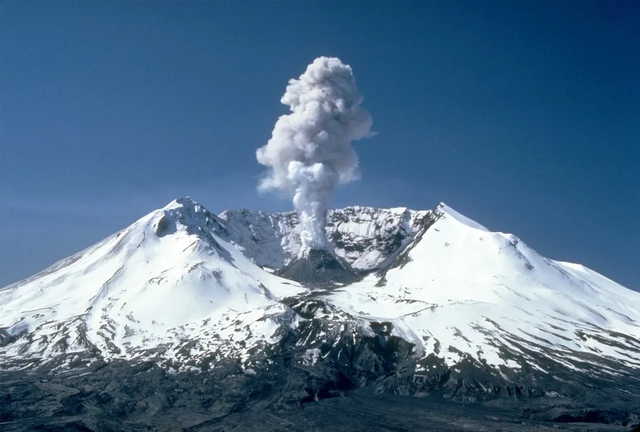
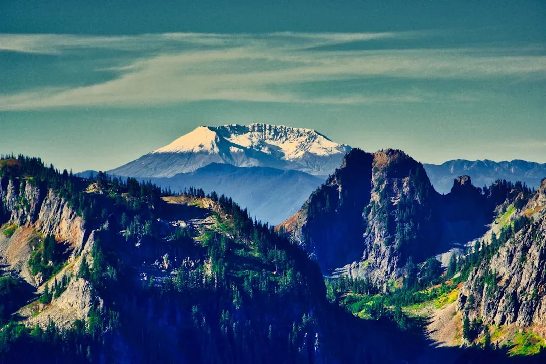
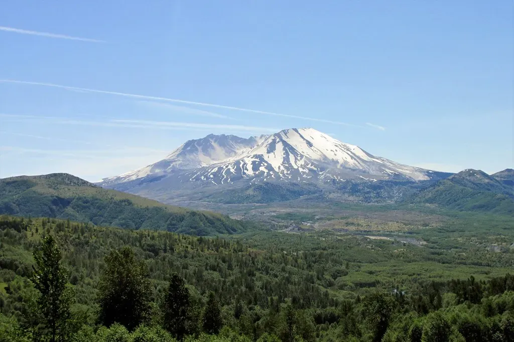
There is a mountain in southwestern Washington that, for most of the year, sits quietly under a thick blanket of snow. Hikers admire it. Tourists photograph it. But beneath that peaceful surface, a restless force has been building for decades. Mount St. Helens is the most active volcano in the Cascade Range, and it is the most likely of the contiguous U.S. volcanoes to erupt in the future.
Most people remember the catastrophic 1980 event as a history lesson. But what if it happened again, right now, at full force? The Pacific Northwest of 2026 is a vastly more populated, more connected, and more economically complex region than it was over four decades ago. The consequences would be staggering in ways most people simply haven’t thought about. Let’s dive in.
The Last Time It Blew: A Terrifying Benchmark
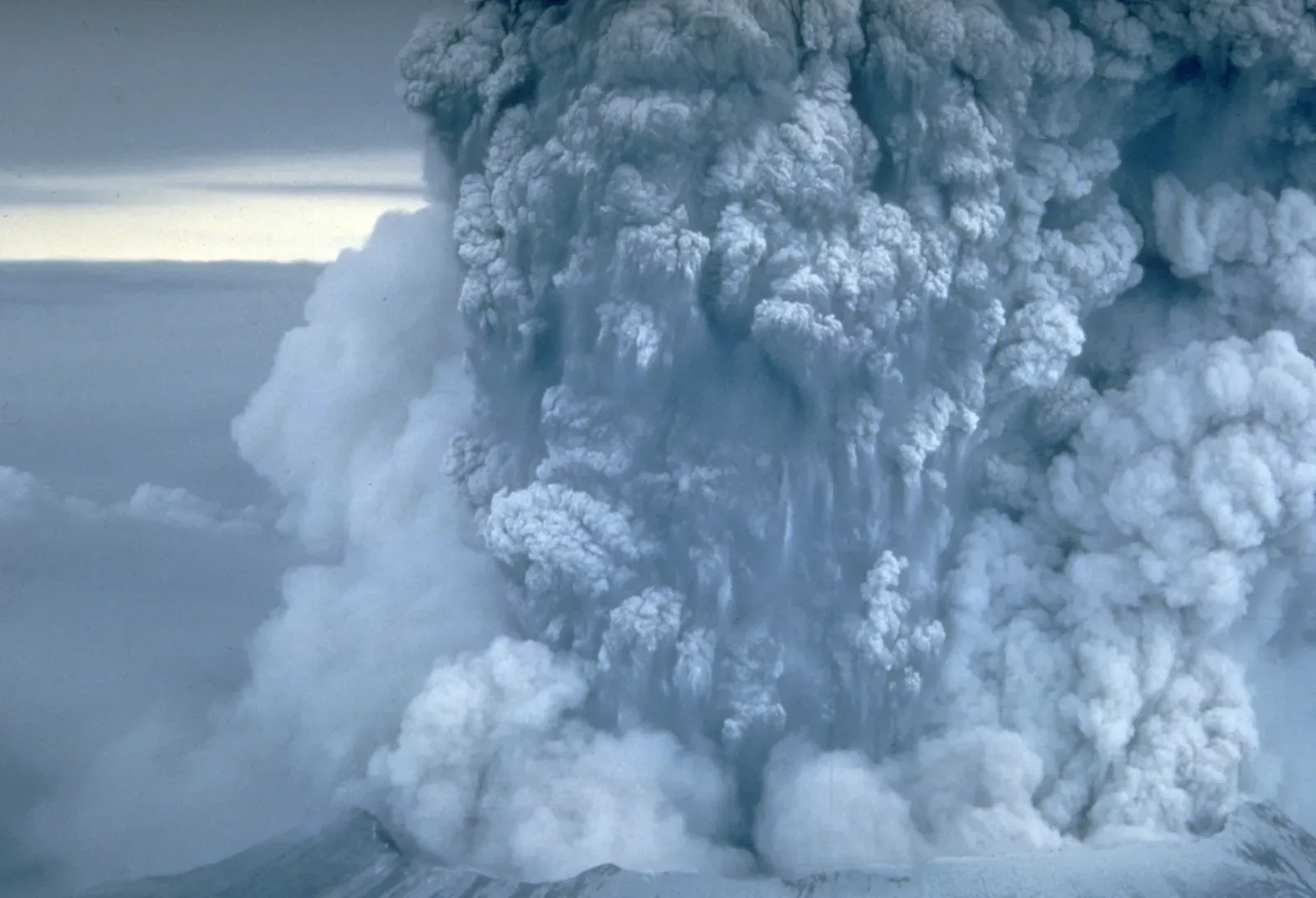
To understand what a full-force repeat eruption would look like, you first have to appreciate just how violent the original event was. The phreatic blasts escalated for nearly two months until a catastrophic explosive eruption took place on May 18, 1980, at 8:32 a.m., the first to occur in the contiguous United States since the much smaller 1915 eruption of Lassen Peak in California. Think about that. Nothing remotely like it had happened on the continental U.S. mainland in nearly seven decades.
The thermal energy released during the eruption was equal to 26 megatons of TNT. About 57 people were killed, including innkeeper and World War I veteran Harry R. Truman, photographers Reid Blackburn and Robert Landsburg, and volcanologist David A. Johnston. These weren’t just statistics. They were real people who believed, as many do today, that they had enough distance or warning to survive.
The near-supersonic lateral blast, loaded with volcanic debris, caused devastation as far as 19 miles from the volcano. That’s roughly the distance from Washington D.C.’s Capitol to Dulles Airport. Everything in that radius, flattened.
The Immediate Blast Zone: Nothing Survives
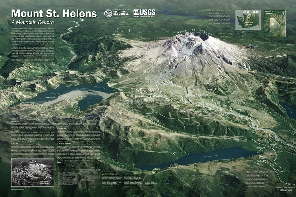
Here’s the thing about a full-scale eruption. The immediate blast zone is not a place you can outrun. The lateral blast devastated an area nearly 30 kilometers from west to east and more than 20 kilometers northward from the former summit. In an inner zone extending nearly 10 kilometers from the summit, virtually no trees remained of what was once dense forest. Just beyond this area, all standing trees were blown to the ground, and at the blast’s outer limit, the remaining trees were thoroughly seared.
Approximately 10 million trees were felled by the blast. The landslide debris, liquefied by the violent explosion, surged down the mountain at speeds in excess of 100 miles per hour. That’s faster than most people drive on a freeway. There is no evacuation plan fast enough for the immediate zone. Any repeat of this force would wipe out everything within that perimeter in minutes.
The Lahar Threat: Rivers Turned Into Walls of Mud
Honestly, the thing that terrifies volcanologists most about a repeat eruption isn’t the initial blast. It’s what comes after. Lahars, volcanic mudflows, are among the most destructive forces a volcano produces. Past lahars at Mount St. Helens have traveled from 50 to 100 kilometers from source, often reaching the Columbia River via the Toutle-Cowlitz, Kalama, or Lewis Rivers. They are a greater threat to life and property in valley communities than any other volcanic phenomenon.
At the same time as the 1980 eruption, snow, ice, and several entire glaciers on the volcano melted, forming a series of large lahars that reached as far as the Columbia River, nearly 50 miles to the southwest. Today, Mount St. Helens is particularly susceptible to lahars because the vent, and site of recent lava-dome building, is surrounded by Crater Glacier. More glacier ice means more potential lahar volume in a future eruption. Lahars commonly destroy mature forests and any human-made structures in their paths, including bridges, roads, pipelines, and buildings.
The Ash Cloud: A Catastrophe Crossing the Entire Country
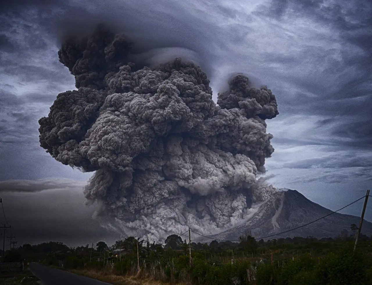
An eruption column rose 80,000 feet into the atmosphere and deposited ash in eleven U.S. states and various Canadian provinces. Eleven states. Let that sink in. A repeat event today would blanket the same geography with fine volcanic particles capable of destroying machinery, contaminating water supplies, and collapsing rooftops under the weight.
Ash ends up orbiting the earth for years to come, in some cases. It affects air traffic, furnace filters, air-conditioning systems, agriculture, the weather, and the atmosphere. The scale of disruption is almost impossible to fully calculate. When a volcano erupts explosively, an ash cloud will be produced, and its size and travel distance are determined by the amount of material erupted, the height of the cloud, plus the wind directions and speeds. In 2026, with far more air traffic than 1980, the aviation disruption alone would be historic.
Transportation and Infrastructure Collapse
People tend to underestimate how deeply modern life depends on roads, rivers, and air routes. The 1980 eruption exposed every single vulnerability. The ash fall created some temporary major problems with transportation, sewage disposal, and water treatment systems. Visibility was greatly decreased during the ash fall, closing many highways and roads. Interstate 90 from Seattle to Spokane was closed for a week and a half.
Air transportation was disrupted for a few days to two weeks as several airports in eastern Washington shut down due to ash accumulation and attendant poor visibility. Over a thousand commercial flights were canceled following airport closures. Now imagine that scenario applied to a 2026 aviation network that operates hundreds of thousands of flights weekly. The ripple effects through supply chains, cargo shipping, and emergency response would be severe. Fine-grained, gritty ash caused substantial problems for internal combustion engines and other mechanical and electrical equipment. The ash contaminated oil systems, clogged air filters, and scratched moving surfaces. Fine ash caused short circuits in electrical transformers, which in turn caused power blackouts.
Economic Devastation: Billions, Not Millions
The 1980 eruption was already a financial disaster of historic proportions. Hundreds of square miles were reduced to wasteland, causing over $1 billion in damage, equivalent to $3.5 billion in 2024, thousands of animals were killed, and Mount St. Helens was left with a crater on its north side. Scale that up to today’s economy, today’s infrastructure density, and today’s property values in the Pacific Northwest, and the numbers become genuinely staggering.
The river systems would be clogged with sediment for years. Communities downstream from Mount St. Helens are still dealing with sediment that washed down in the eruption, which keeps coming down the rivers and clogs water intake pipes and fills up the rivers. The eruption generated so much sediment that scientists don’t actually know what to do with it. That’s a statement made forty-five years later. A fresh eruption of equal or greater force would essentially reset this problem on an even larger scale.
Wildlife and Environment: A Landscape Erased
The ecological toll of the 1980 eruption was breathtaking. Wildlife in the Mount St. Helens area suffered heavily. The Washington State Department of Game estimated that nearly 7,000 big game animals, including deer, elk, and bear, perished in the area most affected by the eruption, as well as all birds and most small mammals. A full-force repeat today would produce a very similar initial wipeout, though the surrounding ecosystem has since grown significantly richer.
As many as 1,500 elk and 5,000 deer were killed, and an estimated twelve million Chinook and Coho salmon fingerlings died when their hatcheries were destroyed. Another estimated 40,000 young salmon were killed when they swam through turbine blades of hydroelectric generators after reservoir levels were lowered along the Lewis River. The downstream ecological cascade from rivers clogged with ash and lahars would threaten commercially critical salmon populations throughout the Columbia River basin. I think this is the environmental dimension that gets overlooked most in disaster discussions.
How Well-Prepared Are We in 2026?
We know that Mount St. Helens is the volcano in the Cascades most likely to erupt again in our lifetimes. It is likely that the types, frequencies, and magnitudes of past activity will be repeated in the future. The good news is that monitoring technology has transformed dramatically since 1980. Today, scientists can remotely use high-precision Global Positioning System receivers, sophisticated borehole tiltmeters and strainmeters, and other sensors to measure and report even small amounts of deformation at the centimeter scale continuously and in real time. In addition, using a remote sensing technique called InSAR, they combine satellite radar images to map ground deformation in remarkable detail over large areas.
Proactive early warning of a potential eruption is key to minimizing loss of life and economic disruption by increasing the time that emergency managers can initiate mitigation measures, improve evacuation alerts, and better position resources for recovery. Earliest detection of eruption precursors with multiple instrument types allows for more accurate forecasts of hazardous eruptive activity needed by land managers and the aviation sector. Still, it’s worth noting that geologists predict that future eruptions will be more destructive, as the configuration of the lava domes requires more pressure to erupt. Better warning systems cannot stop a mountain once it decides to move.
Conclusion: A Sleeping Giant in a Much Bigger World
The 1980 eruption of Mount St. Helens was already the worst volcanic disaster in the recorded history of the lower 48 states. A full-force repeat today would unfold against a backdrop of millions more people living in the Pacific Northwest, highways and cities that barely existed in 1980, and a globally connected economy where a single supply chain disruption ripples across continents. The ash, the lahars, the shattered infrastructure, the economic paralysis, and the ecological loss would each be catastrophic on their own.
Together, they would represent something that most Americans have never experienced. Not just a natural disaster, but a fundamental disruption of the region’s identity and function, lasting not weeks but years. The mountain sits there today at alert level green, remains at normal, background levels of activity, watched by hundreds of sensors. But nature has never asked permission before it acts.
Knowing what we know, the most honest question we can ask ourselves is not “if” but “are we genuinely ready?” What do you think? Drop your thoughts in the comments below.
- Has Your Rescue Dog Finally Chosen You? 14 Signs It Sees You as Home. - July 22, 2026
- 8 of the World’s Rarest Raptors and Where You Might See Them - July 22, 2026
- The Rarest Bird in North America – Can It Still Be Saved? - July 22, 2026