Have you ever looked up at the sky and seen something so strange that it made you question reality? Maybe you witnessed a flash of green light at sunset or spotted a glowing orb floating through the air during a thunderstorm. The atmosphere around us is full of mysteries that even today’s most advanced technology can’t fully explain.
Despite all our modern meteorological instruments and satellite systems, there are weather phenomena occurring right above our heads that continue to baffle researchers. Some happen so quickly they’re almost impossible to study. Others occur so rarely that we barely have any reliable footage or data to work with. Let’s dive into ten of the most perplexing weather events that still leave scientists scratching their heads.
Ball Lightning That Defies Physics
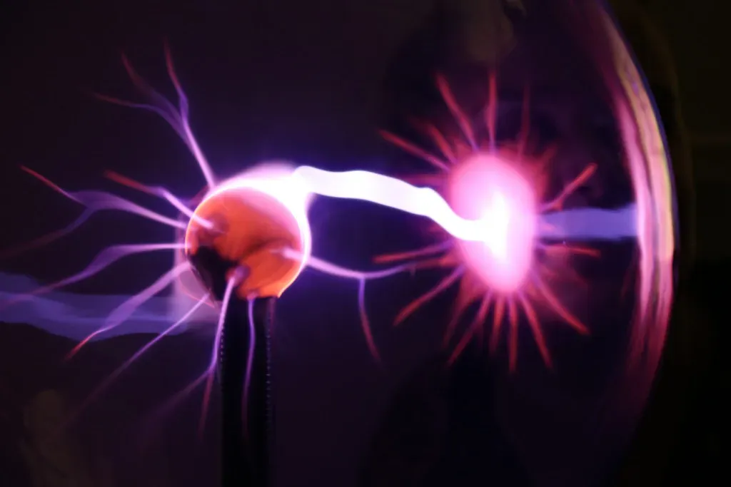
Ball lightning is one of the most enigmatic weather phenomena known to man, occurring globally, particularly during thunderstorms, and has puzzled scientists for centuries. Picture a glowing sphere, roughly the size of a grapefruit, drifting eerily through the air before suddenly vanishing or exploding without warning. These rare and mysterious weather events have been reported by witnesses for centuries as small, glowing spheres of light that appear during thunderstorms and can float or bounce along the ground for several seconds.
The really strange part? Pilots flying through both clear and stormy weather have reported watching flickering balls of light appear in the cockpit and then meander down the inside of the plane, and people simply notice a strange, roughly spherical white, yellow, red, or blue light drift into their vision, which may drift out of sight, wink out, or explode. Despite thousands of sightings over the years, scientists still don’t have a solid explanation for how these luminous orbs form or why they behave the way they do. The exact cause of ball lightning remains a mystery, with some suggesting it might be a result of electrical discharges in the atmosphere.
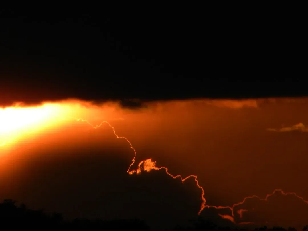
Red Sprites Dancing Above Thunderstorms
Sprites or red sprites are large-scale electric discharges that occur in the mesosphere, high above thunderstorm clouds, or cumulonimbus, and are usually triggered by the discharges of positive lightning between an underlying thundercloud and the ground. These jellyfish-like flashes of red light appear roughly 50 to 90 kilometers above Earth’s surface and last for just milliseconds. What makes them truly bizarre is their appearance, sometimes resembling crowns, carrots, or massive jellyfish with tendrils stretching downward.
Despite being photographed thousands of times since their discovery in 1989, scientists are still working out exactly why they occur. According to NASA’s APOD blog, despite being recorded in photographs and videos for more than 30 years, the “root cause” of sprite lightning remains unknown, “apart from a general association with positive cloud-to-ground lightning.” They’re more common than you’d think, but you need to be in just the right position to see them. Looking above distant thunderstorms from 100 to 200 miles away gives you the best chance of catching these otherworldly light shows.
Mysterious Megacryometeors Falling From Clear Skies
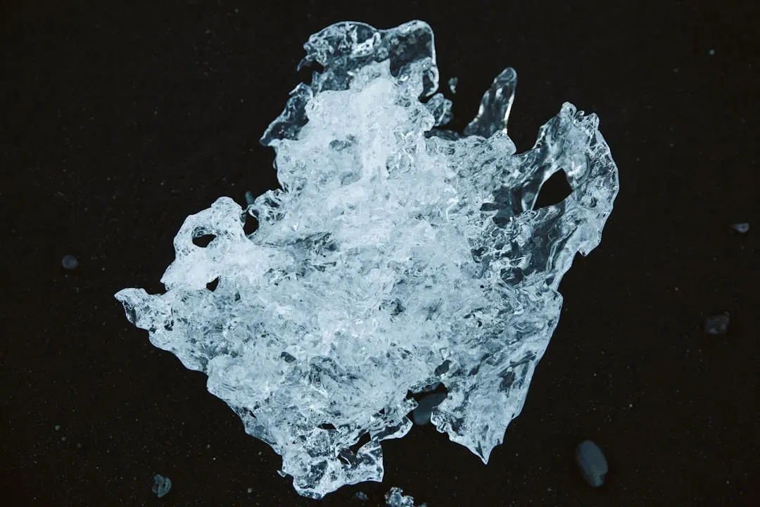
Imagine walking outside on a perfectly clear day when suddenly a massive chunk of ice crashes to the ground near you, weighing more than six pounds. In January 2000, more than 50 large ice chunks fell unexpectedly across Spain, some weighing over 6 pounds, damaging cars and startling communities, and scientists later named them megacryometeors, which unlike regular hail, formed without storms. These aren’t fragments from airplane toilets as urban legends suggest.
Recent research has linked these events to changes in the upper atmosphere, with cooling at the tropopause, possibly caused by global warming, which may create ideal conditions for ice to grow and fall. The fact that they form without storms present makes them particularly puzzling. Scientists are still trying to figure out the exact atmospheric conditions that allow these massive ice formations to develop seemingly out of nowhere, high in the atmosphere, before plummeting to Earth.
Heat Bursts That Warm The Night
Imagine waking up at midnight to find the temperature has shot up 20 degrees in minutes and 80 mph wind gusts have ravaged your town, though a rare phenomena, that’s the power of a heat burst. These strange events occur when dying thunderstorms high in the atmosphere release intensely hot, dry air that plummets toward the ground at incredible speeds. In 2022, Nebraska saw a rare heat burst linked to virga, with temperatures jumping from 75 to 91 degrees Fahrenheit in just minutes.
The physics behind heat bursts involves evaporation and compression, but predicting when and where they’ll strike remains incredibly difficult. In the case of a heat burst, all of the moisture evaporates and that dense air is only getting warmer as it approaches the ground at high speeds, and when it hits, it suddenly delivers oppressively hot and dry air that can stay in place for hours. It’s hard to say for sure, but these midnight heat waves are probably more common than we realize. They often go unnoticed simply because most people are asleep when they happen.
Thundersnow’s Eerie Electric Winter
Snow falling during a thunderstorm might not sound that unusual, but thundersnow is actually an incredibly rare phenomenon. Thundersnow is a rare event where a thunderstorm drops snow instead of rain, with lightning flashing through falling snow and thunder that’s softer than in summer, happening in only 0.07 percent of storms around the world. The lightning appears muffled and strange, flashing through swirling white flakes instead of dark rain clouds.
It forms when cold air moves over warmer lake water or during big winter storms, with strong updrafts carrying ice and snow high into clouds, where electric charges build up, and when the charge gets strong enough, over 3,000 volts per meter, lightning strikes. Famous events include the 1993 Superstorm and a 2025 Midwest blizzard that had 16,000 lightning flashes. The conditions have to be absolutely perfect for this to happen, which is why even seasoned meteorologists get excited when they witness it.
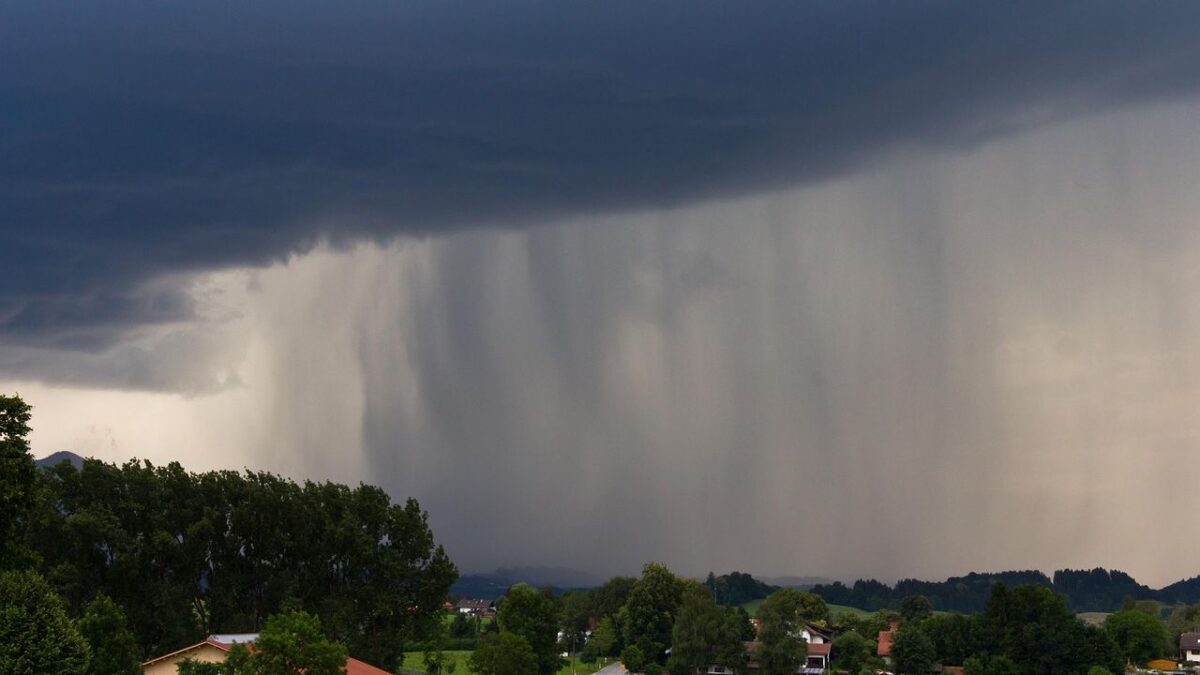
Virga’s Ghostly Precipitation
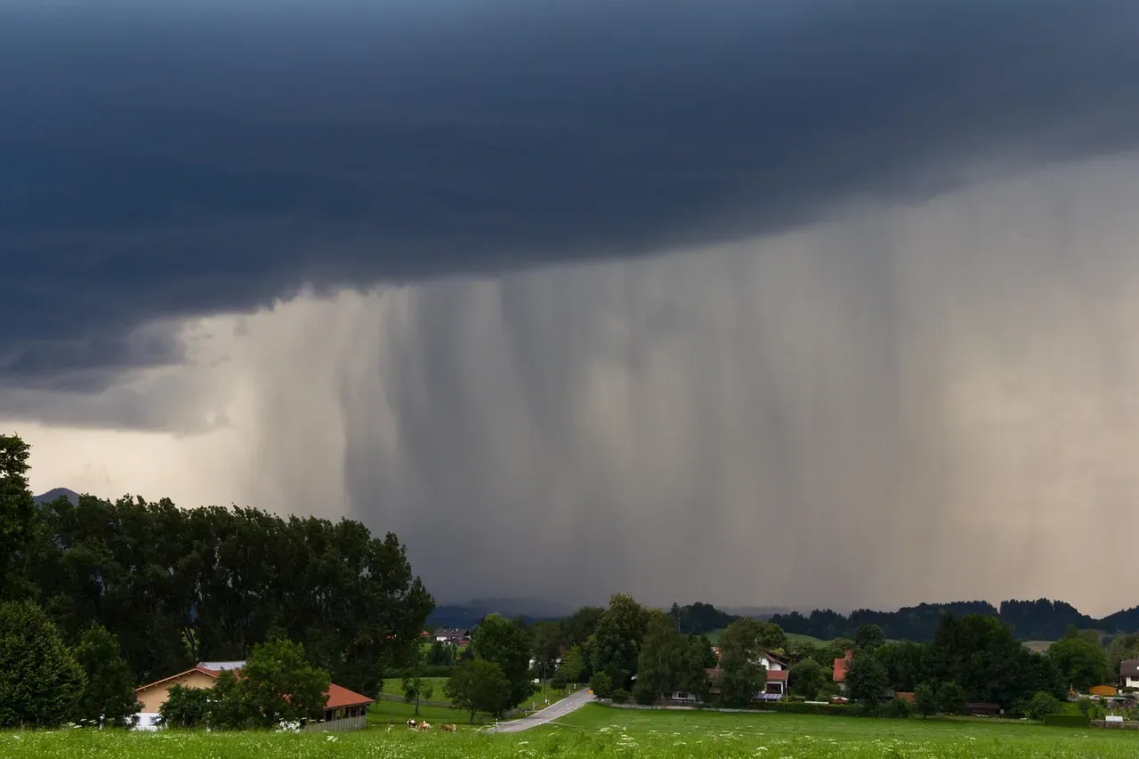
Virga is ghostly precipitation that never makes it to the ground, and when the air beneath a cloud is very dry, precipitation falling through it evaporates before reaching Earth’s surface, leaving feathery streaks extending from the cloud’s base, capturing the path the rain or ice took before becoming water vapor. You can see these curtains of rain or snow hanging from clouds, but they vanish into thin air before touching the ground. It looks almost supernatural, like the sky is crying tears that disappear mid-fall.
What makes virga particularly fascinating to scientists is its dangerous side effects. Although it never touches Earth, it can trigger sudden wind gusts, called microbursts, that endanger planes and damage buildings. Virga also plays a role in storm development by spreading tiny ice crystals that help form new clouds, and it is not just an Earth phenomenon either, as space probes have observed virga on Venus and Jupiter as well, making this beautiful mystery a truly planetary event.
Noctilucent Clouds Shining In The Night
Noctilucent, or ‘night-shining’, clouds form far above the weather-producing clouds that we’re used to seeing, some 80 kilometres above Earth’s surface, and are composed of ice crystals, which may form on dust from meteorites. These are the highest clouds in our atmosphere, and they can only be seen during twilight when the sun has set at ground level but still illuminates these wispy formations from below.
They can generally only be observed in twilight, when most of the sky is shrouded in darkness, but the sun’s rays can still reach the upper atmosphere to illuminate them from below. Scientists are still investigating why these clouds form at such extreme altitudes and whether climate change is making them more visible or frequent. Their delicate, silvery appearance gives them an almost alien quality, like something that shouldn’t exist in Earth’s atmosphere at all.
Haboobs and Their Towering Dust Walls
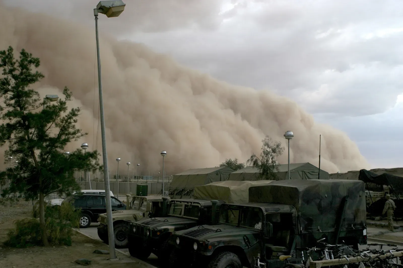
Haboobs are powerful dust storms that can happen anywhere but are most often seen around northern Africa and the southwestern US, in regions with a lot of hot, dry air and loose particles. Haboobs form when a thunderstorm collapses and either all the air it collected is blown out in powerful gusts, or the air within it cools and falls rapidly to the surface in a microburst, with the strong winds releasing and being pushed in front of the storm, picking up dust and debris to create a wall thousands of feet high and miles across.
These massive walls of dust can swallow entire cities in minutes, reducing visibility to zero and causing respiratory problems for anyone caught outside. While scientists understand the basic mechanics of how haboobs form, predicting their exact timing, intensity, and path remains challenging. The sheer scale of these dust walls makes them both terrifying and mesmerizing, a reminder of the raw power hiding within collapsing thunderstorms.
Frost Flowers Blooming On Ice
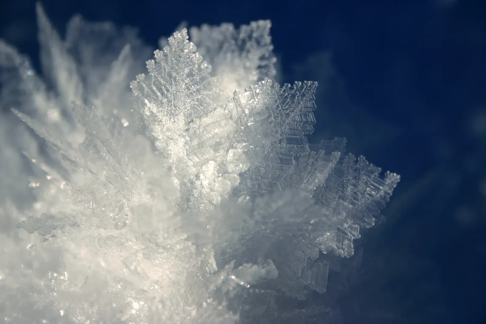
In the frigid Arctic or sub-Arctic regions, where temperatures drop dramatically, nature crafts delicate masterpieces known as frost flowers, which are intricate, crystalline formations that appear on thin ice sheets when the air is extremely cold and humidity is high, resembling beautiful flowers as water vapor freezes and forms detailed patterns on the ice surface. These delicate ice structures look like they’ve been sculpted by an artist, each one unique in its intricate design.
What puzzles scientists is the exact combination of conditions needed for frost flowers to form. Frost flowers are a silent testament to the beauty that can emerge from the harshest conditions, providing a glimpse into the world of microscopic wonders, each one unique in its design, much like a snowflake. They require a precise balance of temperature, humidity, and ice conditions. These ephemeral blooms can also play a role in atmospheric chemistry, releasing sea salt into the air, which affects cloud formation and climate patterns in ways researchers are only beginning to understand.
Blood Rain and Its Crimson Mystery

There are recorded cases of blood rain from all over the world, and this unusual form of rain is stained either by dust from deserts or by microscopic algae that are suspended in the raindrops. When red or reddish-brown rain falls from the sky, it understandably freaks people out. The phenomenon has been reported throughout history, sometimes sparking religious interpretations or fears of apocalyptic events.
It is also important to mention that scientists are not entirely sure how algae get into the clouds. In one famous case in southern India, researchers found red-tinted cells in the rain that initially couldn’t be matched to any known DNA, leading to wild speculation about extraterrestrial origins. In 2013 researchers eventually found the elusive DNA inside the cells, matched with trentepohlia annulata, a type of red algae common in waters all over the world. Still, the mystery of how so much of this material gets so high into the atmosphere remains partially unsolved.
Conclusion: The Atmosphere’s Unfinished Puzzle

These ten phenomena remind us that despite all our technological advances, the atmosphere still holds secrets. From glowing orbs that defy explanation to ice falling from clear skies, weather continues to surprise and perplex even the most experienced scientists. What’s truly fascinating is that many of these events occur with some regularity, yet we’re still piecing together the fundamental physics behind them.
Climate change is adding another layer of complexity to these mysteries. Rising temperatures and shifting weather patterns might be making some of these phenomena more common or intense, but without fully understanding them in the first place, it’s hard to predict what the future holds. The next time you look up at the sky, remember there’s probably something strange happening up there that science can’t quite explain yet. What would you think if you witnessed one of these rare phenomena? Tell us in the comments.
- 10 Things Found in the Ocean That Shouldn’t Exist - June 23, 2026
- The Ancient River System Hidden Beneath the Sahara of North America - June 22, 2026
- The one city in the US sinking under its own weight. - June 22, 2026