Modest Snow Totals Varied by Location (Image Credits: Unsplash)
Washington D.C. region – Snowfall from a recent winter storm tapered off Monday morning, but northwest gusts up to 40 miles per hour and slushy roadways kept residents on alert amid lingering hazards.[1][2]
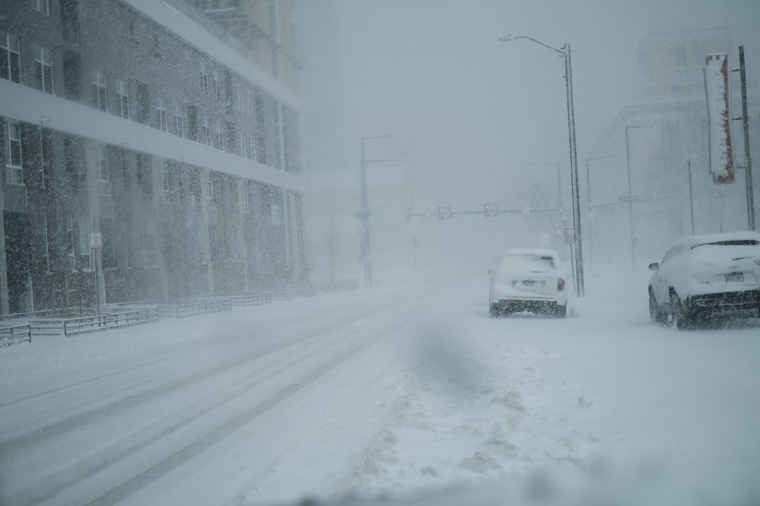
Modest Snow Totals Varied by Location
The storm delivered 2 to 6 inches of accumulation across much of the area Sunday into early Monday, falling short of earlier heavy projections.[1] Higher amounts concentrated north and west of the city, while airports recorded lighter coatings.
Officials noted light flurries could continue briefly Monday, though steady precipitation ended.[1] Maryland declared a state of emergency to streamline snow removal and response efforts, particularly in Montgomery and Prince George’s counties.
- Northern Montgomery County, Gaithersburg: 5.5 inches
- Falls Church: 3.5 inches
- Dulles International Airport: 2.0 inches
- Baltimore-Washington Thurgood Marshall Airport: 1.9 inches
- Reagan National Airport: 1.0 inch
Treacherous Roads Slow the Commute
Slush coated major roadways Monday morning, complicating travel for early commuters and prompting widespread school delays or closures throughout the region.[1] Officials urged drivers to exercise caution as temperatures hovered around freezing, with wind chills dipping well below that mark.
A refreeze loomed overnight into Tuesday, as lows settled into the 20s, potentially turning slush into ice patches.[1] Emergency protocols activated in several counties focused on plowing and salting priority routes.
Winds Drive Power Outage Concerns
Gusts reaching 35 to 40 miles per hour battered the area Monday, whipping northwest and threatening tree limbs burdened by heavy, wet snow.[1] These conditions raised risks of scattered power disruptions and downed lines, especially where branches snapped under the strain.
WTOP meteorologist Lauryn Ricketts highlighted the ongoing threat. “What’s not over is the winds. Gusty winds of up to 35 to 40 mph throughout the day and into Tuesday morning,” she said.[1] Winds from the northwest clocked 15 to 25 miles per hour sustained Monday, with peaks near 40, before easing late Tuesday.
Sunshine Signals Recovery Tuesday
Forecasts promised clearer skies Tuesday, with abundant sunshine and highs climbing into the upper 30s to near 40 degrees.[1] Breezes would diminish after midday, allowing temperatures to moderate further.
Monday highs struggled around 40 degrees under cloudy, blustery skies, but the shift to sunnier weather offered relief from the weekend’s disruptions.
Key Takeaways
- Snow ended, but 35-40 mph winds continue through Tuesday morning, risking outages.[1]
- Slushy roads demand careful driving; refreeze possible overnight.
- Sunshine returns Tuesday with milder conditions and easing gusts.
Residents navigated a tricky transition from snow to wind-driven challenges, underscoring winter’s unpredictable grip on the capital area. Stay vigilant on the roads and prepare for potential outages – what impacts did you encounter today? Tell us in the comments.
- Urban Coyotes Show Remarkable Adaptability, Learning to Thrive in City Environments - July 22, 2026
- Beavers Are Nature’s Engineers, Creating Vital Habitats for Other Wildlife Species - July 21, 2026
- The Recovery of the California Condor Offers Hope for Other Critically Endangered Birds - July 21, 2026