Arctic sea ice hit a troubling milestone in mid-April 2026, registering the second-lowest extent on record according to satellite data. This deficit, roughly 0.2 million square kilometers below the previous year, sets the stage for an intense melt season ahead. Meteorologists now anticipate a powerful super El Niño event peaking in winter 2026/27, which could intensify ice loss through shifts in atmospheric circulation and elevate the odds of polar vortex disruptions across the Northern Hemisphere.
Arctic Sea Ice Plunges to Near-Record Lows Early in 2026
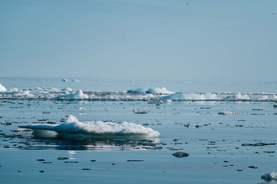
Satellite observations captured the Arctic’s sea ice extent at levels unseen since 2019 during mid-April 2026. The measurement fell short of 2025 figures by a notable margin, highlighting an accelerated decline even before the peak melt period. Volume estimates also trailed last year, pointing to thinner ice overall.
Forecasters project this trend to continue through the summer, with the September minimum potentially shattering records if melting accelerates. Concentration maps reveal outer edges vulnerable to complete thaw, while central regions face above-average losses. Historical charts spanning 46 years underscore the anomaly, placing 2026 below recent decades and nearing the 2012 benchmark.
Super El Niño Emerges as a Game-Changer
Conditions in the equatorial Pacific shifted rapidly from a weak La Niña earlier this year to warming anomalies. A subsurface Kelvin wave now propels heat eastward, fueling expectations of a super El Niño by late 2026. Ensemble models from the ECMWF indicate most scenarios surpassing the +2.0°C threshold in the Niño3.4 region, with peaks timed for the upcoming winter.
This classification applies to events with anomalies at or above +2.0°C, known for triggering profound global weather changes. Projections for August through October show widespread warm waters encroaching on polar areas. Past super El Niño episodes demonstrated similar rapid intensification and atmospheric ripple effects.
Linking Tropical Heat to Polar Melt
Super El Niño patterns often spawn low-pressure systems over the North Pacific and Aleutians, channeling warmer southerly flows into the Arctic’s western and central basins. Reanalysis of four prior super events confirmed this dynamic, with southerly winds hastening September ice retreat. Current forecasts mirror these setups, featuring lows flanking the Arctic alongside highs over Scandinavia.
Sea ice concentration outlooks predict elevated melt across most regions. These pressure configurations historically aligned with the lowest ice extents, as dual low-pressure zones enhance warm air intrusion from both sides. The interplay promises a challenging re-freezing phase starting in October.
- Low pressure over North Pacific drives warm air into Beaufort Sea.
- High pressure over Europe reinforces flows on the eastern flank.
- Result: Above-normal melt in central Arctic Ocean.
- Historical precedent: Matches patterns from record-low years.
- Forecast confidence: High per ECMWF ensembles.
Polar Vortex Vulnerabilities and Winter Weather Threats
The stratospheric polar vortex, a high-altitude circulation trapping cold air over the poles, faces heightened disruption risks. Super El Niño winters frequently weakened this vortex through stratospheric warming events, displacing its core. Low sea ice exacerbates this by warming the lower stratosphere, boosting sudden stratospheric warming probabilities.
Disruptions release frigid Arctic air southward, spawning cold outbreaks in the United States, Canada, and Europe. Mid-latitude winters could see volatile swings, from mild spells to severe freezes. Diagrams of past events illustrate elongated vortex structures under pressure from planetary waves.
| Factor | Impact on Polar Vortex | Weather Outcome |
|---|---|---|
| Super El Niño | Weakens core via high-pressure intrusions | Cold surges into mid-latitudes |
| Low Sea Ice | Warms stratosphere, aids disruptions | Increased extreme cold events |
| Combined Effect | Higher SSW likelihood | Volatile winters 2026/27 |
Key Takeaways:
- Arctic ice at second-lowest mid-April extent signals rapid summer melt.
- Super El Niño odds exceed +2°C, peaking winter 2026/27.
- Expect polar vortex strains leading to cold risks in North America and Europe.
As 2026 unfolds, the convergence of dwindling Arctic ice and a brewing super El Niño demands vigilance for cascading weather impacts. Communities from the U.S. Midwest to European plains should prepare for potential cold snaps amid broader warming trends. Detailed analysis from Severe Weather Europe underscores these interconnected risks.[1] What preparations are you making for the winter ahead? Share in the comments.
- Urban Coyotes Show Remarkable Adaptability, Learning to Thrive in City Environments - July 22, 2026
- Beavers Are Nature’s Engineers, Creating Vital Habitats for Other Wildlife Species - July 21, 2026
- The Recovery of the California Condor Offers Hope for Other Critically Endangered Birds - July 21, 2026