Storms Ignite with Friday Intensity (Image Credits: Pixabay)
Dallas – Severe storms packing heavy rain, flooding potential, high winds, large hail, and isolated tornadoes will target North Texas starting Friday afternoon.
Storms Ignite with Friday Intensity
Residents should prepare immediately as the weather pattern shifts dramatically. An active stretch unfolds across the region, catching many off guard during what promised a routine weekend. Thunderstorms will develop rapidly Friday afternoon, fueled by unstable atmospheric conditions. These systems promise more than scattered showers.
Forecasters highlight the speed at which threats escalate. High winds capable of downing tree limbs accompany the initial bands. The setup favors prolonged activity into Saturday, keeping vigilance essential throughout.
Hazards Breakdown: What to Expect
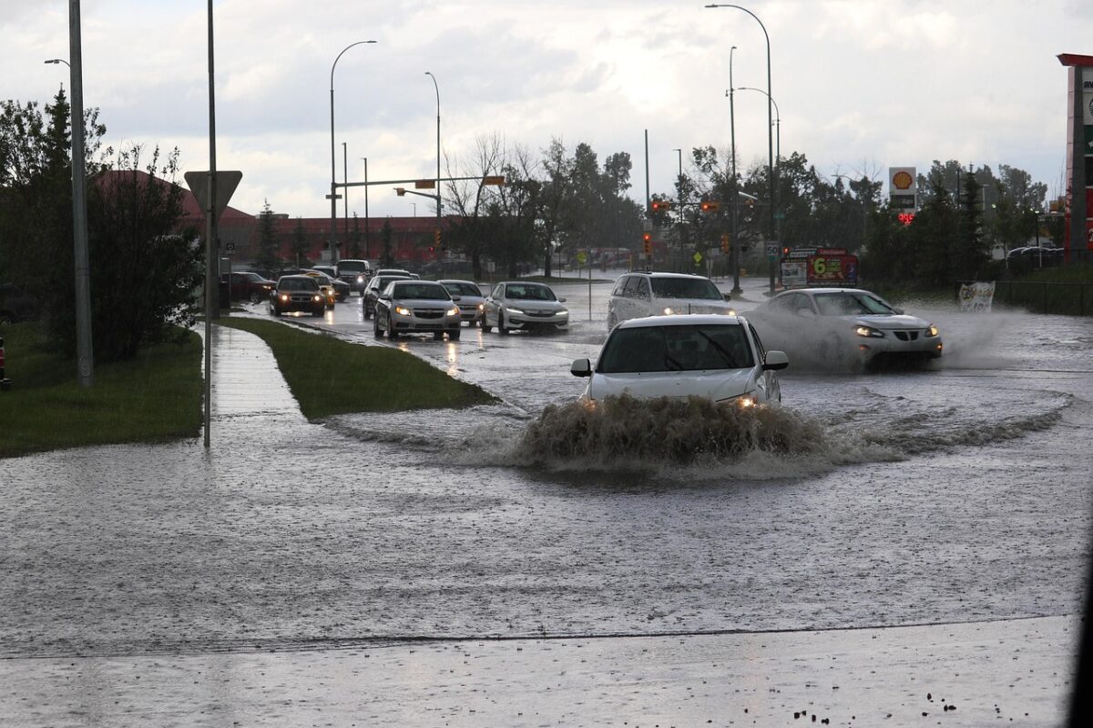
Heavy rainfall stands out as the most widespread concern. Flooding risks rise quickly in low-lying areas and urban zones where drainage struggles. Large hail threatens property from vehicles to rooftops, with stones large enough to cause significant dents.
High winds add another layer of danger, potentially exceeding gusts that snap power lines. Isolated tornadoes remain a stray but serious possibility, forming amid the strongest updrafts. Here are the primary threats in focus:
- Heavy rain leading to flash flooding
- Large hail damaging structures and cars
- High winds toppling obstacles
- Isolated tornadoes in favored spots
- General storm disruption
Regional Impacts and Timing
The storms prioritize North Texas through the weekend, with peak activity Friday into early Saturday. Urban centers like Dallas face heightened flooding from overwhelmed streets. Rural areas contend more with hail and wind across open fields.
Sunday offers partial relief, though lingering showers persist. Travel disruptions loom large, especially on major highways. Power outages become likely where winds peak.
Staying Safe Amid the Onslaught
Officials urge proactive steps well before dark clouds gather. Secure outdoor items against wind. Avoid flooded roads, even shallow ones, which conceal deadly currents. Monitor local alerts via reliable apps and broadcasts.
Emergency kits with essentials prove vital during outages. Seek sturdy shelter if tornado warnings sound. Communities that plan ahead fare best against nature’s fury.
Key Takeaways
- Storms begin Friday afternoon with heavy rain and winds.
- Watch for large hail and flash flooding across North Texas.
- Stay alert for rare tornadoes; preparation saves lives.
North Texas residents face a test of readiness this weekend, where swift action turns potential chaos into manageable inconvenience. Heed the warnings, protect what matters, and stay informed. What preparations are you making? Share in the comments below.
- Urban Coyotes Show Remarkable Adaptability, Learning to Thrive in City Environments - July 22, 2026
- Beavers Are Nature’s Engineers, Creating Vital Habitats for Other Wildlife Species - July 21, 2026
- The Recovery of the California Condor Offers Hope for Other Critically Endangered Birds - July 21, 2026