Landfall Unfolds with Ferocious Intensity (Image Credits: Flickr)
Far North Queensland – Severe Tropical Cyclone Narelle barreled ashore early Friday morning as a high-end category 4 system, unleashing destructive winds and heavy rains across remote coastal communities.[1][2] The storm crossed between Lockhart River and Coen around 7 a.m. AEST, marking a significant event for the Cape York Peninsula region. Officials reported initial damage but no serious injuries as the cyclone weakened while pushing inland.
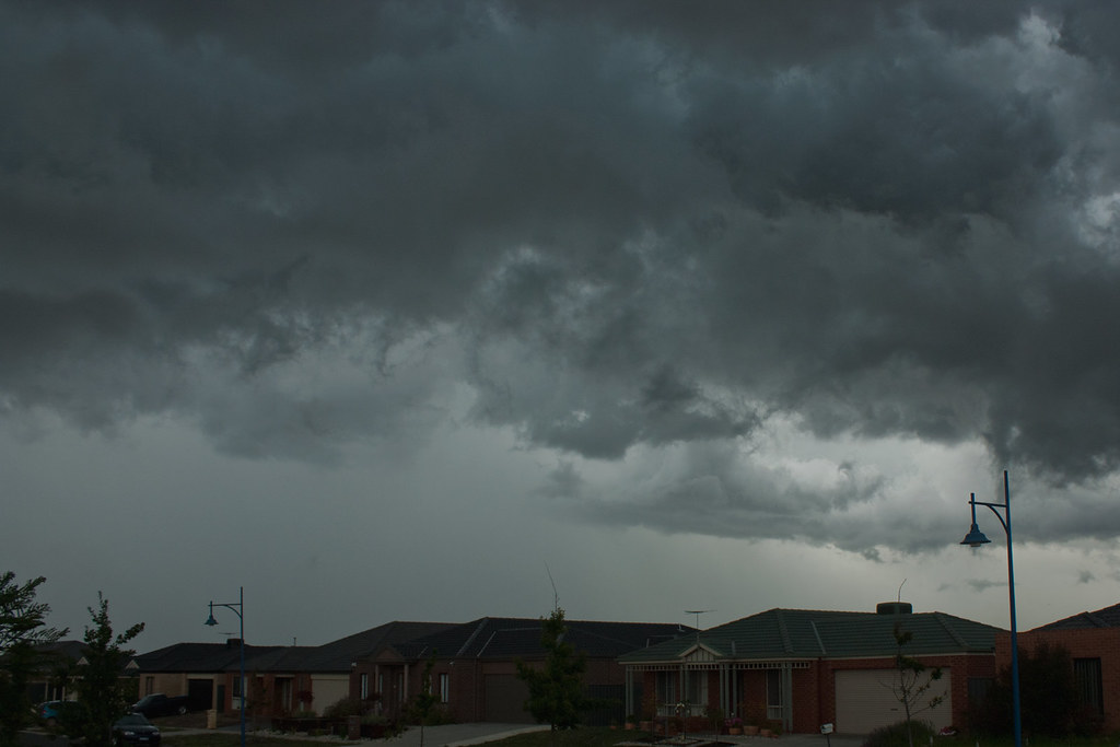
Landfall Unfolds with Ferocious Intensity
Sustained winds reached 195 kilometers per hour near the center at landfall, with gusts climbing as high as 250 kilometers per hour in the most intense zones.[1] Forecasters had anticipated a possible category 5 crossing, but the system dipped slightly before striking shore. The Bureau of Meteorology tracked Narelle from about 240 kilometers northeast of Cooktown prior to impact, moving westward at roughly 27 kilometers per hour.[3]
Powerful ocean swells preceded the core, generating waves over 11 meters in coastal waters. Hurricane-force winds battered the Peninsula coast, prompting gale warnings as far south as Cairns. The cyclone’s compact structure amplified dangers in directly hit areas.
Damage Emerges Amid Flooding Threats
Residents witnessed roofs ripped from homes, trees uprooted, and power lines downed shortly after landfall. In Lockhart River, emergency alerts warned of fallen infrastructure, leaving around 70 homes without electricity. Across the broader Cook Shire, outages affected up to 230 properties.[2]
Flash flooding swelled rivers like the Archer River north of Coen, submerging road crossings and bridges such as Barratt Creek on the Mossman Daintree Road. Rainfall totals hit 400 millimeters in isolated spots, saturating catchments and heightening riverine flood risks. No fatalities occurred, and ambulance services logged few call-outs.
- Roofs torn off structures in Coen and nearby properties
- Trees felled across roads and communities
- Power outages in Lockhart River and Cook Shire
- Rapid river rises leading to flooded crossings
- Heavy rains prompting school closures and flight cancellations
Remote Communities Face Heightened Vulnerabilities
Small, predominantly Indigenous towns bore the brunt, including Coen with its 320 residents, Lockhart River, and Port Stewart. Evacuations shifted some from Port Stewart to Coen beforehand. Wellbeing centers opened for shelter, while water treatment plants shut down, urging stockpiling.
Queensland authorities issued cyclone warnings from Lockhart River to Cape Tribulation and Mapoon to Pormpuraaw. A prepare-to-shelter alert covered Weipa, Aurukun, and Napranum. Premier David Crisafulli vowed seamless recovery efforts following response operations.[2]
Forecast Signals Ongoing Regional Menace
Narelle weakened to a category 3 system post-landfall, with sustained winds dropping to 155 kilometers per hour and gusts to 220 kilometers per hour. It tracked westward across Cape York at 19 kilometers per hour, positioned 563 kilometers northwest of Cairns.[4]
Experts predict further decline over land to category 2 before re-intensification in the Gulf of Carpentaria. A second landfall looms late Saturday or early Sunday near Anindilyakwa Island on the Northern Territory’s east coast. From there, the storm may veer toward Katherine and Daly River areas, delivering 100 to 200 millimeters of rain and risking renewed floods. A potential third crossing eyes northern Western Australia in several days.[1][3]
Key Takeaways
- Narelle crossed as category 4, weaker than the anticipated category 5 but still highly destructive.
- Immediate impacts include structural damage and flooding in far north Queensland, with no major casualties.
- The cyclone heads toward the Northern Territory, where re-strengthening could exacerbate flood-prone regions.
Cyclone Narelle underscores the raw power of tropical systems in Australia’s north, testing preparations in sparsely populated frontiers. Recovery begins even as new threats build. What impacts have you seen or prepared for in cyclone-prone areas? Share in the comments.
- Urban Coyotes Show Remarkable Adaptability, Learning to Thrive in City Environments - July 22, 2026
- Beavers Are Nature’s Engineers, Creating Vital Habitats for Other Wildlife Species - July 21, 2026
- The Recovery of the California Condor Offers Hope for Other Critically Endangered Birds - July 21, 2026