The 2025 Atlantic hurricane season will be remembered not for how many storms formed, but for the raw, almost reckless intensity of the ones that did. Fewer named storms than average, yet three Category 5 hurricanes in a single season. That combination has only happened once before in recorded history. It’s the kind of year that makes meteorologists pause and wonder whether what just happened is a glimpse of something bigger and more permanent.
The season was notable for its striking contrast, wavering between periods of relative calm and bursts of intense activity, generating very powerful storms. What made 2025 unusual wasn’t volume. It was concentration. The storms that formed didn’t meander. They exploded. And while the continental US largely escaped direct hurricane landfalls, the threats were real, the coastal damage was serious, and the near-misses were genuinely frightening.
A Season Built on Dangerous Ocean Heat
Before the first named storm even formed, the conditions were already set for something historic. Over four-fifths of the Atlantic had above-average ocean heat content during the 2025 hurricane season, the third-highest extent on record since records began in 1958, behind only 2023 and 2024. That is an extraordinary baseline for any season to begin with.
The influence of fossil fuel-caused climate change in creating more powerful hurricanes is undeniable, mainly because of ocean temperature. The world’s oceans have absorbed more than 90% of the added heat to the climate system from global warming, and this has manifested as warmer sea surface temperatures at nearly every location on Earth. Simply put, warmer water means more fuel, and in 2025, the fuel supply was nearly limitless.
Warm waters act as fuel for hurricanes: the warmer the water, the more fuel a hurricane has to strengthen. While most modeling studies predict a decrease in hurricane frequency, most of them predict an increase in very intense Category 4 or 5 hurricanes. The 2025 season, in a very uncomfortable way, validated those projections right on schedule.
The Season Officially Begins: Andrea, Barry, and Chantal
Tropical Storm Andrea formed on June 23, kicking off the season, and tropical storms Barry and Chantal then developed in rapid succession, before activity took a pause. None of the three were the monster storms the forecasters had warned about, but Chantal made its presence felt quickly.
Tropical Storm Chantal made the first U.S. landfall of the season and brought high winds and deadly flooding to the Carolinas during the Independence Day holiday weekend. For communities still rebuilding from previous seasons, flooding over the July 4th holiday was particularly disruptive, displacing families and closing roads at the height of summer tourism.
No hurricanes made landfall in the continental U.S. for the first time since 2015. That single fact tells two very different stories at once. On one hand, the US was remarkably fortunate in 2025. On the other, the storms that churned offshore were genuinely terrifying in their own right.
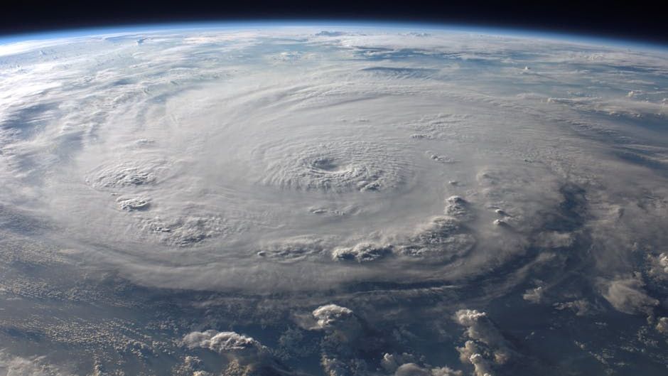
Hurricane Erin: The Category 5 That Stalked the East Coast
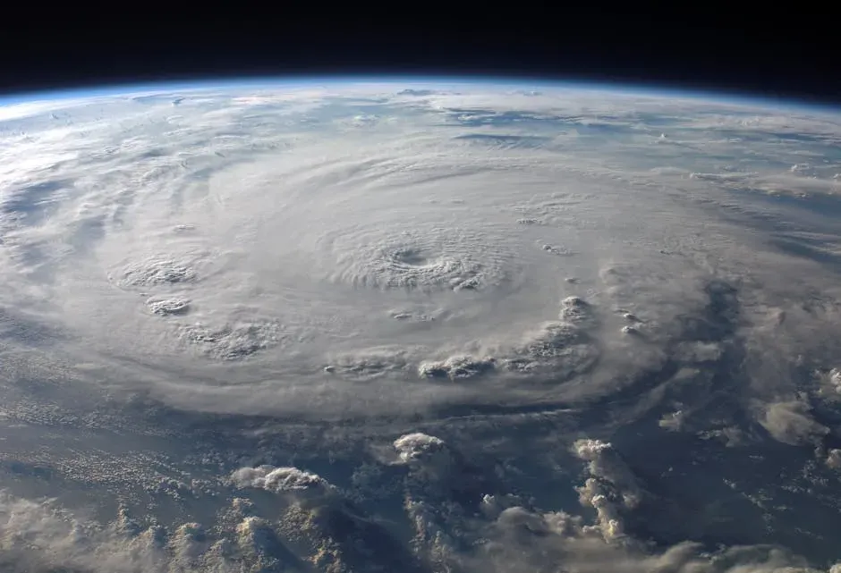
The fifth named storm, first hurricane, first major hurricane, and first Category 5 hurricane of the 2025 Atlantic hurricane season, Erin developed from a tropical wave on August 11, while passing westward over Cape Verde. Its rapid rise from a modest tropical wave to one of the most powerful storms of the year was jarring to watch in real time.
Highly favorable conditions enabled Erin to undergo explosive intensification on August 16, reaching its peak at Category 5 intensity with one-minute maximum sustained winds of 160 mph and a minimum pressure of 913 mb. This intensification is one of the fastest on record. Coastal communities from Florida to New England were put on notice almost immediately.
Although the eye of Hurricane Erin was never closer than about 200 miles from the U.S. East Coast and its center never made landfall, Erin’s effects were still seen along the shoreline and felt by coastal communities. The massive circulation of this powerful storm was a clear demonstration of how distant hurricanes still pose a danger to life and property.
Erin’s Wrath on the Shore: Rescues, Evacuations, and Collapsing Homes
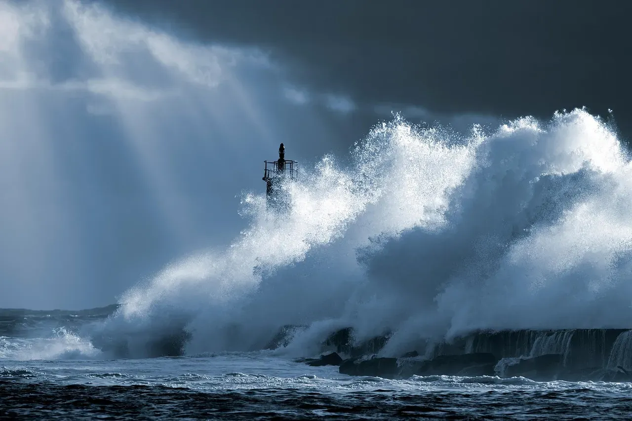
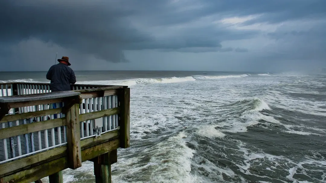
Erin wasn’t expected to make landfall in the U.S., but forecasters said it would push large waves of 15 to 20 feet or higher onto the shoreline, along with storm surge. A tropical storm warning was in effect for the Outer Banks from Beaufort Inlet to Duck, where tropical storm conditions began late Wednesday. The hurricane center also issued a storm surge warning along the Outer Banks from Cape Lookout to Duck, warning of life-threatening inundation of 2 to 4 feet above ground level.
Everyone on Hatteras and Ocracoke islands in the Outer Banks was under mandatory evacuation orders. Authorities wanted people to leave before seawater overtook Highway 12, the main road connecting a long string of North Carolina communities. The logistics of evacuating barrier islands during a storm with wind fields that stretched hundreds of miles offshore were sobering.
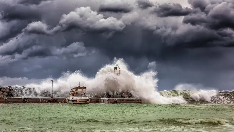
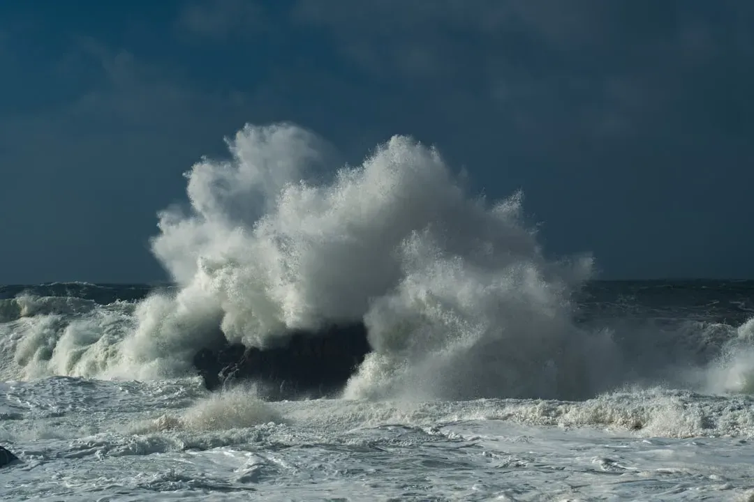
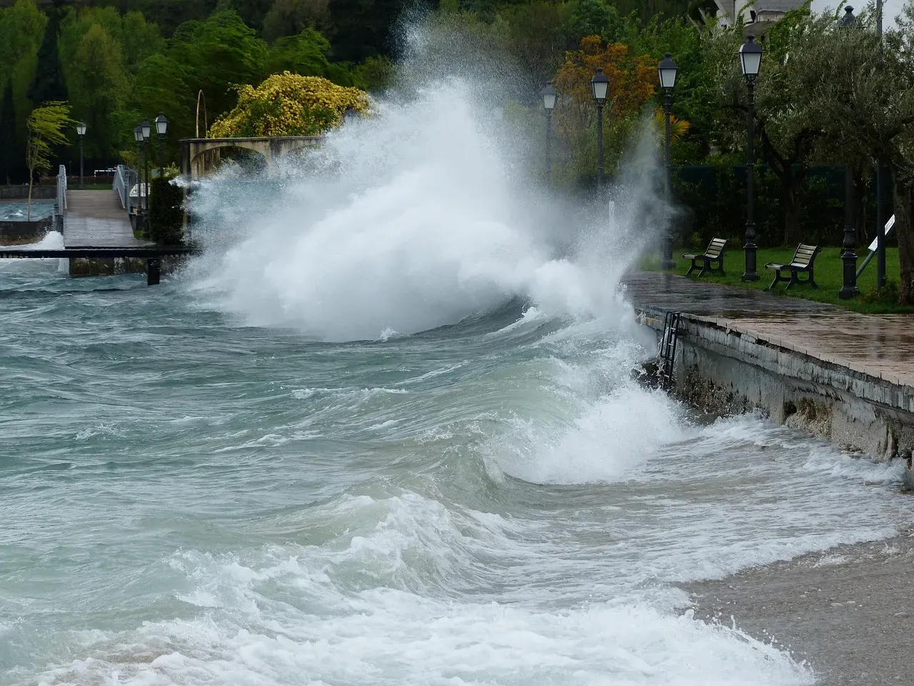
New Jersey declared a state of emergency, with Governor Phil Murphy urging people not to swim. Swimming was also banned in New York City from August 20 through 22 as Erin passed. Life-threatening surf reached 10 to 20 feet along the entire Eastern Seaboard, with rip currents posing a high risk from Florida to Maine, resulting in over 100 rescues in North Carolina alone.
Hurricane Gabrielle: The Forgotten Major Hurricane
In mid-September, activity resumed with the formation of Hurricane Gabrielle in the central Atlantic. Gabrielle rapidly intensified into a Category 4 hurricane before weakening and affecting the Azores and Spain as an extratropical cyclone. Sandwiched between the drama of Erin and the double threat that followed in late September, Gabrielle rarely got the headlines it deserved.
Gabrielle approached Bermuda as a Category 4 hurricane, completed a right turn just southeast of the island, then moved toward the Azores. The track shift spared Bermuda from a direct hit, but the margin was uncomfortably thin. European forecasters were watching closely as Gabrielle’s remnants swept into Spain, bringing heavy rainfall to a continent already stressed by extreme weather patterns.
Hurricane Humberto: A Monster That Stayed Offshore

Hurricane Humberto was the eighth named storm of the 2025 Atlantic hurricane season, forming on September 24, 2025. On September 26, Humberto underwent rapid intensification, strengthening into a major hurricane. The next day on September 27, Humberto transformed into a powerful Category 5 storm with winds of 160 mph. Its offshore position didn’t make it any less of a threat to American coastal communities.
Humberto was expected to send life-threatening surf and rip currents toward Bermuda, the northern Leeward Islands, Puerto Rico, the Virgin Islands, and the U.S. East Coast. In South Carolina, Governor Henry McMaster issued an emergency declaration, state emergency officials said swift-water rescue crews had been activated, and the South Carolina National Guard said 150 troops were assigned to help with the state’s storm response.
During its time as a major hurricane, Humberto helped steer then-Tropical Storm Imelda away from making impact on the southeastern coast of the U.S. That piece of atmospheric physics, where one hurricane alters the trajectory of another nearby storm, was one of the more remarkable dynamics of the entire season.
Hurricane Imelda: The Twin Threat
Imelda and Humberto were so close that they impacted each other’s movements, a process called the Fujiwhara effect. It occurs when two storms rotate in the same direction close to each other around a shared midpoint. Imelda and Humberto made their closest approach, passing within about 465 miles of each other, the second-closest approach by two Atlantic hurricanes on record.
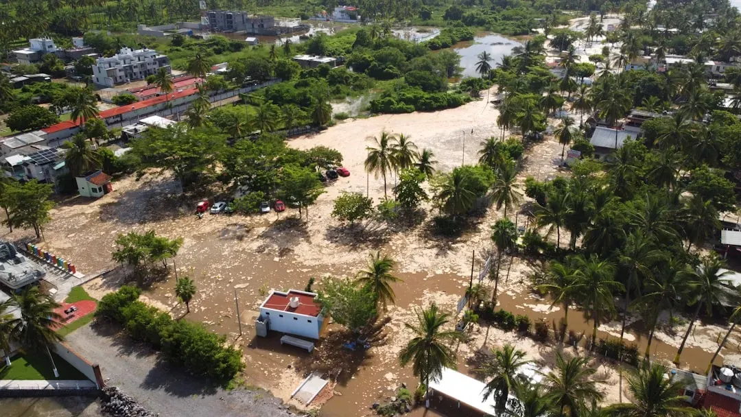
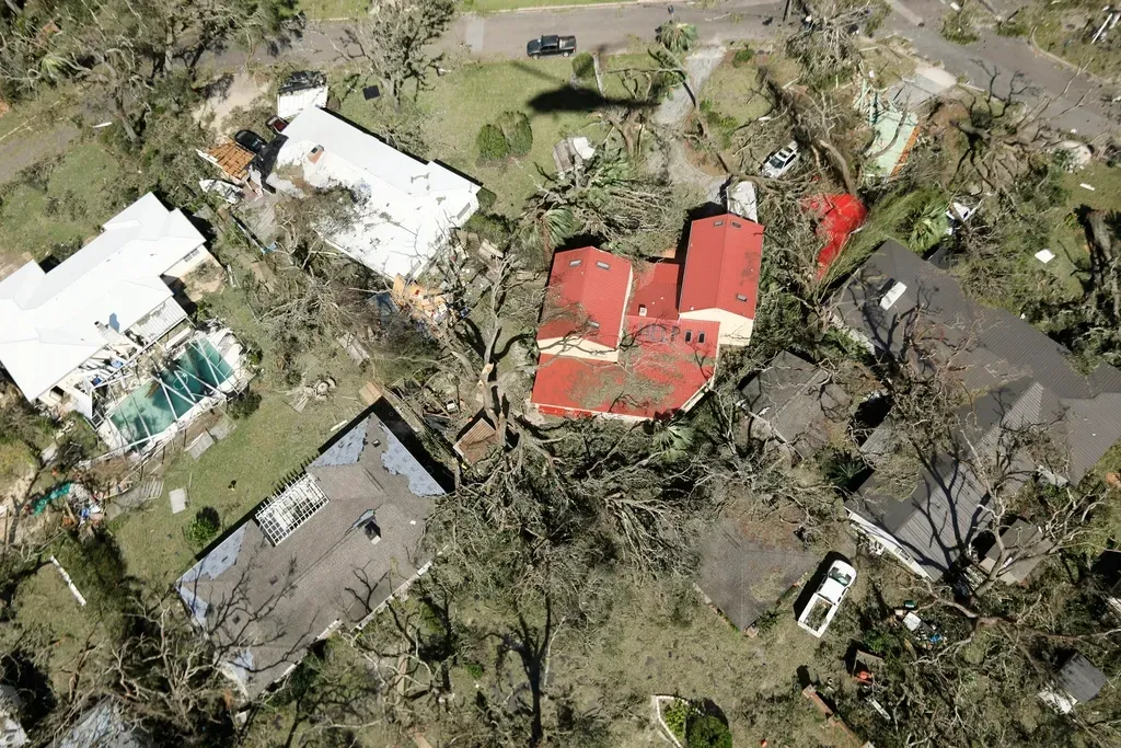
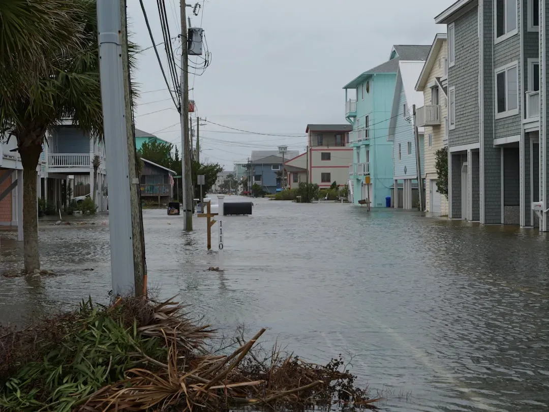
Areas along the southeastern U.S. Atlantic coast received strong wind gusts and rain showers from Imelda, along with rough surf from Imelda and Hurricane Humberto combined. In North Carolina, waves caused eight homes along the Outer Banks shoreline to collapse. These weren’t abandoned structures. They were real homes, swallowed by a shoreline that has been steadily eating into the coast for years.
In North Carolina’s Outer Banks, at least six homes collapsed into the ocean. Coastal erosion from previous storms, combined with the twin power of Imelda and Humberto, left little buffer between these homes and the unrelenting surf. The homes, which had been teetering on stilts as waves battered their support structure, were unoccupied when they fell. A fortunate outcome, but one that underscores just how precarious life on a barrier island has become.
The Record-Breaking Season by the Numbers
Thirteen tropical cyclones formed during 2025, all of which intensified into named storms. Five storms strengthened into hurricanes, four of which became major hurricanes, the highest percentage ever observed in an Atlantic hurricane season. That last statistic is worth sitting with. Nearly every hurricane that formed in 2025 became a major hurricane. The ratio is unmatched in the historical record.
Three Category 5 hurricanes formed this season, the second most of any year on record, behind only the 2005 season, which had four. Due in large part to these systems, and despite a below-average number of named storms and hurricanes, the season had an above-normal accumulated cyclone energy rating of 130.8 units. Raw power, concentrated into fewer storms, is the defining signature of 2025.
Hurricane Melissa: The Season’s Defining Monster
The final and strongest storm of the season, Hurricane Melissa, intensified into a Category 5 hurricane south of Jamaica and made landfall there near peak intensity, resulting in catastrophic destruction. While Melissa’s direct path took it to Jamaica and Cuba rather than the US mainland, the storm loomed over the entire western Atlantic for days and represented the kind of worst-case scenario that emergency managers in Florida, Louisiana, and the Gulf Coast had been preparing for all season.
The last hurricane of the season, Hurricane Melissa, was especially powerful. It tied the 1935 Labor Day Hurricane for the third most intense hurricane ever recorded and was the most intense hurricane ever to make landfall in Atlantic basin history. The Caribbean, not the US coastline, absorbed the blow. But the margin of difference was atmospheric steering patterns, not a weaker storm.
Collectively, the storms during the season caused at least 126 fatalities and resulted in at least 9.36 billion dollars in monetary losses, mostly due to Melissa. That death toll could have been radically different had Melissa’s track shifted even marginally toward South Florida or the Gulf Coast.
How Forecasters Responded: A Season of Warning
The 2025 Atlantic hurricane season showcased near-normal activity, marked by periods of very strong storms. NOAA and the National Hurricane Center demonstrated notable accuracy in tracking the season’s most dangerous systems, with several days of advance warning that gave coastal communities meaningful time to prepare and evacuate when necessary.
NOAA’s model, the Hurricane Analysis and Forecast System, underwent an upgrade that resulted in another 5% improvement of tracking and intensity forecasts, helping forecasters provide more accurate watches and warnings. For Melissa specifically, forecasters provided almost four days of advance notice before the storm’s landfall in Jamaica, with a track forecast accurate to within about 13 miles.
NOAA’s enhanced messaging put the focus on the biggest threat posed by Erin to Americans: the high risk of deadly rip currents. The local NWS office in Morehead City, North Carolina, helped local emergency managers prepare for the impacts of Erin, with briefings beginning five days in advance of anticipated impacts, giving partners ample time to prepare and issue evacuation orders if necessary.
A Changing Pattern: Fewer Storms, Far More Dangerous Ones

Was 2025 a glimpse of a future where fossil fuel-caused climate change produces fewer but more intense hurricanes? The number of hurricanes was below average in 2025, yet the season produced three Category 5 hurricanes, something that has only happened one other year in recorded history, 2005. Scientists are increasingly treating that pattern as signal, not noise.
If environmental conditions do become favorable for hurricane development, a hurricane will form and it will have an ample fuel supply from hot waters to strengthen into a powerful hurricane. While there may be fewer hurricanes in the future, the ones that do form will become powerful, potentially destructive storms. For coastal communities from Texas to Maine, that’s a difficult reality to plan around, because quiet weeks on the forecast radar no longer guarantee a quiet season.
What 2025 Means for Future Preparedness
In the last decade, flooding caused by rainfall has become the deadliest threat of tropical systems. The storms of 2025 reinforced that lesson with particular force. Erin never made landfall, yet North Carolina declared a state of emergency. Humberto never came close to shore, yet homes in the Outer Banks collapsed into the sea. The idea that a hurricane is only dangerous when its eye crosses land is genuinely outdated.
Whatever the forecast, remember that it only takes one hurricane to make landfall, and coastal residents should prepare for every hurricane season. Beyond preparation culture, the 2025 season reinforced the need for smarter coastal development policies, better-funded early warning infrastructure, and honest public communication about what modern storms are capable of, even when they stay just offshore.
Conclusion: The Year America Dodged History
The 2025 hurricane season was, in the plainest possible terms, a near-miss on an epic scale. Three Category 5 storms. The second-highest count of that intensity ever recorded in a single Atlantic season. And somehow, the continental United States avoided a direct hurricane landfall for the first time in a decade. That’s not a testament to preparedness alone. That’s luck, shaped by atmospheric patterns that could just as easily have bent the other way.
What the season should leave us with is not relief, but clarity. The ocean is warmer. The storms that do form are more powerful than they’ve ever been. And the gap between “offshore threat” and “direct hit” is sometimes nothing more than a modest shift in the steering currents. In that sense, 2025 wasn’t a year America was spared. It was a year America was reminded, in the most vivid possible terms, of what’s now possible every summer through November. The question going forward isn’t whether another season like 2025 will happen. It’s whether communities will be ready when the atmospheric dice roll a different way.