
In the heartland of America, where vast plains meet the horizon and agricultural fields stretch for miles, Kansas harbors a peculiar natural phenomenon that seems to defy conventional understanding of how rivers behave. The Arikaree River, nestled in the northwestern corner of Kansas, performs a fascinating vanishing act that has intrigued scientists, locals, and visitors alike. Unlike the continuous flow we typically associate with rivers, this waterway has developed a reputation for its seasonal disappearance and reappearance.
This phenomenon, while seemingly magical, actually provides a fascinating glimpse into the complex interplay between geology, hydrology, and climate that shapes our natural world. Let’s dive into the mystery of Kansas’s disappearing river and uncover the science behind this remarkable natural occurrence.
The Arikaree River: Kansas’s Vanishing Waterway
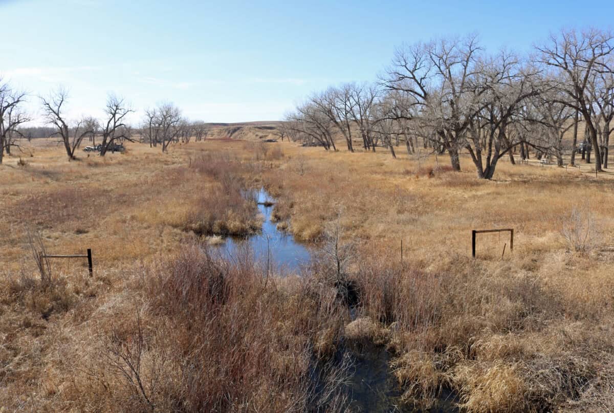
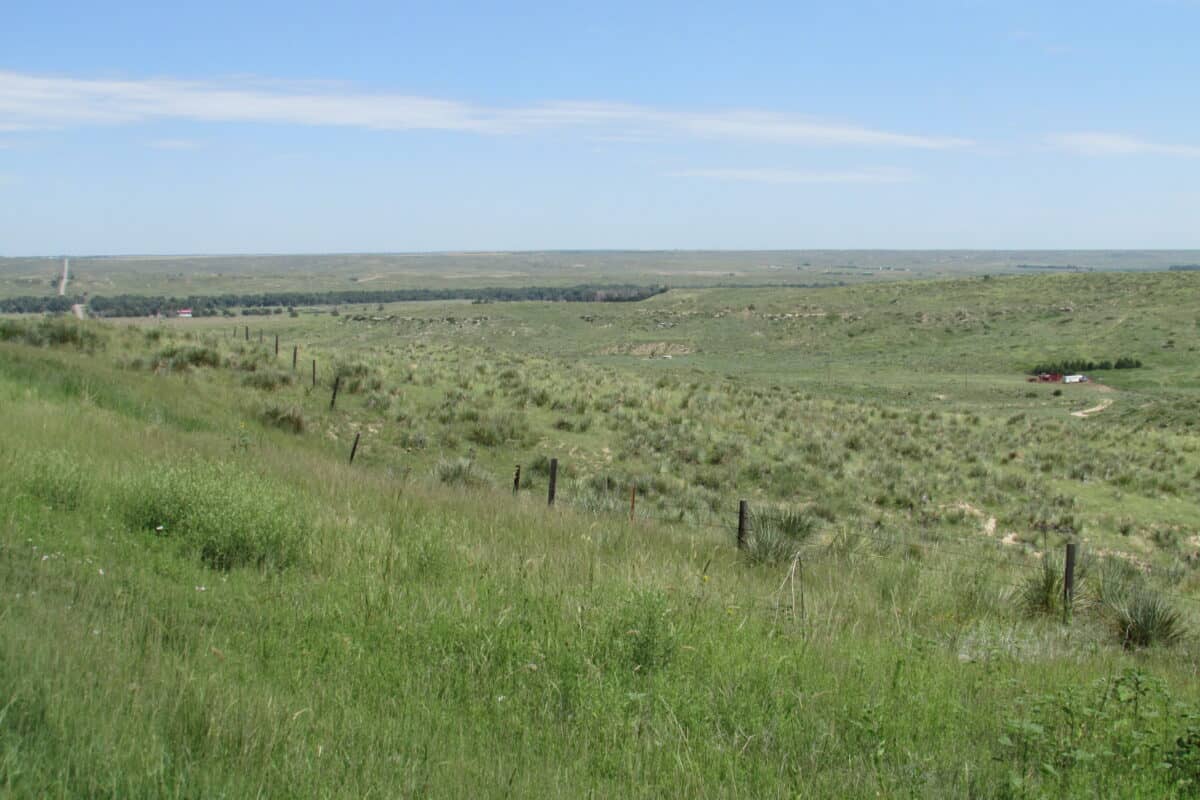
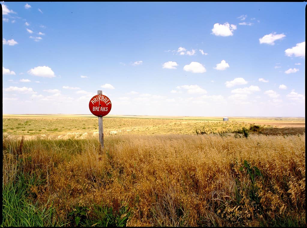
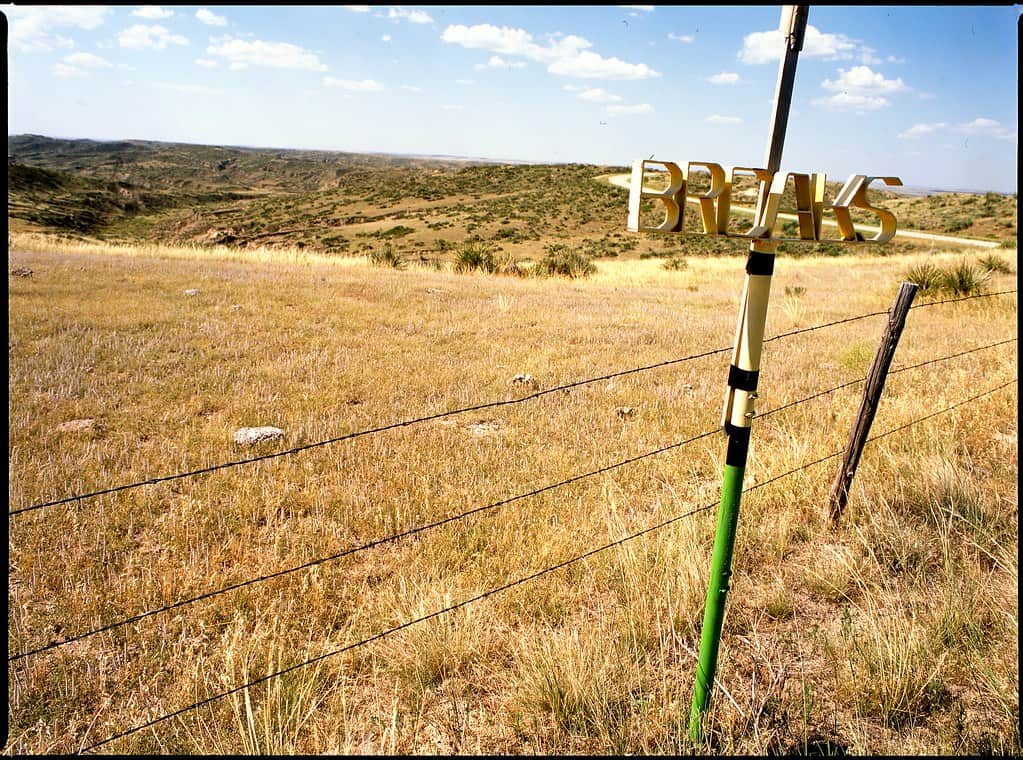
The Arikaree River originates in the eastern plains of Colorado and flows eastward into the northwestern corner of Kansas. It eventually joins the North Fork Republican River in Haigler, Nebraska, to form the Republican River. What makes this river particularly special is not its length or volume, but rather its intermittent nature. For significant portions of the year, sections of the Arikaree River in Kansas simply disappear from sight, leaving behind a dry riverbed that gives little indication of its aquatic identity. Then, almost like clockwork, the river returns during certain seasons, flowing visibly again across the landscape.
This disappearing act isn’t unique to the Arikaree River alone. It belongs to a category of waterways known as “intermittent streams” or “ephemeral rivers.” However, the regularity and extent of the Arikaree’s disappearance make it a particularly notable example of this phenomenon in the United States. The river’s behavior has become something of a local legend in northwestern Kansas, with generations of residents marking the seasons partly by the river’s presence or absence.
The Geological Context of Northwestern Kansas
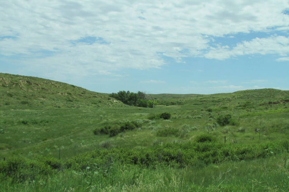
To understand why the Arikaree River vanishes, we must first examine the unique geological context of northwestern Kansas. This region sits atop the High Plains Aquifer system (also known as the Ogallala Aquifer), one of the world’s largest aquifers. The landscape is characterized by porous soils and underlying sedimentary rock formations that were deposited millions of years ago when ancient rivers flowed across the region.
The geology of this area features layers of sand, gravel, silt, and clay that allow water to move relatively freely below the surface. These permeable materials create a dynamic relationship between surface water and groundwater, which is essential to the disappearing river phenomenon. Additionally, the relatively flat topography means that rivers in this region often have shallow channels and low gradients, making them more susceptible to fluctuations in water levels compared to rivers in more mountainous regions.
The Science Behind the Disappearing Act
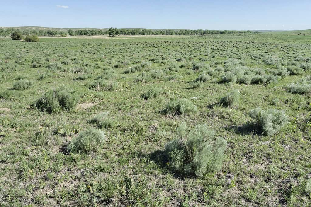
The Arikaree River’s disappearance isn’t actually magical—it’s a textbook example of a hydrological process called transmission loss. During dry periods, particularly in the summer months when temperatures rise and precipitation decreases, the river’s water seeps into the porous riverbed faster than it can be replenished by upstream flow. Essentially, the river doesn’t truly disappear; it simply goes underground, continuing its journey beneath the surface rather than above it.
This phenomenon is exacerbated by several factors specific to the region. The sandy soils of western Kansas have high infiltration rates, meaning they readily absorb water. Furthermore, the water table in certain sections can drop below the level of the riverbed during dry periods, creating what hydrologists call a “losing stream” condition, where surface water feeds the groundwater system rather than the other way around. When these conditions persist, the visible flow of the river ceases, and the Arikaree “disappears” from the surface landscape.
Seasonal Patterns and Predictability
The Arikaree River’s disappearance and reappearance follow a somewhat predictable seasonal pattern, though there can be significant variation from year to year depending on precipitation patterns. Typically, the river flows most consistently during spring, when snowmelt from Colorado contributes to higher water volumes and when spring rains help maintain surface flow. By late summer, sections of the river often run dry as transmission losses exceed inflow and evaporation rates increase.
The river typically begins to reappear in visible form during fall and winter, when evaporation rates decrease and the water table may rise to intersect with the riverbed again. Following wet years with above-average precipitation, the river may maintain surface flow for longer periods, while during drought years, the disappearance can be more extensive and prolonged. Long-term residents of the area often remark that they can gauge the relative wetness of recent years simply by observing how much of the Arikaree is flowing above ground.
The Role of Agricultural Practices
Human activities, particularly agricultural practices, have significantly influenced the Arikaree River’s flow patterns over the past century. The High Plains region has been transformed by intensive agriculture, with irrigation being a critical component of farming success in this semi-arid climate. Groundwater pumping from the Ogallala Aquifer to irrigate crops has lowered the regional water table in many areas, potentially exacerbating the river’s tendency to disappear.
Historical accounts suggest that the Arikaree River’s disappearance may have become more pronounced and extended in duration since the mid-20th century, coinciding with the expansion of irrigation in the region. When groundwater levels drop due to pumping, the disconnection between surface water and groundwater becomes more significant, making it more difficult for the river to maintain surface flow. This human dimension adds another layer of complexity to understanding the river’s behavior and raises questions about how water management practices might affect the future of this natural phenomenon.
Similar Phenomena Across the Great Plains

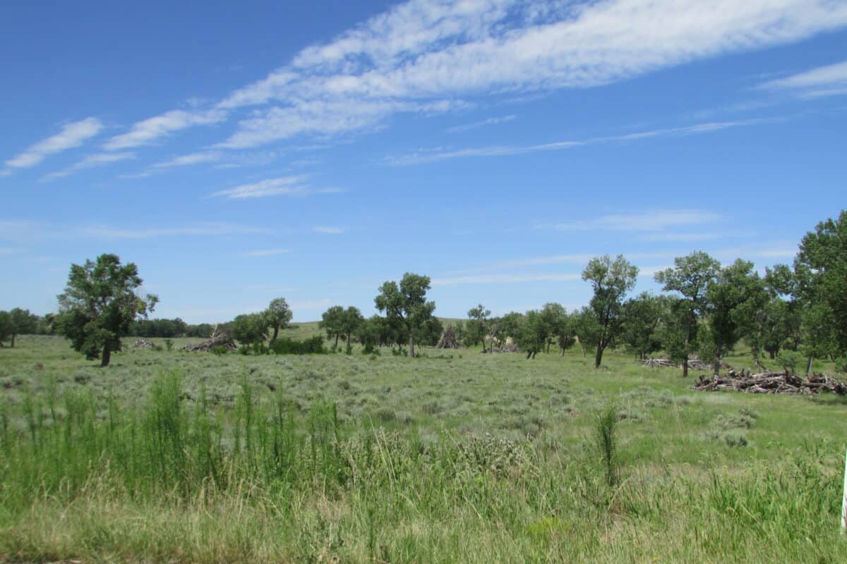
The Arikaree River’s disappearing act, while notable, is not entirely unique to Kansas. Similar intermittent flow patterns can be observed in other waterways across the Great Plains, including sections of the Cimarron River, the Arkansas River in western Kansas and eastern Colorado, and portions of the Canadian River in the southern Plains. These rivers share many physical characteristics with the Arikaree, including relatively shallow channels, sandy substrates, and connections to underlying aquifer systems.
What makes these Great Plains rivers particularly susceptible to disappearing is the combination of climate (semi-arid with high evaporation rates), geology (permeable soils and underlying materials), and hydrology (complex interactions between surface and groundwater systems). Understanding the Arikaree’s behavior thus provides insights into broader regional patterns and the vulnerability of prairie waterways to both natural fluctuations and human-induced changes in the hydrological cycle.
Ecological Implications of an Intermittent River
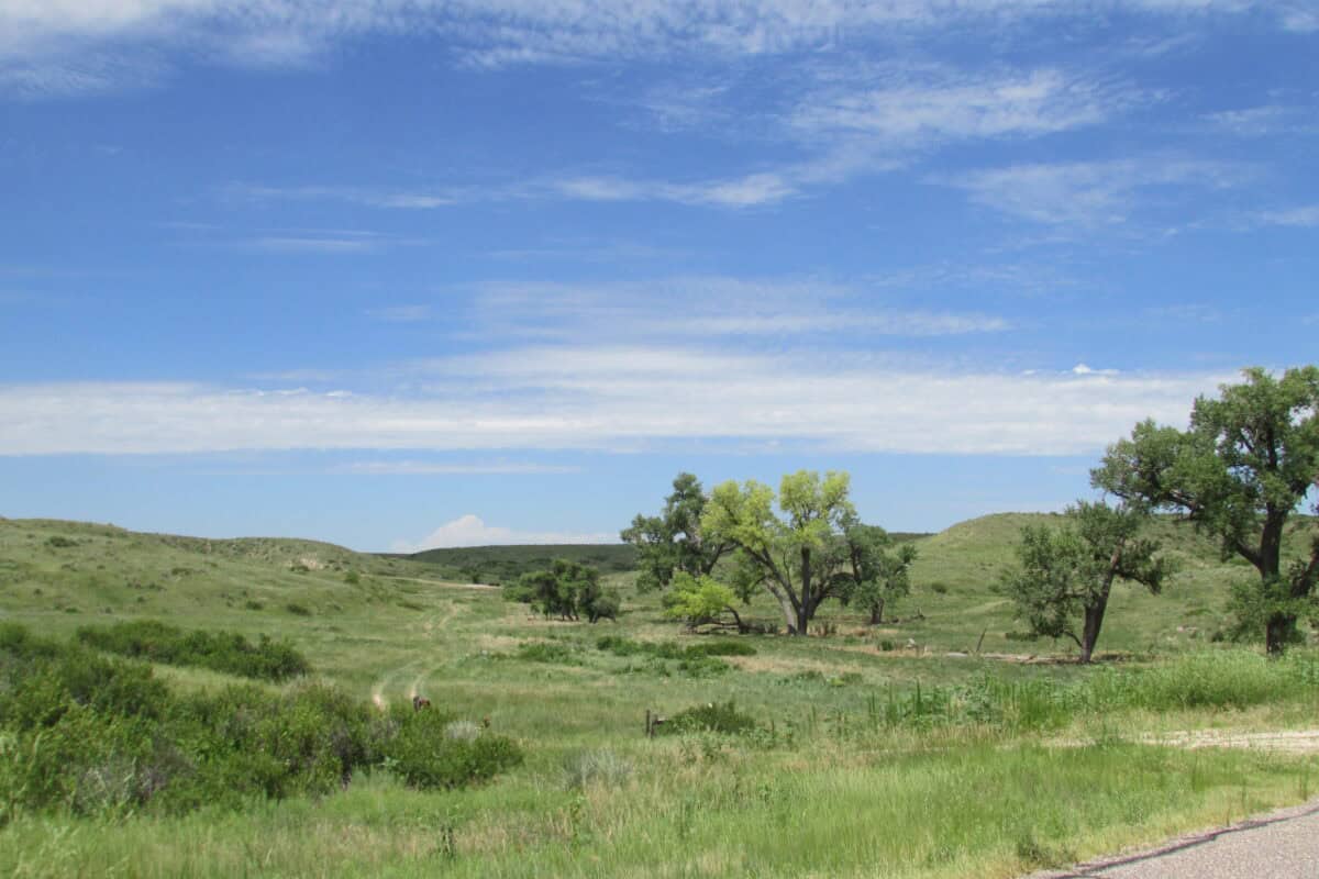
The Arikaree River’s intermittent nature creates a unique ecological system that has evolved to accommodate periodic dry spells. Aquatic organisms in this environment have developed remarkable adaptations to survive the river’s disappearance. Some fish species, for example, retreat to deeper pools that remain wet even when the main channel runs dry. Other aquatic creatures, including certain invertebrates, have life cycles timed to coincide with the river’s flowing periods, or have drought-resistant eggs or larvae that can remain dormant during dry times.
Riparian vegetation along the Arikaree has also adapted to these fluctuating conditions. Plants with deep root systems can access groundwater even when surface flow is absent, while others complete their growth cycles during the predictably wet seasons. This creates a specialized ecological community that differs from those found along permanently flowing rivers. Ecologists consider these intermittent river ecosystems particularly interesting for studying adaptation and resilience in the face of variable environmental conditions—qualities that may become increasingly important in a changing climate.
Historical Significance to Native Peoples and Settlers
The Arikaree River holds historical significance for both the indigenous peoples who first inhabited the region and the European settlers who later arrived. Archaeological evidence suggests that Native American groups, including the Arikara people (from whom the river takes its name), developed seasonal patterns of movement that accounted for the river’s periodic disappearance. They understood the river’s cycles and planned their hunting and gathering activities accordingly.
When European settlers arrived in the 19th century, they initially struggled to adapt to the river’s unpredictable nature. Historical accounts from early homesteaders describe the confusion and hardship caused by settling near what appeared to be a reliable water source, only to find it vanished during crucial growing seasons. Over time, settlers developed their own adaptations, including the digging of wells and construction of small reservoirs to maintain water access during the river’s dry periods. These historical interactions with the disappearing river highlight how natural phenomena can shape human settlement patterns and cultural adaptations.
Studying and Monitoring the Phenomenon
Modern scientific understanding of the Arikaree River’s disappearance has been enhanced by systematic monitoring and research efforts. The United States Geological Survey (USGS) maintains stream gauges on the river that collect data on flow rates, helping to document the timing and extent of the river’s presence and absence. Hydrologists use this information, combined with groundwater monitoring wells, to build more comprehensive models of the interaction between surface water and groundwater in the region.
Research techniques have evolved significantly in recent decades. Scientists now employ technologies such as ground-penetrating radar to map subsurface water movement, environmental tracers to track how water moves between the surface and underground, and remote sensing to monitor changes in vegetation patterns that might indicate subsurface water availability. These scientific efforts not only help explain the Arikaree’s behavior but also contribute to broader understanding of how rivers function in semi-arid environments and how they might respond to future changes in climate and land use.
Climate Change and the Future of the Disappearing River
Climate change projections for the Great Plains region suggest that the Arikaree River’s disappearing act may evolve in the coming decades. Most climate models predict that the region will experience more variable precipitation patterns, with potentially longer and more severe droughts interspersed with more intense rainfall events. These changes could amplify the river’s intermittent nature, potentially extending the duration of dry periods while making wet periods more flashy and unpredictable.
Additionally, higher temperatures are expected to increase evaporation rates and plant water demand, potentially accelerating transmission losses during summer months. These climatic shifts, combined with ongoing water management challenges related to the declining Ogallala Aquifer, create significant uncertainty about the future hydrological regime of the Arikaree River. Scientists and water managers are increasingly focused on developing adaptive strategies that can accommodate these changes while maintaining ecological function and supporting the agricultural communities that depend on the region’s water resources.
Visitor Experiences and Local Perspectives

For visitors to northwestern Kansas, the Arikaree River offers a fascinating natural attraction, though one that requires good timing to fully appreciate. Those who arrive during the river’s “visible” season are treated to a pleasant prairie waterway flanked by cottonwoods and willows, supporting a variety of bird and wildlife species. Visitors during the dry season, on the other hand, might initially be disappointed to find only a dry riverbed, though many find the concept of the disappearing river intriguing in itself, and interpretive materials at local museums and visitor centers help explain the phenomenon.
Local residents have developed their own rich folklore and practical knowledge about the river’s behavior. Farmers and ranchers in the area often have detailed mental maps of which sections of the river tend to hold water longest and which disappear first. Some can predict with remarkable accuracy when certain stretches will run dry based on upstream conditions and recent weather patterns. This local ecological knowledge, passed down through generations and refined through direct observation, complements scientific understanding and represents an important cultural dimension of this natural phenomenon.
Conclusion: The Enduring Mystery of Kansas’s Disappearing River
The Arikaree River’s annual vanishing act represents a fascinating intersection of geology, hydrology, ecology, and human interaction with the natural environment. While science has explained the mechanisms behind the river’s disappearance, the phenomenon retains an element of wonder that continues to captivate both residents and visitors. In a world where natural resources are increasingly stressed by human demands and changing climate conditions, the Arikaree offers valuable lessons about adaptation, resilience, and the complex interconnections between surface water and groundwater systems.
For Kansas, the disappearing river serves as a unique natural landmark that highlights the state’s diverse and dynamic landscapes beyond the stereotype of endless flat fields. It reminds us that even in seemingly simple environments, complex and fascinating natural processes are at work. As research continues and our understanding deepens, the Arikaree River stands as both a scientific curiosity and a testament to the ever-changing relationship between water, land, and the communities that depend on them.
So yes, there really is a river in Kansas that disappears and reappears each year—a natural phenomenon that, while explainable by science, still retains the power to inspire awe and appreciation for the subtle wonders of America’s heartland. The Arikaree River’s cycle of presence and absence continues as it has for millennia, a persistent reminder of the dynamic nature of our planet’s hydrological systems and their fundamental importance to both ecosystems and human societies.
From exploring the marine wonders in the Azores and witnessing the vast savannas of Kenya, to delving deep into the rich biodiversity of South Africa and traversing iconic landscapes in Australia and the US like Yellowstone, Chris's experiences are vast.
With a penchant for diving alongside sharks, the ocean holds a special place in his heart.
Through his academic insights, he champions wildlife conservation, striving with 'Animals Around The Globe' to cultivate a profound connection between humans and animals, enhancing our mutual appreciation.
Connect with him at Feedback@animalsaroundtheglobe.com.
- The Animal With the Heaviest Horns Uses Them Like Sledgehammers - July 30, 2026
- Why Some Animals Are Getting Smaller—and Others Bigger - July 30, 2026
- The Longest-Tailed Bird Uses It to Win Mates in Dazzling Displays - July 30, 2026