New Orleans, Louisiana stands as America’s most flood-vulnerable major city, facing a staggering 1-in-3 chance of significant flooding annually. This extraordinary risk factor means that in any given year, there’s approximately a 33% probability that residents will experience flood conditions capable of damaging property, disrupting daily life, and potentially causing catastrophic damage. Unlike many other American cities that might face flood risks measured in terms of 1-in-100 years or even 1-in-500 years, New Orleans lives with this threat as an almost routine annual possibility.
The city’s unique geographic position, sitting mostly below sea level between the Mississippi River and Lake Pontchartrain, creates a precarious situation exacerbated by climate change, land subsidence, and coastal erosion. Understanding this vulnerability is crucial for both residents and policymakers as they grapple with the realities of maintaining a vibrant urban center in an increasingly flood-prone environment.
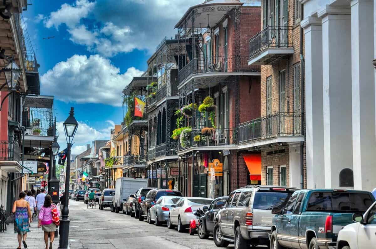
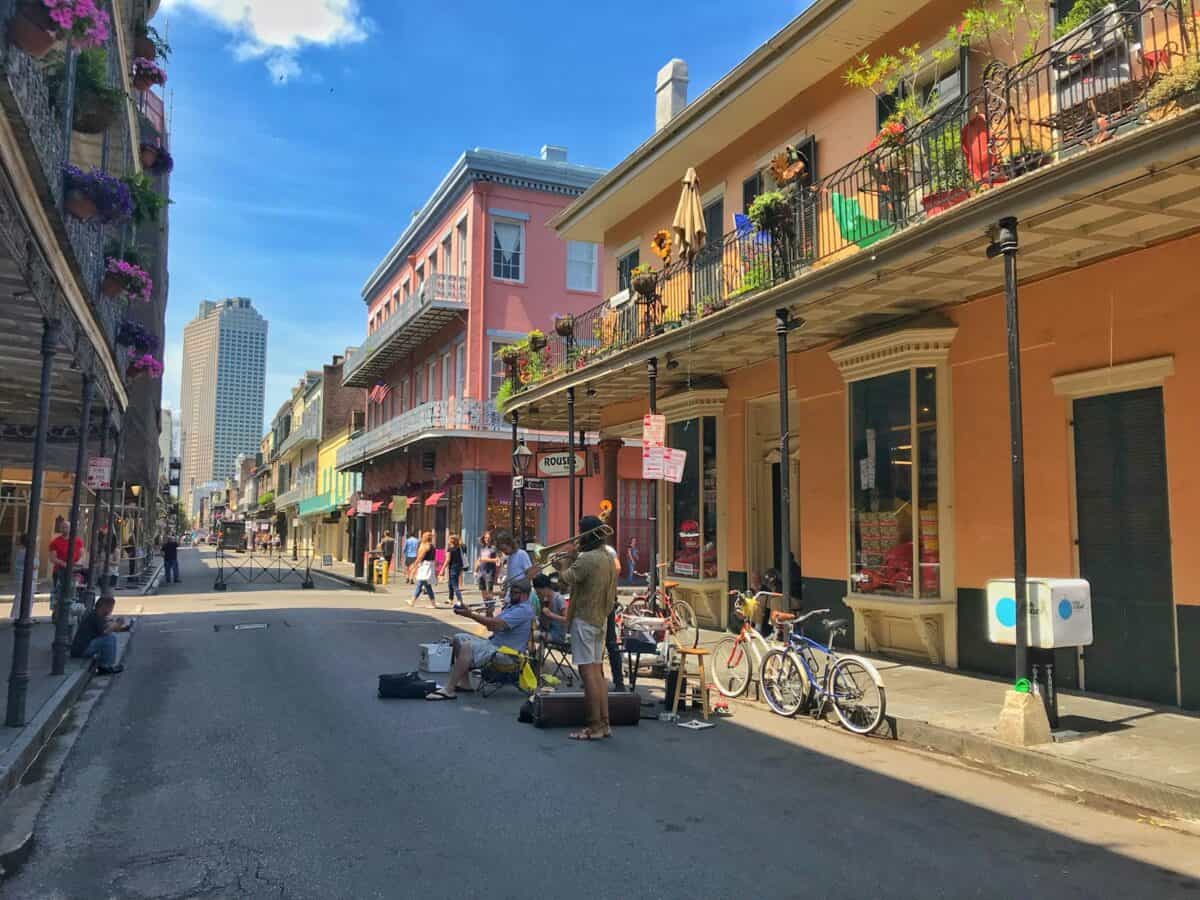
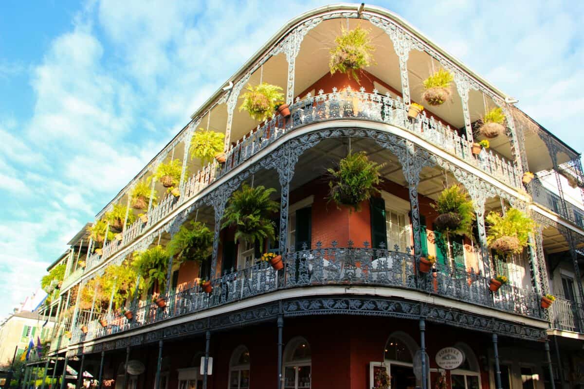
Geography: A City in a Bowl

New Orleans’ geography can be visualized as a bowl-like depression sandwiched between the Mississippi River and Lake Pontchartrain. Approximately 50% of the city sits below sea level, with some neighborhoods as much as 10 feet below. This topographical reality creates a natural collection point for water. Originally, the city was built on slightly elevated natural levees formed by the Mississippi River’s seasonal flooding, which deposited sediment over thousands of years.
As the city expanded beyond these natural high grounds into reclaimed swampland, its vulnerability increased dramatically. The surrounding wetlands that once absorbed excess water have been drastically reduced through development and canalization. Today, New Orleans is essentially surrounded by water on three sides—Lake Pontchartrain to the north, the Mississippi River to the south, and Lake Borgne connecting to the Gulf of Mexico to the east—creating a perfect storm of flood risk factors that few other American cities must contend with.
Hurricane Katrina: The Catastrophic Benchmark
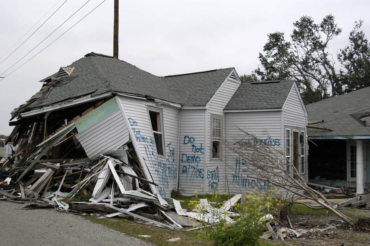
Hurricane Katrina’s devastating impact in 2005 serves as the most dramatic illustration of New Orleans’ flood vulnerability. When the Category 3 hurricane made landfall on August 29, 2005, it caused multiple catastrophic failures in the city’s flood protection system. Over 50 levee and floodwall breaches allowed water to pour into the city from Lake Pontchartrain, the Industrial Canal, and the Mississippi River Gulf Outlet.
Approximately 80% of the city was flooded, with water depths reaching 20 feet in some neighborhoods. The disaster claimed over 1,800 lives across the Gulf Coast, with the majority in New Orleans, and caused an estimated $125 billion in damage. Beyond the immediate devastation, Katrina triggered the largest displacement of Americans since the Dust Bowl of the 1930s, with the city’s population dropping from 485,000 to about 230,000 within a year. While significant improvements have been made to the city’s flood protection systems since 2005, Katrina remains a somber reminder of what can happen when New Orleans’ annual flood risk becomes catastrophic reality.
The Triple Threat: Rain, River, and Storm Surge

New Orleans faces a unique triple threat of flood sources that combines to create its extraordinary annual risk profile. First, the city receives approximately 62 inches of rainfall annually—significantly higher than the national average of 38 inches—and can experience intense precipitation events that overwhelm drainage systems. The city’s record for rainfall in a 24-hour period exceeds 20 inches. Second, the Mississippi River poses a constant threat, carrying water from 31 states and two Canadian provinces through New Orleans on its way to the Gulf of Mexico.
During spring snowmelt and heavy rainfall periods upstream, the river can rise dramatically, pressing against the levees that protect the city. Third and perhaps most dangerous is storm surge during hurricanes, when winds push Gulf waters toward the coast and into Lake Pontchartrain. These storm surges can exceed 20 feet in height during major hurricanes, placing immense pressure on the city’s flood defense systems. Any one of these sources can cause flooding; when they occur simultaneously, as during hurricane events, the risk becomes exponentially greater.
The Levee System: Protector and Potential Point of Failure
New Orleans relies on an extensive network of levees, floodwalls, pumps, and gates that collectively form the Hurricane and Storm Damage Risk Reduction System (HSDRRS). This system, redesigned and fortified after Hurricane Katrina at a cost of $14.5 billion, extends for approximately 133 miles around the greater New Orleans area. The U.S. Army Corps of Engineers designed the system to withstand a “100-year flood”—an event with a 1% chance of occurring in any given year.
While this represents a significant improvement over pre-Katrina protections, it still leaves New Orleans with flood defense standards lower than many international cities facing similar threats. For comparison, London is protected against a 1,000-year flood event, while the Netherlands protects some areas against 10,000-year events.
Moreover, the levee system itself presents a paradox: while essential for protection, it also interrupts natural watershed processes and prevents sediment deposition that would naturally build land. The system requires constant maintenance, with the Corps of Engineers spending approximately $30 million annually just to maintain New Orleans’ flood protections, highlighting both the engineering achievement and ongoing vulnerability.
Subsidence: The Sinking City

Land subsidence significantly compounds New Orleans’ flood vulnerability, with some areas of the city sinking at rates of up to two inches per year. This subsidence occurs primarily because the Mississippi River delta is naturally compacting and settling, a process dramatically accelerated by human activities. When New Orleans’ extensive drainage system removes water from the soil to keep the city dry, it causes the organic matter in the soil to decompose and compact more quickly. Additionally, groundwater pumping for industrial and municipal use creates voids that allow the land to compress further.
The result is a city that continues to sink deeper below sea level each year, increasing the height differential between the water bodies surrounding New Orleans and the neighborhoods within it. Buildings, roads, and infrastructure regularly show signs of this subsidence, with cracked foundations, broken water and sewer lines, and streets that need frequent releveling. Some neighborhoods have sunk so significantly since their initial development that homes once at ground level now sit well below the street grade, exacerbating their flood risk during even minor rain events.
Climate Change: Amplifying the Annual Risk

Climate change is steadily increasing New Orleans’ already substantial flood risk through multiple mechanisms. Sea level rise along the Gulf Coast is occurring at rates faster than the global average due to regional land subsidence combined with global oceanic expansion.
Current projections suggest the Gulf Coast could experience sea level rise of 14-18 inches by 2050, which would directly translate to higher storm surges during hurricanes. Additionally, warming ocean temperatures are increasing the intensity of hurricanes that form in the Gulf of Mexico. Research indicates that the proportion of storms that rapidly intensify before landfall has been increasing, giving less preparation time for coastal communities like New Orleans.
Precipitation patterns are also changing, with the Southeast United States experiencing a 27% increase in the amount of rain falling during the heaviest downpours since 1958. Models project this trend will continue, with more frequent extreme rainfall events capable of overwhelming urban drainage systems. Together, these climate change impacts could potentially increase New Orleans’ annual flood probability from 1-in-3 to even more frequent occurrences within coming decades.
Coastal Wetland Loss: The Disappearing Buffer
Louisiana is experiencing the most rapid rate of coastal wetland loss in the United States, losing approximately a football field of land every 100 minutes. These wetlands historically served as natural buffers that absorbed storm surge energy before it reached New Orleans. Since the 1930s, Louisiana has lost more than 2,000 square miles of coastal wetlands—an area larger than the state of Delaware.
This dramatic loss stems from multiple causes, including the leveeing of the Mississippi River (which prevents natural sediment deposition), thousands of miles of canals cut through marshes for oil and gas exploration, and sea level rise. Each mile of healthy wetlands can reduce storm surge height by approximately one foot, meaning the lost wetlands would have provided substantial natural protection for New Orleans.
The state’s Coastal Master Plan allocates $50 billion for restoration projects designed to rebuild some of these wetlands through controlled Mississippi River diversions and direct marsh creation, but implementation faces funding challenges and cannot fully restore what has been lost. Without these natural buffers, New Orleans becomes increasingly exposed to the full force of hurricanes coming in from the Gulf of Mexico.
The Pumping System: Engineering Marvel with Limitations
New Orleans relies on one of the world’s most powerful urban drainage systems, capable of moving more than 45 billion gallons of water per day—enough to empty a lake 10 square miles in area and 13.5 feet deep every 24 hours. This system includes 24 drainage pumping stations with approximately 120 pumps throughout the city.
Some of these pumps date back to the early 20th century and still use their original steam-powered equipment, representing both an engineering marvel and infrastructure vulnerability. During intense rainfall events, when more than an inch of rain falls per hour, even this massive system can be overwhelmed, leading to street flooding and potential property damage. The system requires enormous energy to operate—up to 80 megawatts during peak pumping, approximately enough electricity to power 80,000 homes.
Power failures during storms have historically compromised pumping operations, though backup generators have been installed at critical locations following Hurricane Katrina. The Sewerage and Water Board of New Orleans faces ongoing challenges maintaining this aging yet essential infrastructure, with frequent pump outages reported during heavy rain events, further contributing to the city’s precarious relationship with water.
Economic Impact: The Cost of Living with Water
The economic consequences of New Orleans’ flood vulnerability manifest in multiple ways that affect residents’ daily lives. Property insurance in the city ranks among the nation’s most expensive, with flood insurance premiums through the National Flood Insurance Program often exceeding $3,000 annually for homes in the highest-risk areas.
These costs create housing affordability challenges and can impact property values. The city also bears substantial infrastructure maintenance costs, spending approximately $50 million annually just on drainage system operations and repairs. Major flood events exact tremendous economic tolls; Hurricane Katrina’s $125 billion in damages represented the costliest natural disaster in U.S. history until Hurricane Harvey in 2017. Beyond direct costs, the perception of flood risk influences business decisions about locating or expanding in New Orleans, potentially limiting economic growth opportunities.
Tourism, which generates over $10 billion annually and supports 89,000 jobs in New Orleans, can be dramatically affected by flooding events and their aftermath. Despite these challenges, innovative approaches to water management are emerging, including developments designed to work with rather than against water, potentially creating new economic opportunities in adaptation and resilience.
Adaptation Strategies: Living with Water
New Orleans is increasingly adopting “living with water” strategies that represent a philosophical shift from fighting against water to accommodating it within the urban landscape. The city’s Urban Water Plan, developed after Hurricane Katrina, focuses on creating water retention areas throughout the city to temporarily store rainwater during heavy downpours rather than immediately pumping it out.
These include blue-green corridors along canals, water gardens in public spaces, and bioswales along roadways that slow, filter, and store rainwater. On private property, residents are being encouraged to install rain gardens, pervious paving, and rain barrels to reduce runoff. The Gentilly Resilience District represents one of the most ambitious implementations of these principles, using a $141 million federal grant to transform an entire neighborhood with water management features like the Mirabeau Water Garden, which can store up to 10 million gallons of stormwater.
Building modifications are also becoming more common, with many new constructions and renovations incorporating elevated first floors, water-resistant materials, and mechanical systems moved to upper levels. These adaptation strategies acknowledge the reality that while flooding cannot be completely eliminated in New Orleans, its impacts can be significantly reduced through thoughtful design and implementation.
Community Resilience: Beyond Infrastructure

Beyond physical infrastructure, New Orleans has developed remarkable social resilience mechanisms to cope with its flood risk. Neighborhood-based organizations like the Lower Ninth Ward Center for Sustainable Engagement and Development and Broadmoor Improvement Association have become critical players in community-led resilience planning.
These groups maintain neighborhood evacuation plans, conduct regular disaster preparedness training, and advocate for vulnerable residents. The city’s official hurricane season preparations now include identifying residents who need evacuation assistance, maintaining emergency communication systems that don’t rely on potentially vulnerable cellular networks, and coordinating with faith-based organizations that provide essential support during disasters. Schools incorporate flood education into curricula, teaching children about the city’s geography, risk factors, and appropriate responses during emergencies. Social media networks have evolved to share real-time information about street flooding during heavy rain events, allowing residents to navigate the city safely.
This combination of formal and informal resilience mechanisms reflects a community that has transformed the trauma of past floods, particularly Hurricane Katrina, into preparedness for future events. The city’s unique cultural traditions, including second line parades, neighborhood gatherings, and strong family networks, further reinforce these social bonds that prove critical during emergencies.
The Future: Increasing Risks and Uncertain Sustainability
The long-term sustainability of New Orleans faces profound questions as climate change accelerates and infrastructure ages. Current projections suggest that without significant adaptation measures, the city’s 1-in-3 annual flood probability could increase to nearly 1-in-2 by 2050. The U.S. Army Corps of Engineers estimates that maintaining and improving the current flood protection system will require investments of approximately $200 million annually for the foreseeable future.
Demographic trends show population concentration shifting toward slightly higher ground within the city, a pattern likely to continue as flood risks become more apparent. More radical adaptation proposals include intentional resettlement from the most vulnerable areas to create space for expanded water storage, though such measures face significant political and cultural resistance. Some climate scientists question whether portions of New Orleans will remain viable for habitation beyond this century without transformative changes to both infrastructure and settlement patterns.
Despite these challenges, the city’s 300-year history demonstrates remarkable persistence through disasters and changing environmental conditions. As climate scientist Torbjörn Törnqvist of Tulane University notes, “New Orleans has always been a city that shouldn’t exist where it does, yet it has survived through innovation and adaptation. That must continue, but at a pace and scale we haven’t seen before.”
Conclusion: A City at the Forefront of America’s Climate Future

New Orleans stands as a critical case study for how American cities will respond to increasing flood risks in a changing climate. Its 1-in-3 annual flood probability represents an extreme example of what many coastal and riverine communities may face in coming decades as sea levels rise and precipitation patterns intensify. The strategies developed in New Orleans—from massive engineering works like the HSDRRS to neighborhood-scale green infrastructure and community resilience networks—provide valuable lessons for other vulnerable communities.
The economic, social, and cultural costs of maintaining a city under such persistent threat raise fundamental questions about sustainable urban development in the climate change era. Yet New Orleans also demonstrates the remarkable human capacity for adaptation and persistence in the face of environmental challenges. As America confronts growing climate impacts, the story of New Orleans and its relationship with water will continue to offer critical insights into both the limits and possibilities of urban resilience in flood-prone environments.
From exploring the marine wonders in the Azores and witnessing the vast savannas of Kenya, to delving deep into the rich biodiversity of South Africa and traversing iconic landscapes in Australia and the US like Yellowstone, Chris's experiences are vast.
With a penchant for diving alongside sharks, the ocean holds a special place in his heart.
Through his academic insights, he champions wildlife conservation, striving with 'Animals Around The Globe' to cultivate a profound connection between humans and animals, enhancing our mutual appreciation.
Connect with him at Feedback@animalsaroundtheglobe.com.