
Stand in the flat, wind-swept grasslands of western Kansas today, and nothing about the landscape suggests anything other than dry, sunbaked earth. Yet beneath your feet, buried in layers of ancient chalk and shale, lie the fossils of sharks, sea turtles, and enormous marine reptiles. That same quiet prairie was, not so long ago in geological terms, the floor of a vast ocean.
The idea that much of the continental United States was once submerged under seawater isn’t mythology or speculation. It’s one of the most well-documented facts in North American geology, supported by rock formations, fossil records, and the careful work of paleontologists and geologists across decades of research.
The Western Interior Seaway: America’s Vanished Ocean
The Western Interior Seaway was a large inland sea that existed roughly over the present-day Great Plains of North America, splitting the continent into two landmasses, Laramidia to the west and Appalachia to the east. This wasn’t a shallow pond or a flooded river delta. It was a genuine ocean sitting in the heart of a continent.
The ancient sea existed for 34 million years, from the early Late Cretaceous around 100 million years ago to the earliest Paleocene around 66 million years ago, and at its largest extent it was roughly 2,500 feet deep, 600 miles wide, and over 2,000 miles long.
The seaway covered parts or all of what is now Montana, North Dakota, South Dakota, Wyoming, Iowa, Nebraska, Colorado, Utah, Arkansas, Oklahoma, New Mexico, and Texas, as well as much of Canada including Alberta, Saskatchewan, Manitoba, Ontario, and the Northwest Territories. That’s a staggering footprint by any measure.
Up to half of the continent’s modern surface area may have been submerged by this sea. The land we now call the American heartland was, during this period, effectively the bottom of an ocean.
What Caused It: Tectonic Forces at Work
During the Cretaceous period, the ancient Farallon and Kula tectonic plates were in the process of subducting beneath the North American Plate, causing the overlying land to warp and form a large back-arc basin. Ocean waters began to fill in the basin during a series of sea level increases during the Cretaceous, producing the Western Interior Seaway.
The Western Interior Seaway was present during one of the warmest periods on Earth, when the poles were devoid of ice and sea levels were 500 feet higher. That global warmth made flooding on this scale not only possible but inevitable given the tectonic setup.
The earliest phase of the seaway began in the mid-Cretaceous when an arm of the Arctic Ocean transgressed south over western North America, forming the Mowry Sea. In the south, the Gulf of Mexico was originally an extension of the Tethys Ocean. In time, the southern embayment merged with the Mowry Sea in the late Cretaceous, forming a completed seaway and creating isolated environments for land animals and plants.
Two great continental watersheds drained into it from east and west, diluting its waters and bringing resources in eroded silt that formed shifting delta systems along its low-lying coasts. The seaway was dynamic, not static, constantly reshaped by the forces feeding it.
Life in a Vanished Sea

The waters of the Western Interior Seaway were warm, shallow, and inhabited by a plethora of marine animals. These included bony fish, sharks, marine reptiles such as mosasaurs and plesiosaurs, birds, mollusks including ammonites, bivalves, and snails, and echinoderms including echinoids and crinoids.
Mosasaurs, a group of marine lizards, were the apex predators for the final stretch of the seaway’s existence, living from about 75 to 69 million years ago, with some species reaching lengths of up to 50 feet, roughly the length of a school bus. It was not a peaceful body of water.
Xiphactinus audax, one of the most common large predators throughout the seaway’s history, was a bony fish that grew up to 20 feet long. Fossils of Xiphactinus have been found with entire smaller fish preserved inside their rib cages, swallowed whole.
The seaway was also home to some of the earliest birds adapted to a fully aquatic lifestyle. Hesperornis regalis was a flightless, foot-propelled diving bird, somewhat like a modern loon but with teeth and vestigial wings. So many Hesperornis specimens were found in one layer of rock that paleontologists named it the “Hesperornis beds.” Giant pterosaurs completed the picture, hunting fish from the skies above.
The Evidence Left Behind: Rock, Chalk, and Fossil
The Cretaceous-aged rocks of the continental interior of the United States, from Texas to Montana, record a long geological history of this region being covered by a relatively shallow body of marine water called the Western Interior Seaway. The evidence isn’t buried too deep to find. In some places, it’s right on the surface.
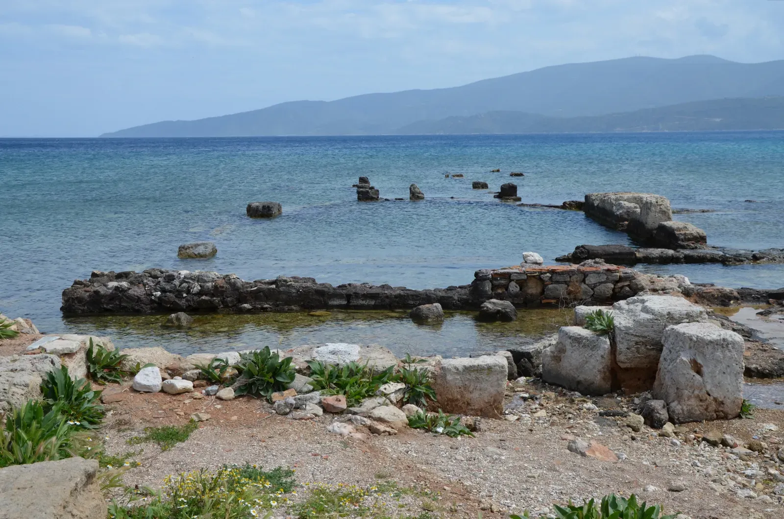
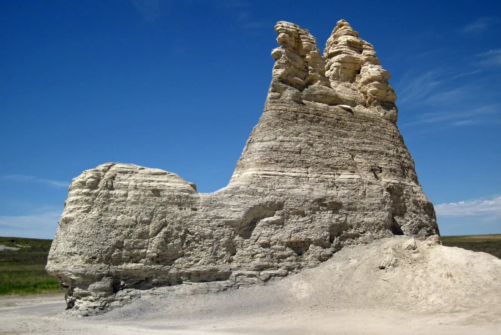
Traces of the Western Interior Seaway can still be found in marine deposits throughout the United States ranging from New Mexico to North Dakota, including famous ones such as the Pierre Shale and the Austin Chalk. Some of the most notable outcrops are the Monument Rocks of western Kansas. Monument Rocks is a relatively large, isolated, and weathered outcrop of chalk that preserves rock layers deposited 87 to 82 million years ago.
The Pierre Shale, a thick deposit of dark marine mudstone laid down on the seaway floor, crops out in a belt up to 20 miles wide along the Front Range in Colorado and extends across South Dakota, Wyoming, Montana, Nebraska, Kansas, and into the Canadian prairies. The Niobrara Formation, a chalky limestone layer deposited in the seaway’s warm, shallow waters, is one of the richest fossil beds in North America, particularly in western Kansas.
During the Paleozoic, shallow inland seas spread across the interior of Laurentia, covering North America’s Precambrian shield. Even the high areas of northwestern Texas and the Ozark Mountains of Missouri were occasionally underwater. Extensive deposition of sediment occurred across significant sections of Kansas, Missouri, Oklahoma, and Texas, with a sequence of sediments between 5,000 and 10,000 feet thick deposited during the Paleozoic and much of the Mesozoic.
How It All Drained Away
The Western Interior Seaway, a vast shallow sea that once split North America in two, drained away over roughly 20 million years as sea levels dropped and the Rocky Mountains rose. The disappearance was gradual, almost imperceptibly slow by human standards.
The Laramide orogeny, the mountain-building event that created the Rocky Mountains, played a central role. As tectonic plates collided along the western edge of North America, the land rose. Sediment eroded off the new mountains and poured eastward, gradually filling in the shallow sea basin. The combination of rising land, falling sea levels, and massive sediment deposits squeezed the seaway from both sides.
During the early Paleocene, parts of the Western Interior Seaway still occupied areas of the Mississippi Embayment, submerging the site of present-day Memphis. The sea lingered long after its peak, retreating in stages rather than vanishing all at once.
This period was marked by extensive sedimentation, as layers of sand, silt, and clay were deposited, forming the rich geological record we study today. These deposits capture the transition from a marine environment to a terrestrial one, spanning the dramatic close of the Mesozoic Era and even encompassing the turbulent mass extinction event at the end of the Cretaceous. What is now farmland was once seafloor in the middle of a cooling, draining ocean.
Conclusion
The story of North America’s ancient underwater past is genuinely one of the most striking chapters in Earth science. Much of what we now recognize as the American interior, from the broad plains of Kansas to the dry ranges of Wyoming and the flatlands of the Texas panhandle, spent tens of millions of years beneath a warm, teeming sea.
The physical evidence is still there if you know where to look. Chalk formations jutting above the prairie. Shark teeth in Oklahoma hilltops. Fossil fish frozen mid-meal in layers of ancient stone. These aren’t curiosities. They’re direct records of a world that was radically different from the one we inhabit.
What the Western Interior Seaway ultimately reminds us is that the land beneath our feet has never been fixed. Continents warp, seas invade, mountains rise, and oceans drain. The quiet flatness of the Great Plains today is not a permanent condition. It is simply the latest chapter in a story that has been rewriting itself for hundreds of millions of years.