Most places on Earth sit comfortably above the ocean’s waterline. Death Valley does not. Tucked into the eastern corner of California, not far from the Nevada border, it occupies a landscape so far beneath sea level that simply standing in it feels like a quiet geological secret. The valley floor drops, the mountains rise impossibly high on either side, and the whole scene makes you wonder: how does a place on dry land end up lower than the ocean?
The answer reaches back hundreds of millions of years and involves some of the most dramatic forces the planet can produce. Plate tectonics, crustal stretching, ancient lakes, relentless heat, and a landscape still in motion today all play a role. This is not a simple story.
The Lowest Point on the Continent
Death Valley’s Badwater Basin is the point of lowest elevation in North America, at 282 feet below sea level. That number is easy to say but harder to fully absorb. Stand at the edge of the salt flats and look up at the cliff face beside you – there is a small sign marking where sea level actually is, far above your head.
Just fifteen miles away, Telescope Peak rises to 11,049 feet above sea level, and the vertical drop from that summit to Badwater Basin is about twice the depth of the Grand Canyon. The contrast within such a short distance is genuinely staggering.
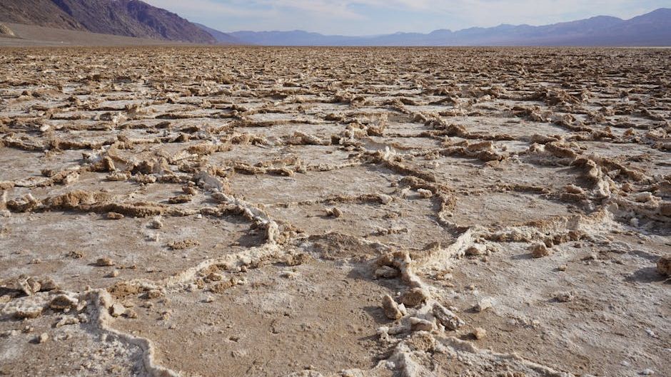
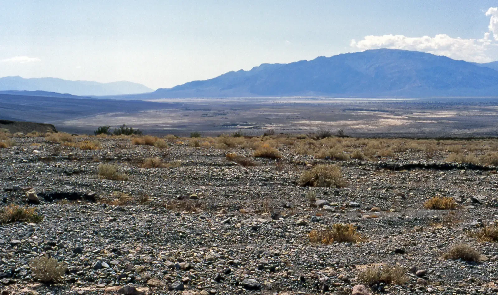
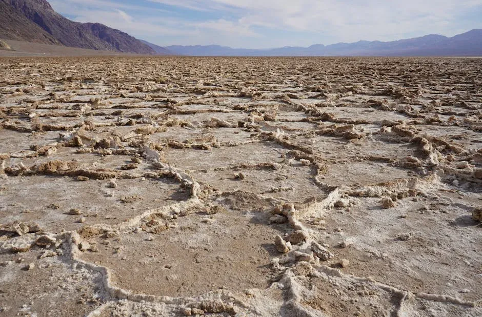
The valley is a closed basin, with about 500 square miles located below sea level in the Badwater Basin saltpan. Water flows in but has no way out, and that geographic reality has shaped everything about the place, from its salt-crusted floor to its extreme heat.
Tectonic Forces Tore the Crust Apart
The geological foundation for Death Valley began to form roughly 15 to 20 million years ago, driven by massive tectonic forces pulling the western North American continent apart – a process known as crustal extension, which affected the Basin and Range Province stretching from eastern California to Utah.
Death Valley is part of the Basin and Range Province, where the Earth’s crust is being stretched and pulled apart. The valley itself is formed by a series of fault systems, including the Death Valley Fault, which runs through the area.
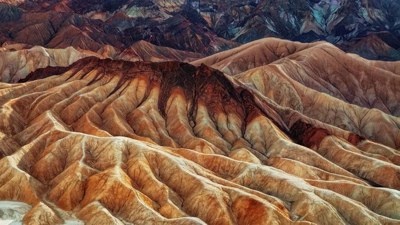
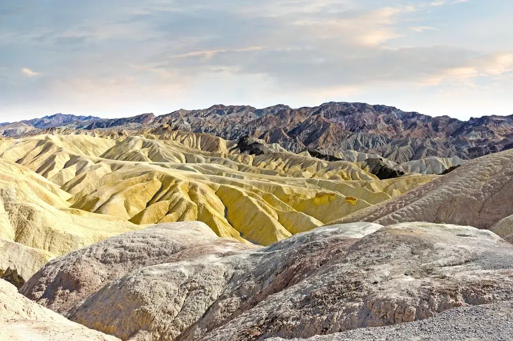
Beginning two to three million years ago, local extension intensified, causing the central block of the valley floor to drop significantly. Geologists call this dropped block a graben, bounded by steep faults. Adjacent blocks, such as the Panamint Range and the Black Mountains, were simultaneously uplifted relative to the valley floor, forming horsts. The valley sank while the mountains climbed – the two movements are inseparable parts of the same process.
The immense depth of Death Valley results from the valley floor sinking and the mountains rising simultaneously. Geophysical surveys indicate the bedrock floor is buried beneath as much as 9,000 feet of sediment, meaning the graben is far deeper than the visible 282 feet below sea level. What you see at the surface is just the tip of a far deeper geological depression.
A Valley Still Sinking Today
The valley floor has been steadily slipping downward, subsiding along the fault that lies at the base of the Black Mountains. Subsidence continues today, and evidence of this can be seen in the fresh fault scarps exposed near Badwater. This is not ancient history frozen in rock. It is an active process.
Death Valley itself is subsiding at roughly one inch per year, a testament to the powerful tectonic forces at work. Over thousands of years, that rate adds up considerably.
Death Valley itself is currently an active pull-apart basin developed between the Northern and Southern Death Valley Faults, with mainly normal faulting along the Black Mountains Fault zone between these two major strike-slip fault zones. The forces that created it have not finished their work.
Beneath Badwater lies more than 11,000 feet of accumulated sediment and salts, a testament to just how long the basin has been collecting material washing down from the surrounding ranges.
Ancient Seas, Ice Ages, and a Vanished Lake
The creation of dolomitic limestone found in the Panamint Mountains can be attributed only to shell-building marine organisms, and geologists widely agree that throughout most of the Paleozoic Era the entire area was a warm, shallow sea. The oldest limestone dates back to around 500 million years, while rocks 400 million years and younger contain fossilized marine invertebrates, further proving the existence of a large body of water throughout the Paleozoic Era.
The geological story of Death Valley took a sharp turn when Earth entered a phase of cooling. Ice formed and receded many times, the last one as recently as 10,000 years ago, and the global climate during these times was much wetter – it is now evident that the whole area of today’s eastern California was covered by large lakes.
The valley’s history includes periods when it was filled with water, most notably by the vast, ancient Lake Manly. This large lake intermittently occupied the basin during wetter periods of the Ice Ages, with the longest stage lasting from approximately 185,000 to 120,000 years ago. At its maximum, Lake Manly was nearly 90 miles long, 6 to 11 miles wide, and up to 600 feet deep, fed by meltwater from the Sierra Nevada.
As Lake Manly evaporated, it left behind an abundance of evaporites, including sodium chloride, calcite, gypsum, and borax. That ghostly white crust stretching across Badwater Basin today is what remains of a deep Ice Age lake.
Why the Heat Gets So Extreme
The region is situated in the rain shadow of four major mountain ranges, including the Sierra Nevada and the Panamint Range. As moisture-laden air moves east from the Pacific Ocean, it is forced upward over each range, cooling and dropping its water as rain or snow on the western slopes. By the time the air reaches Death Valley, it has been stripped of most of its moisture, resulting in an average annual precipitation of only about two inches.
The reflected heat rises, but the shape of the valley and the height of the surrounding mountain ranges trap the hot air. As hot air rises, it cools slightly and falls again, all the while being relentlessly heated by the sun, which beats down on the valley’s exposed rocks and salt flats, creating an endless cycle of superheating that’s only slightly tempered by nightfall.
The extremely low elevation below sea level compresses the air, which heats it further. The depth of the basin is not just a geographic curiosity. It is a direct contributor to the most punishing heat on the planet’s surface.
Conclusion: A Landscape That Refuses to Stand Still
Death Valley sits below sea level not because of a single dramatic event, but because of an almost incomprehensibly long sequence of them. Crustal stretching pulled the land apart. Fault blocks dropped. Mountains rose. Ancient lakes filled the basin and disappeared. Salt was left behind. The whole process is still happening now, slowly and steadily, one fault slip at a time.
Death Valley’s landscape has been changing for millions of years. It is changing now and will continue to change long after we have departed. Erosion slowly carves away at the ancient rock formations, reshaping the surface of the land.
There is something worth sitting with in that fact. The valley floor is still sinking. The mountains around it are still rising. The salt flats are still accumulating mineral traces of vanished water. Death Valley is not a relic of the past. It is the past in motion, wearing the present on its surface.